GRAVÜR DÜNYASI
Digital Engraving Library
| Date | 1878 |
| Technique | Lithography-Colored |
| Category | Maps |
| Source | The Collegiate Atlas - William Collins Sons & Co. Limited, Glasgow & London |
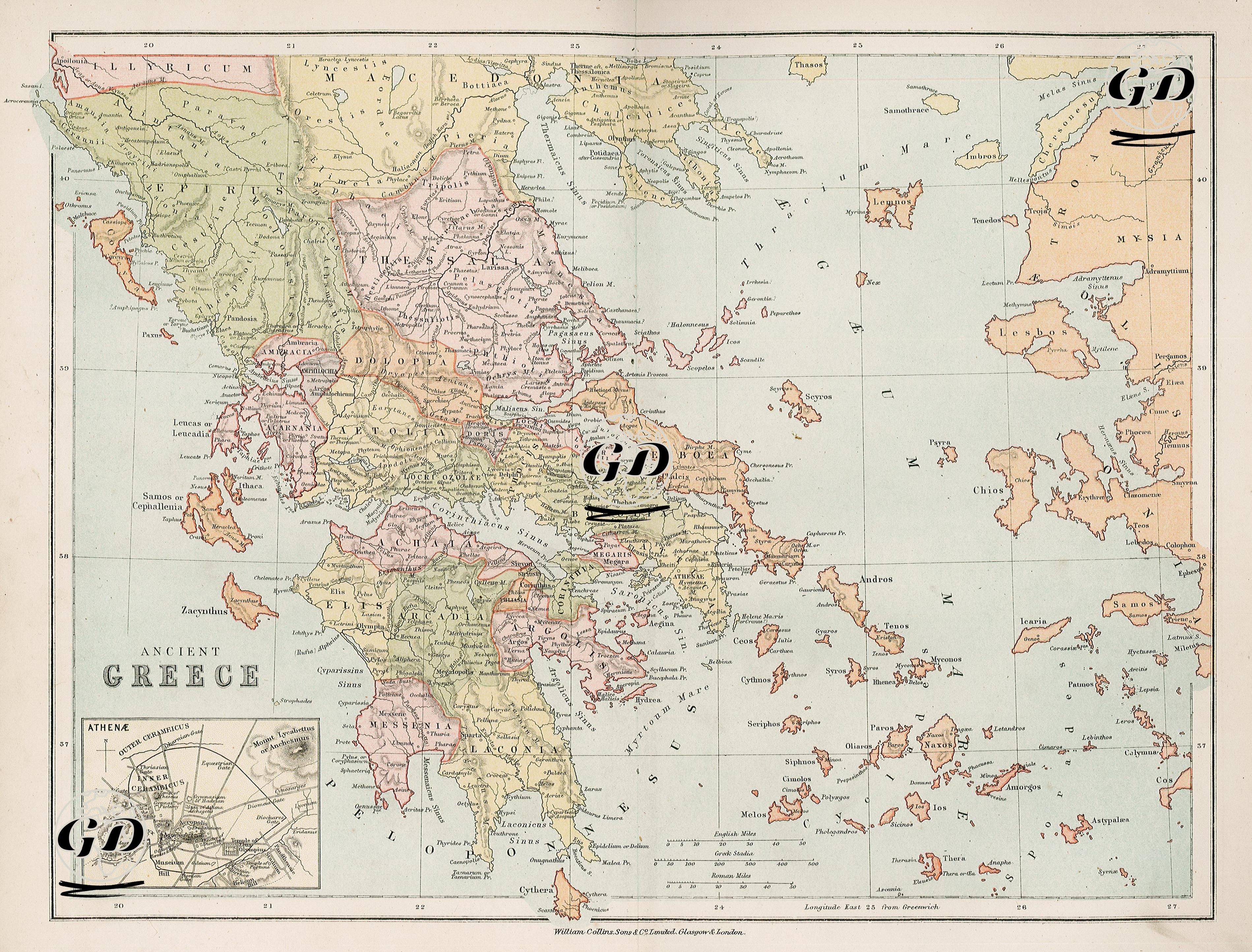
This map, focusing on the classical period, depicts the geography of ancient Greece in detail. It encompasses the Greek mainland, extending from Thrace, Paionia, and Macedonia in the north to the Peloponnese in the south; to the east, the western Anatolian regions of Asia Minor, such as Mysia, Lydia, and Ionia, as well as the island cities scattered throughout the Aegean Sea. The "Athenae" plan, located in the lower left corner of the map, presents Athens's classical-era topography in fine detail, including important structures such as the Acropolis, Areopagus, and Agora. The regional designations are based on political mapping based on ancient polis structures such as Thessaly, Boeotia, Attica, Laconia, Elis, and Arcadia. The map also emphasizes the geographic realism of the period with its prominent mountain ranges (e.g., Pindos), rivers, and coastlines. Among the Aegean islands, religious and commercial centers such as Delos, Naxos, and Paros stand out. Cities such as Ephesus, Smyrna and Pergamon located on the Anatolian coast are important settlements that document the spread of Greek cultural influence in the east.