GRAVÜR DÜNYASI
Digital Engraving Library
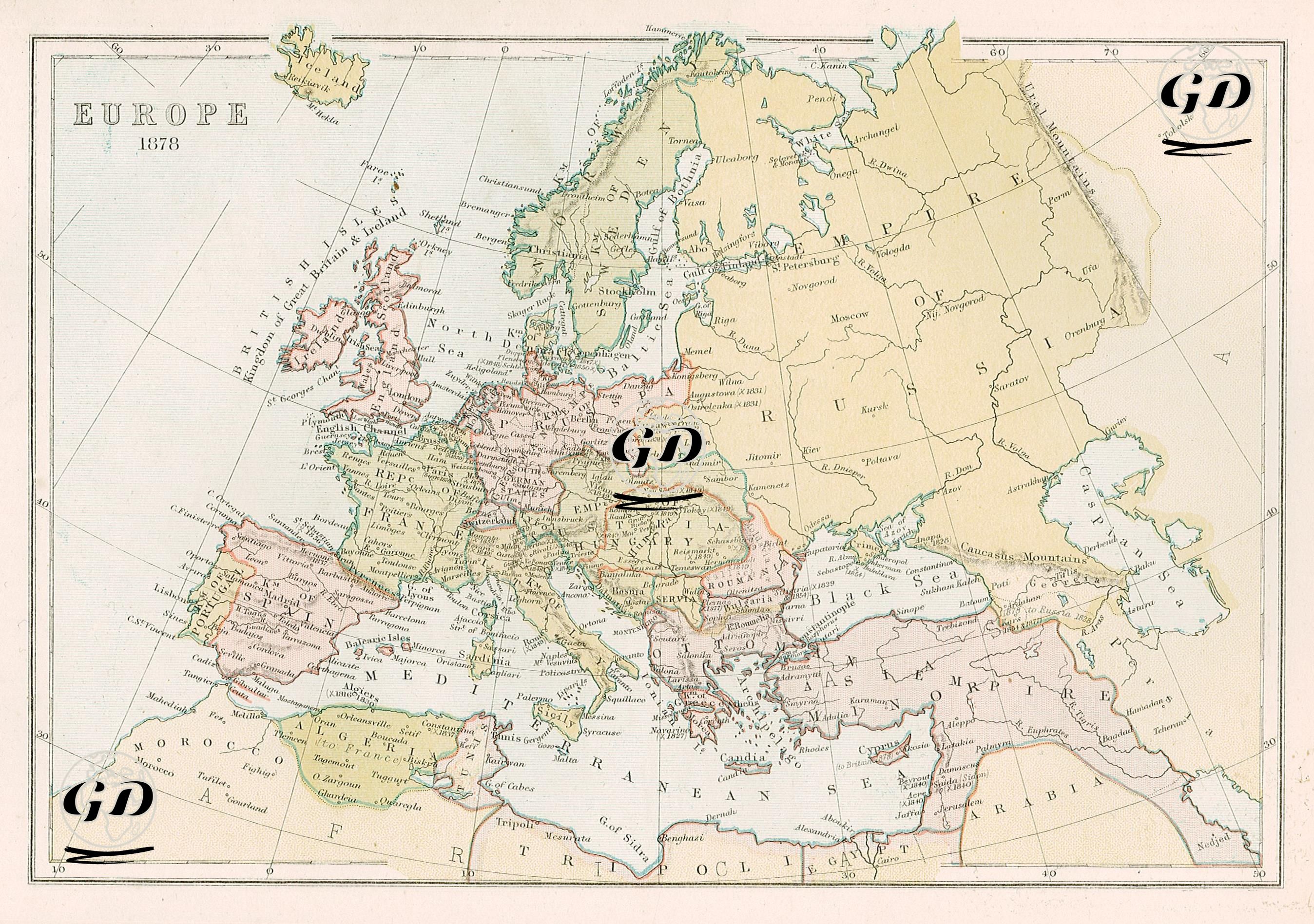
| Date | 1878 |
| Technique | Lithography-Colored |
| Category | Maps |
| Source | The Collegiate Atlas - William Collins Sons & Co. Limited, Glasgow & London |
This map shows the political borders of Europe in 1878, reflecting the political changes that followed the Russo-Turkish War of 1877-1878. The Austro-Hungarian Empire occupies a vast area in the center of the map, with Germany to the north, France to the west, and the Russian Empire to the east. In the south, the Italian peninsula is united under the single name "Italy," signifying Italy's political unity following its unification in 1861. The Ottoman Empire, located in the southeast of the map, is notable for its territorial losses in the Balkans. By this time, Serbia and Montenegro had gained their independence; these two countries are now shown in different colors on the map with their respective borders. Similarly, Romania had transitioned from autonomy to de facto independence. The map shows Bulgaria, not yet an independent state, but as an autonomous province of the Ottoman Empire, representing the Bulgarian Principality established after the 1878 Treaty of Berlin. The Russian Empire, on the other hand, possesses vast territories in the east, extending from the northeast of the map to the Caucasus. South of the Caucasus Mountains, Russia continues to seize Transcaucasian territories such as Georgia, Armenia, and Azerbaijan. In terms of the balance of control surrounding the Black Sea, the fact that Crimea is located within Russian borders is noteworthy; although this has been limited since the Treaty of Paris in 1856, it maintains Russia's presence in the Black Sea. The Balkan Peninsula is particularly fragmented: Bosnia-Herzegovina is de facto occupied by Austria-Hungary (though officially Ottoman territory), Serbia, Montenegro, and Romania are independent, Bulgaria is autonomous, and Macedonia and Thrace remain Ottoman subjects. Greece, on the other hand, remains an independent state but has not yet annexed certain Ottoman territories such as Thessaly and Crete. In general, this map shows the balance of power in Europe after the Congress of Berlin (1878), the decline of the Ottoman Empire in the Balkans, the completed political unification of Germany and Italy, and the struggle for influence between Austria-Hungary and Russia in the Balkans.