GRAVÜR DÜNYASI
Digital Engraving Library
| Date | 1878 |
| Technique | Lithography-Colored |
| Category | Maps |
| Source | The Collegiate Atlas - William Collins Sons & Co. Limited, Glasgow & London |
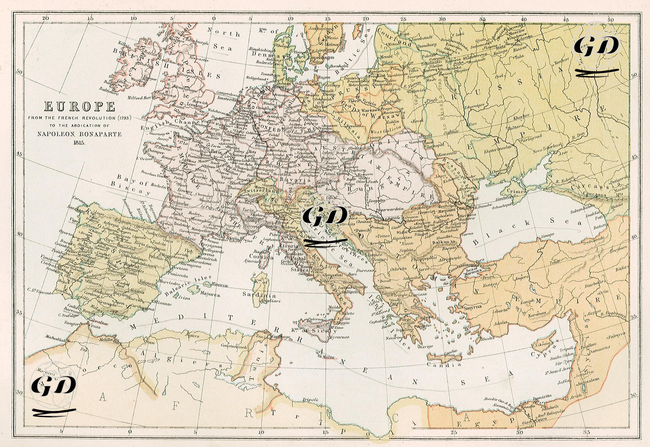
This map represents the period from the beginning of the French Revolution (1789) to Napoleon Bonaparte's abdication (1815), an extraordinarily turbulent era shaped by the convulsions of revolution and empire. The map dramatically reveals the political restructuring of the period. The dramatically altered borders of Europe under Napoleon's influence, particularly in Central Europe, reveal the dissolution of traditional imperial structures and the first traces of modernized nation-state forms. France is depicted as the "Empire of the French" in a vast and dominant area on the map, symbolizing Napoleon's direct or indirect dominance of Europe. Puppet states under Napoleon's control (such as the Confederation of the Rhine) are obscured from the map, reflecting the collapse of the Holy Roman Empire. The Italian peninsula, far from being a unified state, consists of small states that have come under French influence or are under threat, such as the Kingdom of Italy established by Napoleon in the north, the Kingdom of Naples and Sicily in the south. While the Austrian territories remaining under the Habsburgs are shown on the map as the "Austrian Empire," states like Prussia and Bavaria in Germany are now represented with clearer borders, reflecting Napoleon's influence on the German landscape and the consequences of the "Reichsdeputationshauptschluss" reforms. In the east, the Russian Empire covers a vast area, recalling the confrontation that culminated in Napoleon's 1812 campaign. The Ottoman Empire, meanwhile, still holds significant territories in the Balkans, but its influence in Europe is beginning to crumble under pressure from Austria and Russia. Another striking element on the map is the apparent transition amidst the semi-independent struggle that began with the French occupation of Spain and developed with British support. Similarly, Poland has been completely erased from the map; its territory has been divided among Russia, Prussia, and Austria.