GRAVÜR DÜNYASI
Digital Engraving Library
| Date | 1878 |
| Technique | Lithography-Colored |
| Category | Maps |
| Source | The Collegiate Atlas - William Collins Sons & Co. Limited, Glasgow & London |
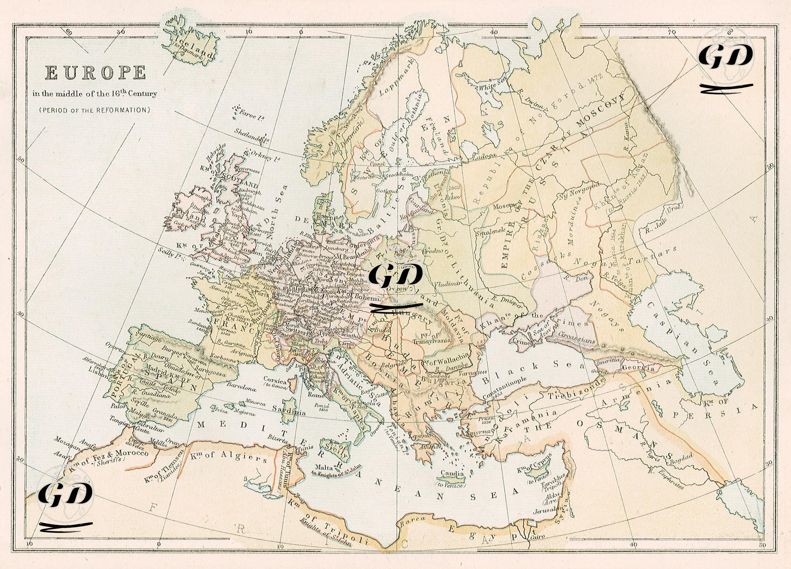
This map depicts Europe in the mid-16th century, particularly during the Reformation (circa 1550). The political boundaries, religious divisions, and centers of power depicted on the map reflect the geopolitical structure of Europe as it transformed under the influence of the Reformation. In Central Europe, the Holy Roman Empire is depicted as fragmented, with numerous independent principalities, duchies, and city-states. This area also saw the spread of the Protestant Reformation initiated by Martin Luther. German principalities such as Saxony, Württemberg, and Hesse were some of the leading regions supporting the Reformation. Regions such as Bohemia (Czechia), Austria, and Bavaria, however, remained Catholic. This demonstrates that religious divisions, in addition to political boundaries, played a significant role on the map. England is shown as "England," and this period saw Henry VIII's separation from the Pope by establishing the Anglican Church. Scotland and Ireland are shown separately; Scotland remains an independent kingdom. Spain and Portugal are shown on the map as Catholic kingdoms. This period also marks the peak of the Spanish Empire's overseas colonial power. North African Muslim states such as the "Kingdom of Yez and Morocco," the "Kingdom of Algiers," and the "Kingdom of Tripoli" also appear in the west of the map; these were under Ottoman influence. The Ottoman Empire is depicted as extending from the Balkans to the Arabian Peninsula, from Anatolia to Iraq. The word "Empire of the Osmans" on the map represents this expanse. During this period, the Ottomans were at their most powerful during the reign of Suleiman the Magnificent. Some of the Ottoman territories extended into Europe, encompassing areas such as present-day Hungary, Romania, and Serbia. In Eastern Europe, the Polish-Lithuanian Commonwealth (Republic of Poland) controlled a vast area, while in the east, the Russian Tsardom and in the north, the Kingdom of Sweden were gaining ground. These areas were still far removed from the influence of the Reformation and were generally shaped by Orthodox and Catholic traditions. Terms like "Tartars," "Nogai," and "Crimea" on the map indicate the continued existence of nomadic or semi-independent Islamic dynasties in and around the Crimean Peninsula. Consequently, this map provides a detailed reflection not only of political borders but also of religious divisions, the geographical spread of reform movements, Ottoman influence in Europe, and the balance of power in the early modern period.