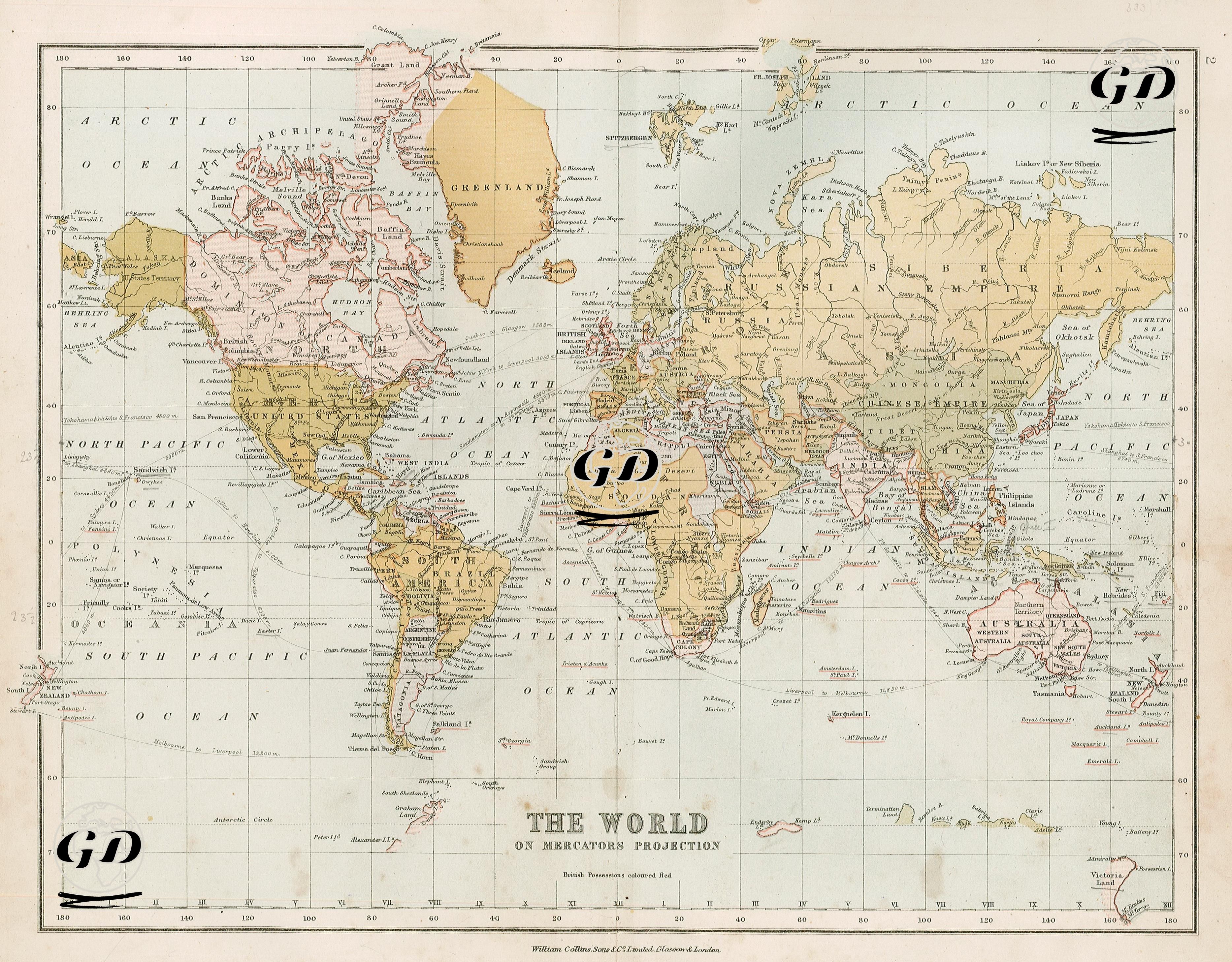
GRAVÜR DÜNYASI
Digital Engraving Library
| Date | 1878 |
| Technique | Lithography-Colored |
| Category | Maps |
| Source | The Collegiate Atlas - William Collins Sons & Co. Limited, Glasgow & London |
The Mercator projection, developed by Flemish cartographer Gerardus Mercator in 1569, has been one of the most widely used map projections in navigation throughout history. The Mercator projection is based on projecting the Earth's surface onto a cylinder. Latitude and longitude lines are drawn as equally spaced perpendicular lines, making the map useful for navigation. This projection is particularly known for its accurate preservation of angles and directions. This projection is useful for navigation, especially in navigation and cartography, but it results in large scale distortions in polar regions.