GRAVÜR DÜNYASI
Digital Engraving Library
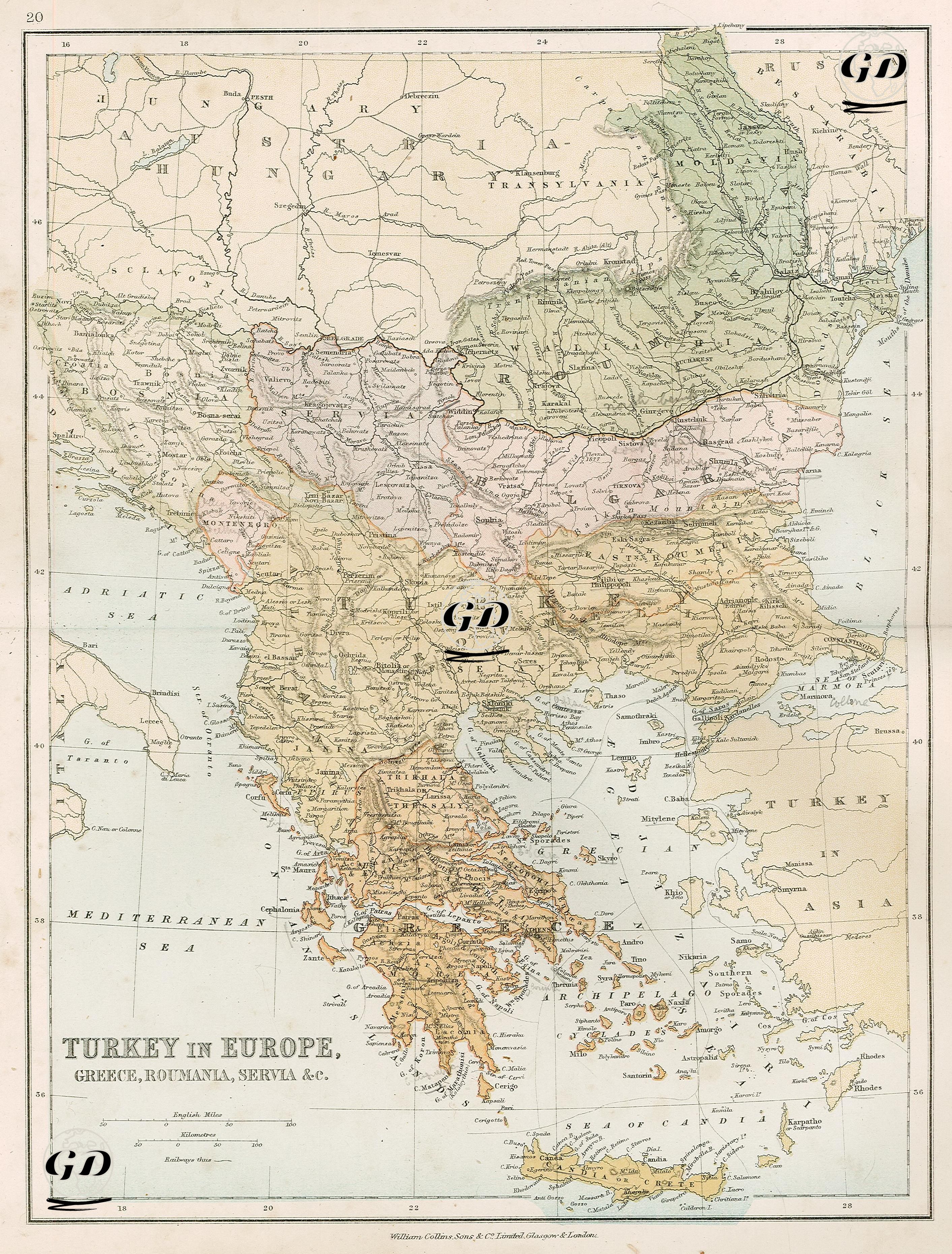
| Date | 1878 |
| Technique | Lithography-Colored |
| Category | Maps |
| Source | The Collegiate Atlas - William Collins Sons & Co. Limited, Glasgow & London |
This 1878 map is a detailed political and physical map depicting the Ottoman Empire's territories on the European continent (in other words, Rumelia in the classical sense). The newly independent Balkan states bordering these territories (Greece, Serbia, Montenegro, and Romania) are also highlighted in different colors, emphasizing the map's political nature. The map's focal point is the Balkan Peninsula, extending from the Adriatic to the Black Sea and the southern tip of the Greek peninsula. Ottoman provinces in Europe (such as Kosovo, Bitola, Thessaloniki, Adrianople, Bosnia, Shkodra, and Ioannina) are clearly depicted. Furthermore, the borders of Ottoman-dominated territories are marked with bold lines and separated from other newly formed nation-states by color gradients. Romania (Wallachia and Moldavia) is shown in green on the map. These regions declared independence from the Ottoman Empire in 1877 and were internationally recognized by the 1878 Treaty of Berlin. Similarly, Serbia and Montenegro are colored separately. Greece, a state that gained independence in 1830, is entirely colored orange and encompasses a geography extending from the Peloponnese Peninsula to Thessaly. At the southern end of the map, Crete and to the east, the Aegean Islands (Chios, Lesbos, Samos, etc.) are shown as Ottoman territories. This map documents the political fragmentation in the Balkans following the Treaty of Berlin (1878). It reflects a period in which Ottoman influence in Europe waned, local nationalist movements succeeded, and international diplomacy (especially the influence of Britain, Russia, and Austria-Hungary) reshaped the region. Ultimately, this map is a multilayered map encompassing not only the late geography of Ottoman Rumelia but also the dissolution of the Ottoman presence in Europe, the geographical repercussions of the wave of nationalism, and the ideological aspects of late 19th-century cartography.