GRAVÜR DÜNYASI
Digital Engraving Library
| Date | 1768 |
| Technique | Copper Engraving |
| Category | Maps |
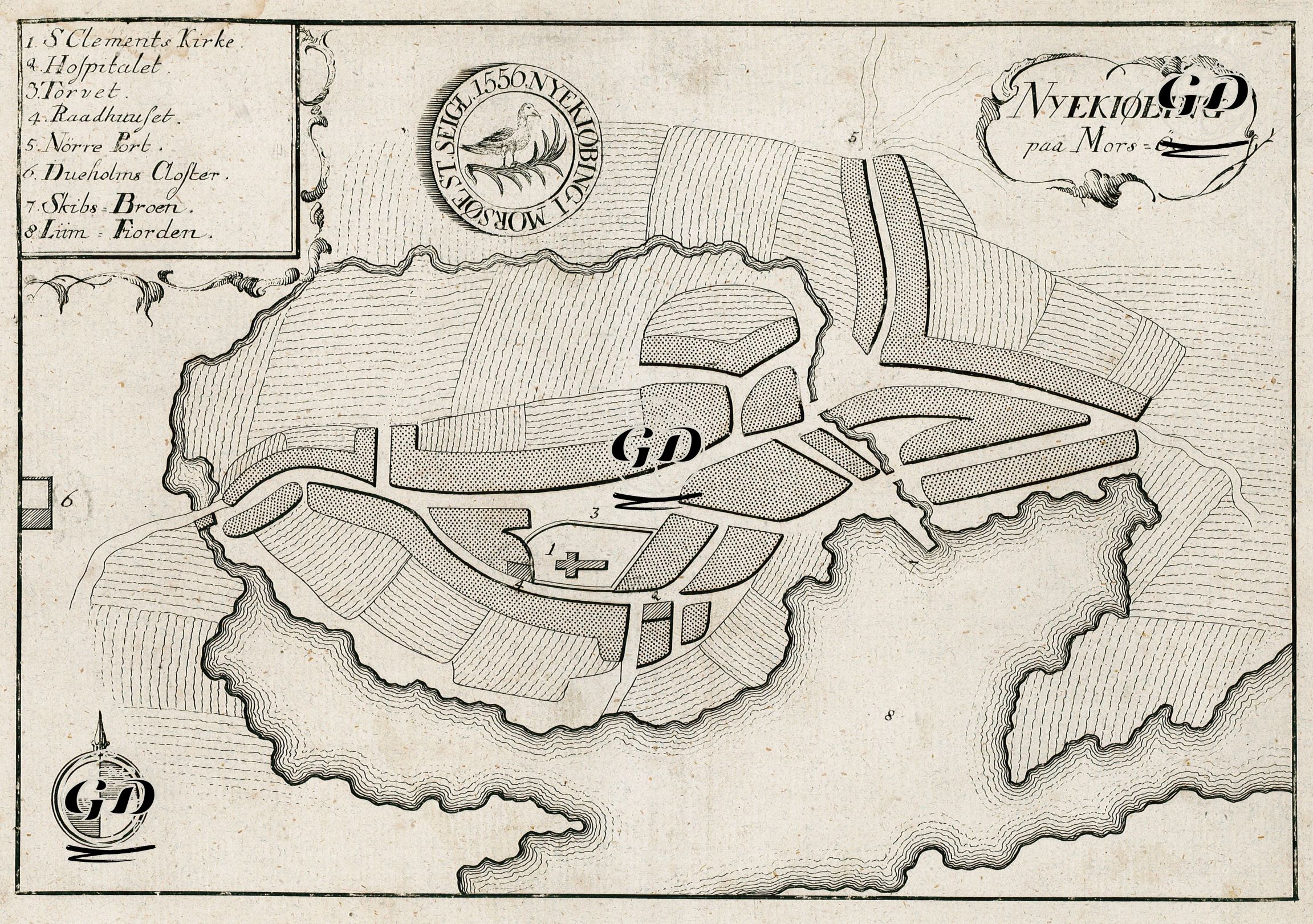
This engraving is an early 18th-century town plan of Nykobing, a town on the island of Mors, located west of the Jutland peninsula in northern Denmark. The map is titled "Nykjobing paa Mors-Oe" (Nykjobing on the island of Mors) and is drawn from a detailed bird's-eye perspective. The engraving displays a simple yet striking graphic layout, both topographically and morphologically. A numbered legend in the upper left corner identifies the town's major public buildings and geographical landmarks. These are, in order: 1. St. Clements Church, 2. Hospital, 3. Torvet, 4. Raadhuset, 5. Norre Port, 6. Dueholms Cloſter, 7. Skibs Broen, 8. Lim Fiorden. The centrally located buildings surrounding the town's main square are clearly demarcated. This square, designated number 3, is a focal point in typical Scandinavian town planning, where administrative and religious centers, such as the church (number 1) and the town hall (number 4), are concentrated. The surrounding hatched textures represent different land use types (e.g., agricultural fields, hamlets, open spaces), while the coastline is detailed with sloping lines. This technique adds a topographic dimension to the map, suggesting the terrain's slope. The city seal at the top of the map bears the inscription "Sigillum Thystedense 1550," and in its center is the coat of arms of Nykobing Mors: a bird standing in a reed bed, likely associated with local nature and fishing. This seal is an iconographic element that reflects both the municipal autonomy of the period and its visual identity. One of the most interesting aspects of the map is the settlement's structure within an island, virtually protected by natural boundaries. The city's passages opening to the water on both the north and southeast sides, and its internal roads connected by bridges, reinforce this impression. The "Skibs Broen" (ship pier), marked with the number 7, demonstrates the town's direct economic and logistical connection to the sea. The "Limfjorden", shown as number 8, is one of the most important inland waterways in northern Denmark and highlights Nykobing's strategic position in terms of maritime trade and transportation.