GRAVÜR DÜNYASI
Digital Engraving Library
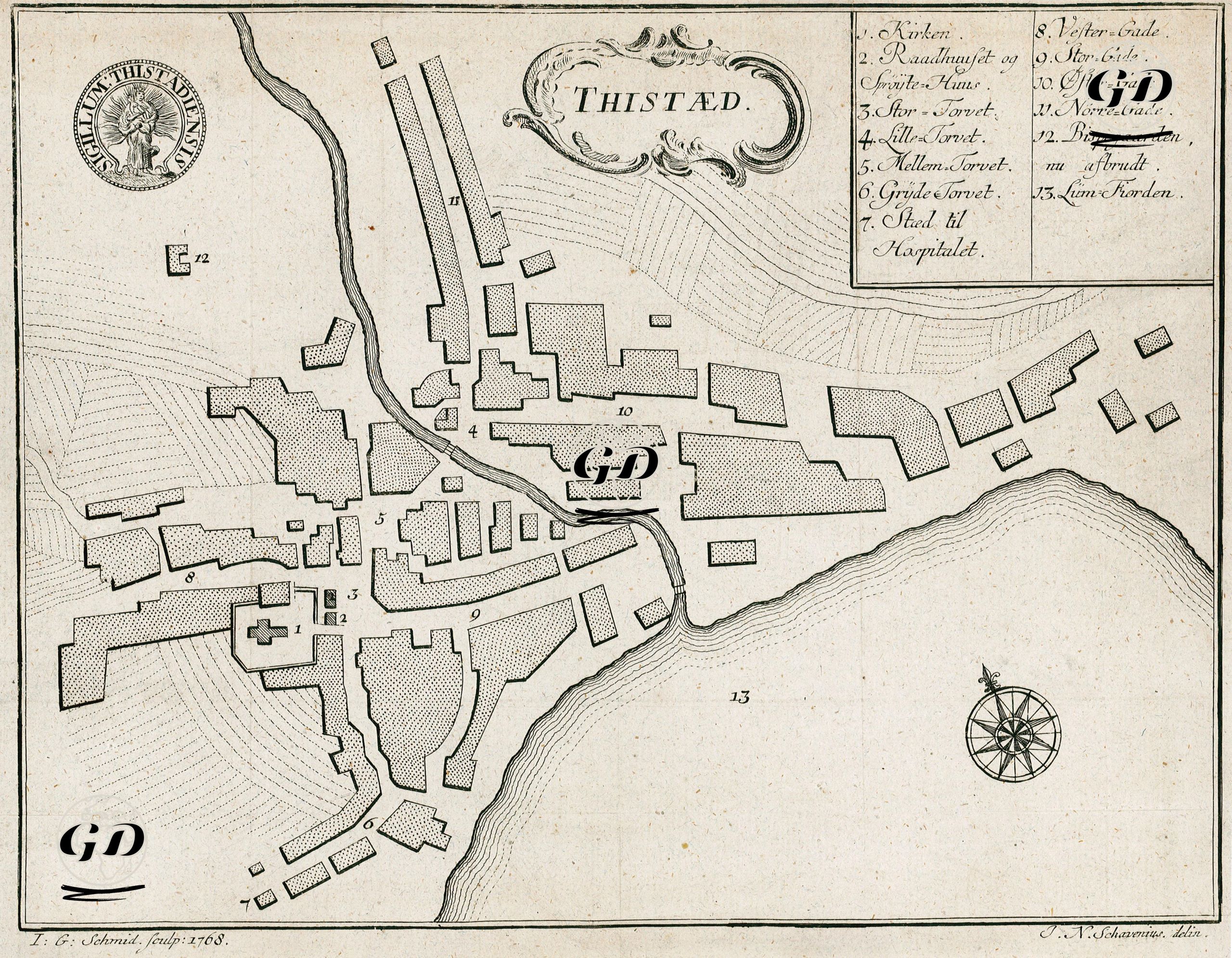
| Artist | Johan Nicolai Schavenius (1713-?) |
| Engraver | Johann Georg Schmidt |
| Date | 1768 |
| Technique | Copper Engraving |
| Category | Maps |
This map is an early modern town plan of the town of Thisted (written "Thistæd" on the map) in northwestern Denmark, dating from the 18th century. The map shows a bird's-eye view of the architectural structures, street network, and squares in the town center. Thisted was a market town and had a population of around 1,000. The legend in the upper right corner numbers the important buildings and settlements: 1. "Kirken" (Church), 2. "Raadhuset og Svines-Huus" (Town Hall and Pigsty), 3. "Store Torvet" (Large Square), 4. "Lille Torvet" (Small Square), 5. "Mellem Torvet" (Middle Square), 6. "Gryde Torvet" (Gryde Square), 7. "Sted til Hospitalet" (Place reserved for the hospital). The other entries are street names: Vester Gade, Øster Gade, Nørre Gade, etc. The map bears the typical characteristics of 18th-century northern European town plans: a simple yet readable drawing style based on symmetry and geometric spatial distribution. Architectural blocks are stylized and represented with various texture hatchings. The town of Thisted's coat of arms, in the form of a seal, is located in the upper left corner of the map. The map presents both urban morphology (the layout of squares, streets, and public buildings such as churches) and topography (elevations and coastline, as indicated by slope lines). The slope lines descending towards the shore in the lower left and lower right corners indicate that the city was a coastal settlement, sloping towards the sea. The area on the east side (number 13) contains "Sund-Forden" (probably meaning a fjord or sea arm). A small stream or channel (probably the present-day Havn Canal) flows from the northwest through the center of the map, reaching the sea from the city center.