GRAVÜR DÜNYASI
Digital Engraving Library
| Date | 1899 |
| Technique | Lithography-Colored |
| Category | Maps |
| Source | W.Lincoln 239 High Holborn, London- |
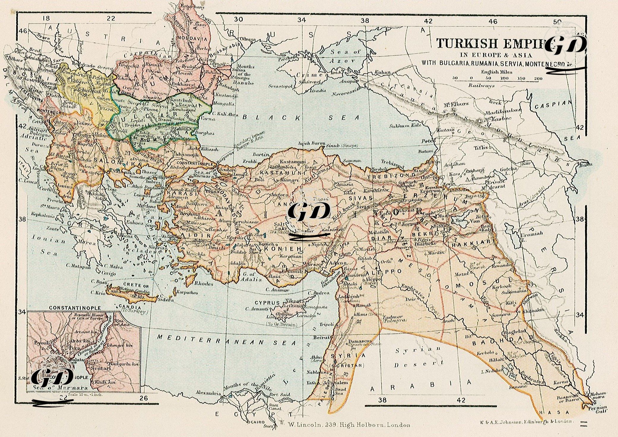
his 1899 map shows in detail the Ottoman Empire's final borders and administrative geography in Europe and Asia, while also defining the political entities of Balkan states such as Bulgaria, Romania, Serbia, and Montenegro, reflecting the political balance shaped by the Treaty of Berlin. The map's color coding serves to distinguish both Ottoman administrative provinces and regions outside the Ottoman Empire but historically associated with this region; the borders of the new Balkan states, in particular, are marked with bold lines and light tones. Cities such as Konya, Ankara, Sivas, Erzurum, Diyarbakir, and Adana, provincial centers on the Anatolian peninsula, are clearly marked. The map considers not only political borders but also geographical features: natural features such as mountain ranges, rivers, and steppes are shown in detail. The strategic location of the straits (the Dardanelles and the Bosphorus) is clearly shown, and a more detailed map of Istanbul and its surroundings is provided in a small box in the lower left corner of the map.