GRAVÜR DÜNYASI
Digital Engraving Library
| Artist | A.Bizet-Barbier |
| Engraver | Lecocq |
| Date | 1889 |
| Technique | Steel Engraving-Original Hand Colored |
| Category | Maps |
| Source | Atlas France and its Colonies, published by J. Migeon - Dresse Sous La Direction De J.Migeon Par Ch.Lacoste - Migeon Editeur imp. 11 r. du Moulin Vert, Paris |
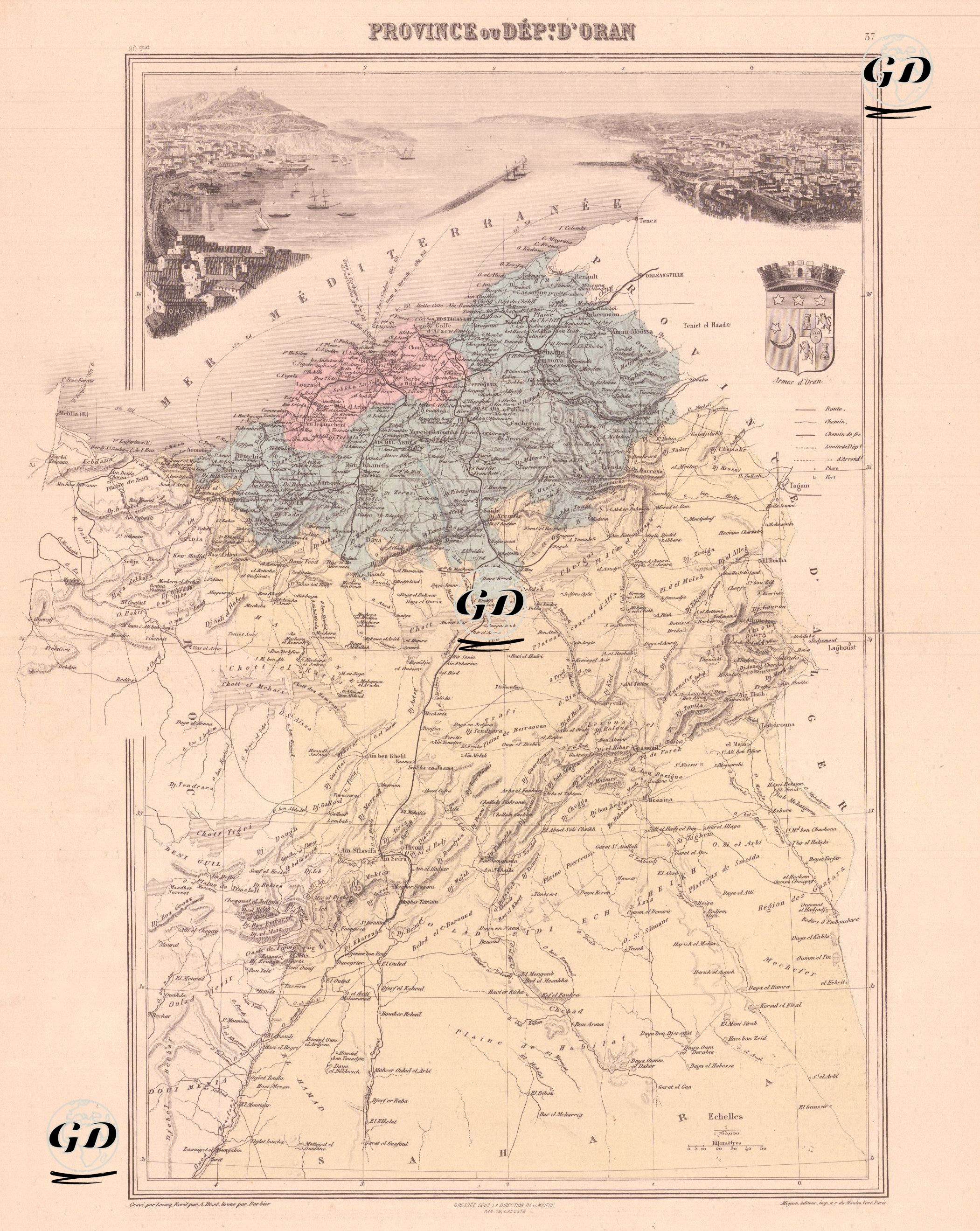
This map, dating from the French colonial period, depicts the Province of Oran, or Department of Oran, located west of Algeria, and reflects both geographical and topographical distinctions and political distinctions. Algeria became a military colony of France from 1834. According to the French Constitution of 1848, it became an integral part of French territory and was divided into three French departments (Algiers, Oran, and Constantine). The map's level of detail is quite high, containing a wealth of information, from tribal settlements to mountain passes, trade routes to military outposts. One of the map's most striking features is its detailed geographical information and panoramic visual element. At the top of the map is a detailed panorama of Oran's port and city, serving as a visual representation of the city's geographic layout and architecture during that period. The coat of arms in the upper right corner of the map indicates the symbolic representation of Oran during the French period. The symbols used on the map are also explained below the coat of arms.