GRAVÜR DÜNYASI
Digital Engraving Library
| Engraver | Thomas Starling (1796-1850) |
| Date | 1834 |
| Technique | Steel Engraving |
| Category | Maps |
| Source | Published By Baldwin & Gradock 47, Paternoster Row, Under the Superintendence of the Society for the Diffusion of Useful Knowledge. April 1 1834 - Wilminghton Square, London |
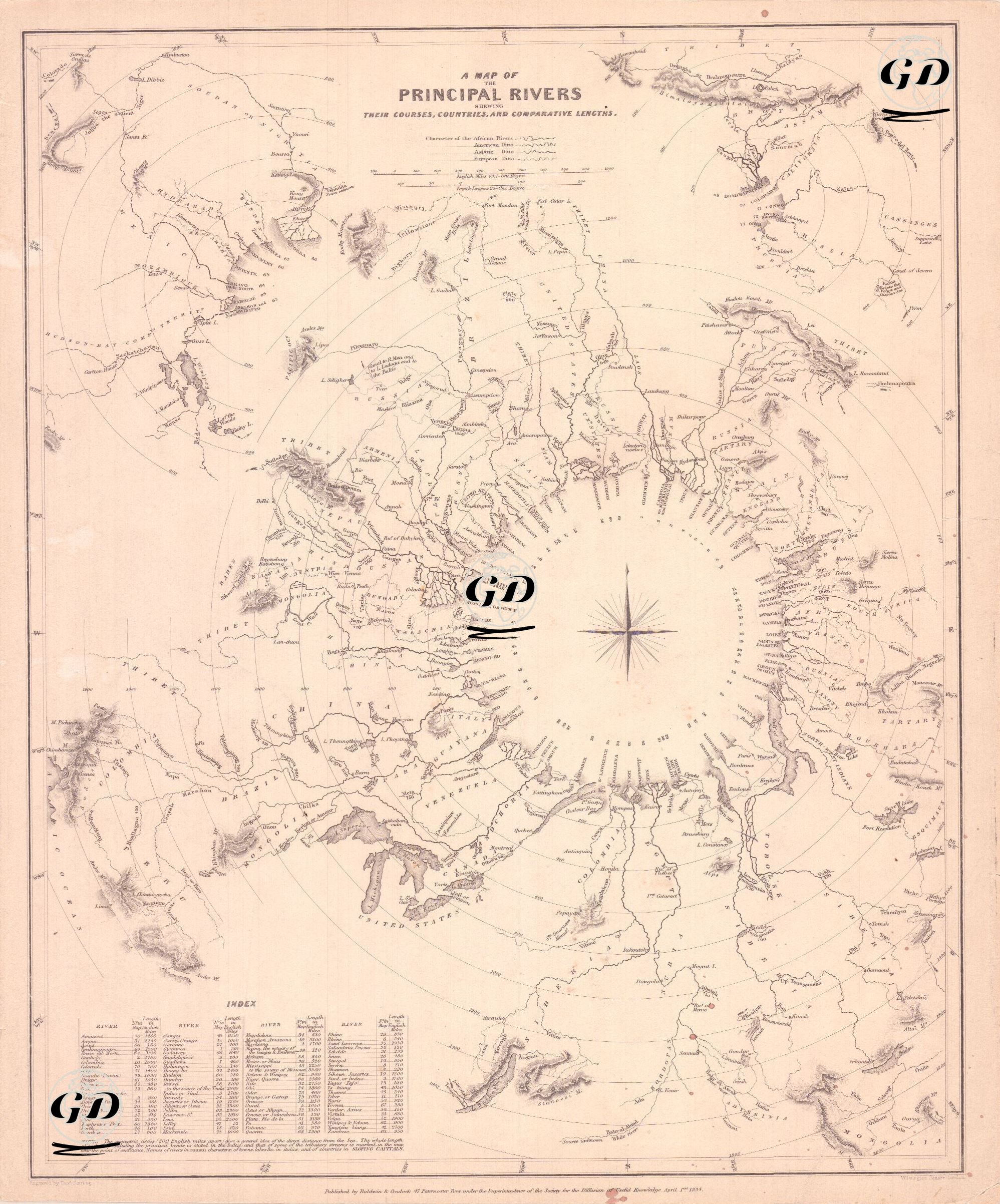
This map is a special thematic map designed to show the flow directions, countries, and comparative lengths of the world's major rivers. Rather than a traditional geographical map, the map is more like a comparative diagram. It was published by the Society for the Diffusion of Useful Knowledge (SDUK). SDUK was founded in 1826 by the Englishman Lord Henry Peter Brougham. The London-based society, which published inexpensive but high-quality scientific maps for a rapidly expanding readership, played a significant role in the history of 19th-century education. The map was designed in an unusual way: instead of the traditional north-south orientation of the world map, the rivers are arranged circumferentially around a compass rose. Around the large circular compass rose at the map's center, the flow paths of rivers from the world's different continents, from their source points to their confluence with the sea, are drawn. Next to each river is the name and the countries it flows through, making it easy to compare the lengths of major rivers on different continents, from the Amazon to the Nile, from the Mississippi to the Ganges. Rivers are listed thematically, focusing on length and information rather than geographical accuracy. Relevant topographic or political details such as mountain ranges, cities, and major tributaries are also depicted. The "Index" section in the lower left corner lists river names alphabetically, along with their map numbers and lengths in miles, in a table. This table can be matched to their locations on the map. Therefore, the map contributes to geographic education, fosters understanding of the importance of intercontinental waterways, and facilitates comparative analysis.