GRAVÜR DÜNYASI
Digital Engraving Library
| Engraver | J. & C.Walker (Active 1820-1895) |
| Date | 1833 |
| Technique | Copper Engraving |
| Category | Maps |
| Source | Published Under the Supervision of the Society for the Diffusion of Useful Knowledge (SDUK)-Published April 1 1833 By Baldwin & Gradock 47, Paternoster Row London-Zahrtman, Carl af Forsell 1826. |
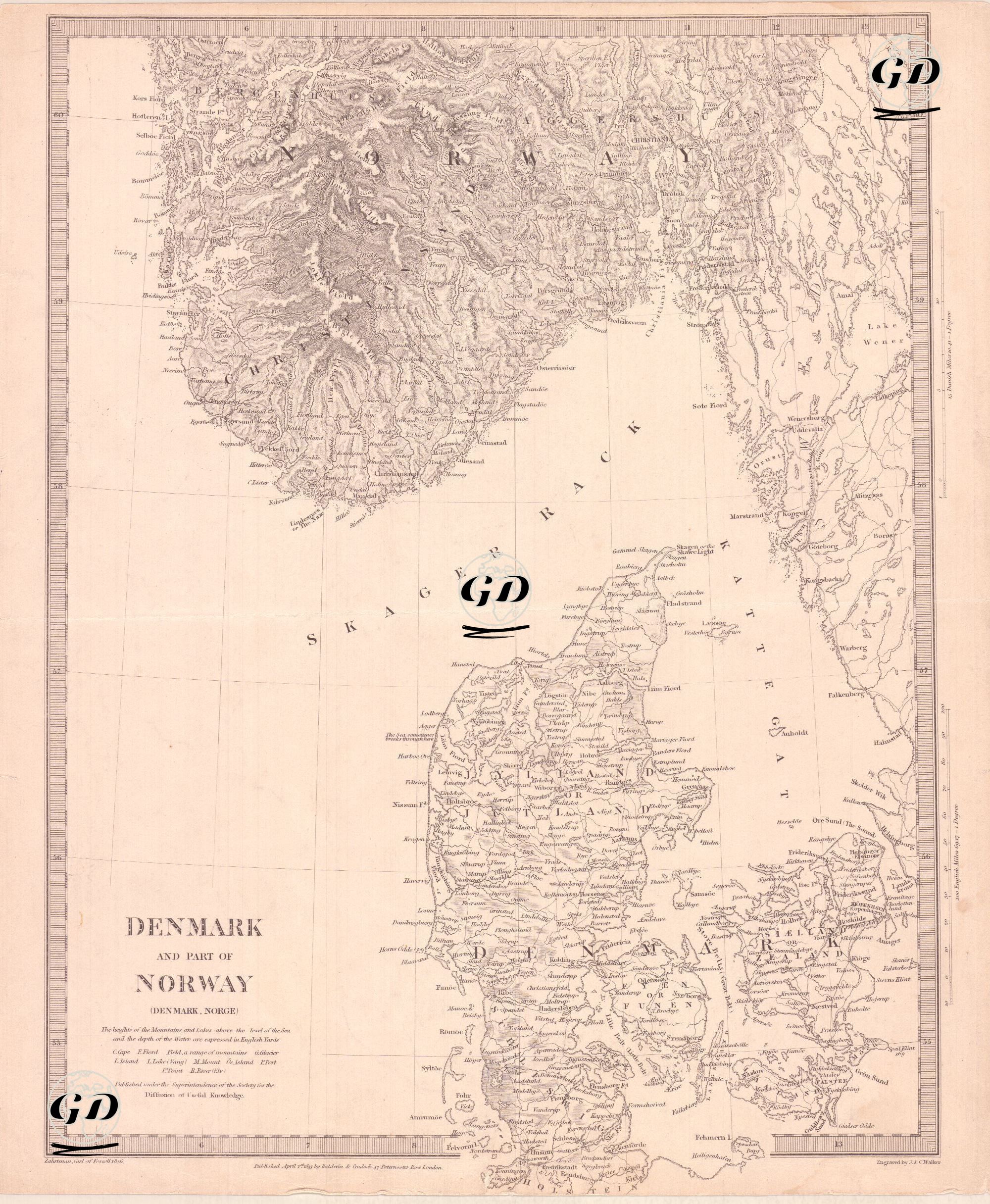
This 1833 map shows the geography, sea passages, port cities, and administrative districts of the northern coast of Denmark and the southern coast of Norway in detail. The map was published by the Society for the Diffusion of Useful Knowledge (SDUK). SDUK was founded in 1826 by Lord Henry Peter Brougham. The London-based society, which published inexpensive but high-quality scientific maps for a rapidly expanding readership, played a significant role in the history of 19th-century education. The map shows the peninsula of Jutland, Denmark's mainland, and the large islands of Fyn (Funen) and Sjælland (Zealand) to its east, along with the surrounding islands of various sizes. Important cities include Copenhagen, Odense, Aarhus, Aalborg, Haderslev, Roskilde, Nyborg, Elsinore (Helsingør), and Svendborg. Administrative borders, cities and towns, rivers, ports and crossing points on the map are carefully marked. The fjords and mountain ranges at the southern tip of Norway are depicted in detail using topographic shading; prominent city names include Christiania (present-day Oslo), Drammen, Bergen, Stavanger, Arendal, Christiansand, and Skien. The Skagerrak Strait, located in the map's center, is highlighted as the natural waterway between Norway and Denmark, while the Kattegat Strait encompasses the waterways between Denmark and Sweden.