GRAVÜR DÜNYASI
Digital Engraving Library
| Artist | Auguste-Henri Dufour (1798-1865) |
| Engraver | Charles Dyonnet (1822-1880) |
| Date | 1845 |
| Technique | Steel Engraving-Original Hand Colored |
| Category | Maps |
| Source | Atlas de l'Histoire du Consulat et de l'Empire, par Joseph Louis Adolphe Thiers (1797-1877), Édité à Paris |
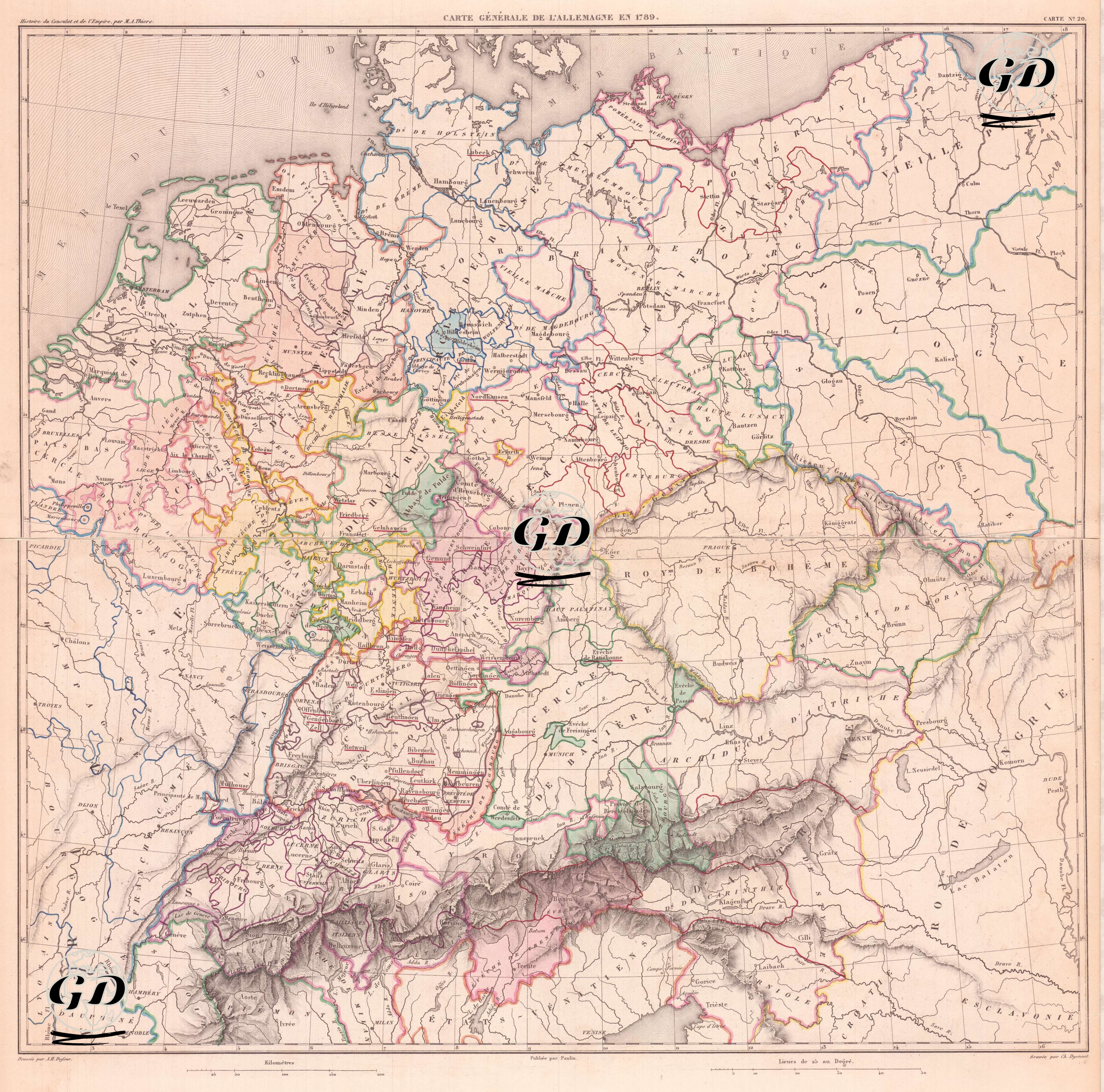
This map, titled “Carte Generale de l’Allemagne en 1789,” shows in detail the complex and fragmented political structure of the Holy Roman Empire just before the French Revolution. The map reveals the state of Germany during this period, when the landscape was fragmented into hundreds of autonomous and semi-autonomous units, and distinguishes various administrative units such as duchies (duchies), counties (comtes), principalities (principautés), episcopal lands (Eveches/Archeveches) and free cities (Villes Libres) through colored borders. Major episcopal centers such as Cologne, Trier and Mainz stand out in the west; duchies such as Swabia, Bavaria, Württemberg and Baden in the south; and Brandenburg, Pomerania, Mecklenburg and the Kingdom of Prussia in the north. Neighboring regions such as the Archduchy of Austria, the Kingdom of Bohemia and Poland are clearly defined on the map’s eastern borders; A detailed drawing of the Alps to the south shows Germany's borders with Switzerland and Italy. This map lends itself to in-depth analysis not only in terms of political borders but also dynastic relations, feudal structures, and European diplomatic history. Showing the final order before Napoleon's dissolution of the Holy Roman Empire in 1806 and the establishment of organizations such as the Confederation of the Rhine, this map is important for documenting Germany's multi-centered structure before unification.