GRAVÜR DÜNYASI
Digital Engraving Library
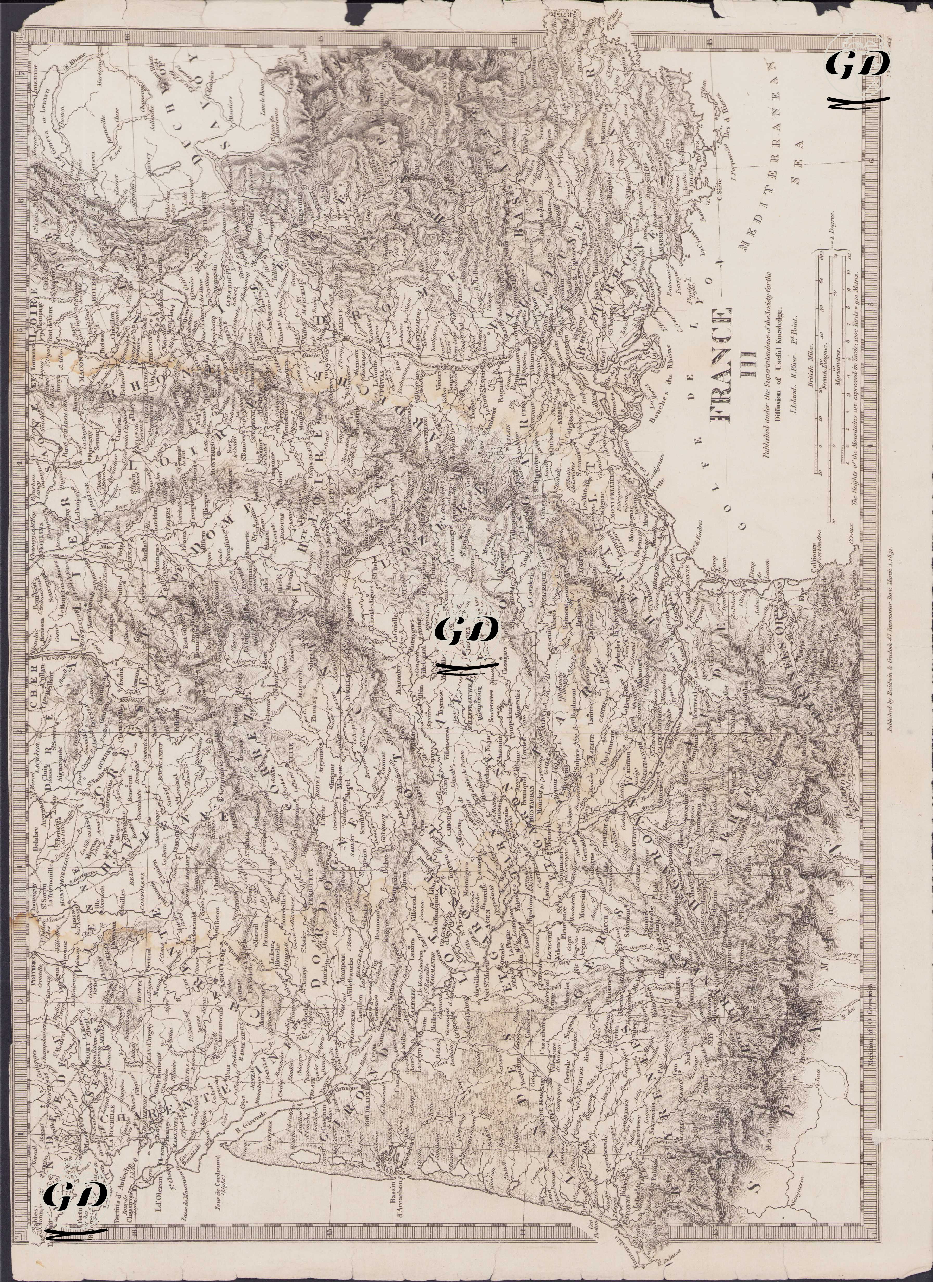
| Engraver | J. & C.Walker (Active 1820-1895) |
| Date | 1831 |
| Technique | Copper Engraving |
| Category | Maps |
| Source | Published Under the Supervision of the Society for the Diffusion of Useful Knowledge (SDUK) - Published By Baldwin & Gradock 47, Paternoster Row, March 1 1831 |
This map, dated 1831, shows the southern regions of France in geographical detail. The title "France III" appears at the bottom of the map and indicates that it was published by the Society for the Diffusion of Useful Knowledge (SDUK). SDUK was founded in 1826 by the English Lord Henry Peter Brougham. The London-based society, which published inexpensive but high-quality scientific maps for a rapidly expanding readership, played a significant role in the history of 19th-century education. The map covers a vast area from southwestern France to the Mediterranean coast, from the Spanish border to the Massif Central mountains. Cities such as Bordeaux, Bayonne, and Pau lie to the west, and important cities such as Nîmes, Avignon, Valence, and Grenoble to the east. The map provides detailed information on both administrative boundaries and natural features (rivers, mountain ranges, valleys). For example, important rivers such as the Garonne, Dordogne, Tarn, Lot, Rhone, and Herault are clearly marked on the map. Geographically, the Pyrenees Mountains form a natural border with Spain at the southern edge of the map. The Massif Central region is also depicted with intense elevations, carefully reflecting its rugged nature. Departments such as Aveyron, Cantal, Lozere, and Haute-Loire lie within this elevation zone. Place names on the map are transcribed entirely in English, demonstrating that it was designed for an English-speaking audience.