GRAVÜR DÜNYASI
Digital Engraving Library
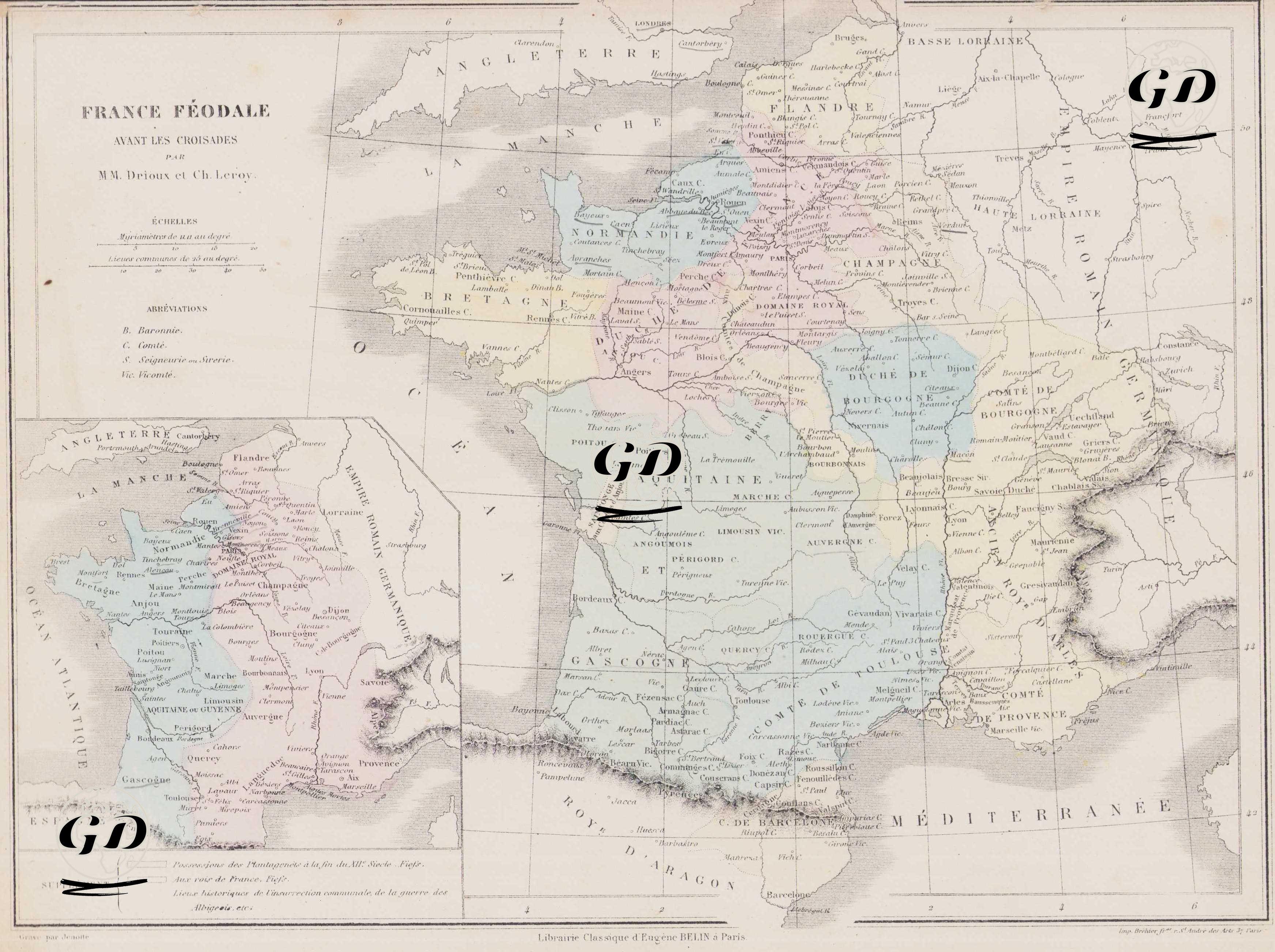
| Artist | Claude Joseph Drioux (1820-1898)-Charles Leroy |
| Engraver | Jenotte |
| Date | 1872 |
| Technique | Steel Engraving-Original Hand Colored |
| Category | Maps |
| Source | Atlas Universel et Classique de Geographie - Librairie Classique Eugene Belin a Paris |
This map shows the political and administrative structure of France just before the Crusades. Regional lordships, counties, duchies, and royal authorities are marked in different colors, visually emphasizing feudal fragmentation. The box in the lower left corner of the map provides the meanings of the symbols used: B (Baronnerie), C (County - Comte), D (Duchy - Duchy), V (Local or semi-independent governments - Gouvernement ou Souverainete), R (Kingdom - Royaume). Particularly noteworthy on the map are the Duchy of Normandie (Duchy of Normandy), the Duchy of Bourgogne (Duchy of Burgundy), the Count of Flanders (County of Flanders), the regions of Aquitaine and Gascogne (in the southwest), the narrow core area known as the Royaume de France, which the Capetian dynasty held around Paris, and the Comte de Toulouse, Royaume d'Aragon, and the Comte de Provence in the south, all depicted as semi-independent political entities of the period. The small inset in the lower left corner of the map shows the Plantagenet dynasty of England's holdings in France at the end of the 12th century.