GRAVÜR DÜNYASI
Digital Engraving Library
| Date | 1843 |
| Technique | Steel Engraving |
| Category | Maps |
| Source | Complement de L'Encyclopedie Modern...Librairie de Firmin-Didot, Paris |
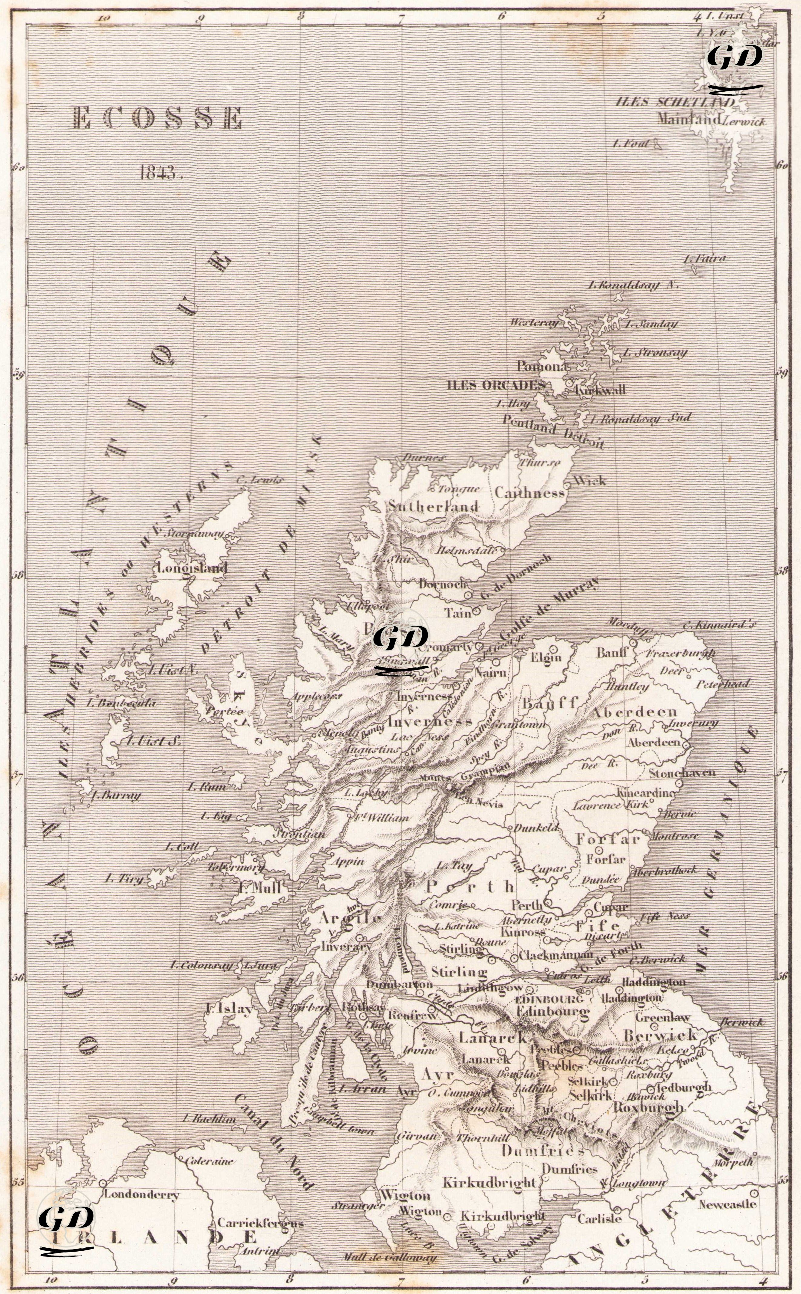
This map is a French-titled map of Scotland (“Ecosse”) dated 1843. Created by the French geographer Theophile Duvotenay, this engraving provides a detailed depiction of Scotland’s political and geographical divisions during the mid-19th century. The map presents Scotland not only with its mainland boundaries but also includes the adjacent island groups—the Hebrides, Orkney, and Shetland Islands—emphasizing its strategic location between the “Ocean Atlantique” (Atlantic Ocean) to the west and the “Mer du Nord” (North Sea) to the east. The map features regional names, urban centers, river valleys, and mountain ranges in precise detail. The capital Edinburgh (Edimbourg) stands out in the southeast, while Inverness is prominent in the north, Aberdeen in the east, Argyle in the west, and Dumfries, Lanark, Ayr, and Selkirk represent key counties in the south. The map also includes the entire Hebrides archipelago off the western coast of Scotland, carefully depicting islands such as Islay, Mull, Skye, and Lewis. Additionally, the Orkney Islands (Iles Orcades) to the north and the Shetland Islands (Iles Shetland) further north are represented, with place names such as Mainland and Lerwick clearly marked. Geographical markings on the map depict mountain chains using linear symbols, while rivers and lakes are illustrated with conventional cartographic signs typical of the classical mapmaking tradition. The north–south elongation of Scotland and its irregular coastline are emphasized, showcasing the natural topography that characterizes the region.