GRAVÜR DÜNYASI
Digital Engraving Library
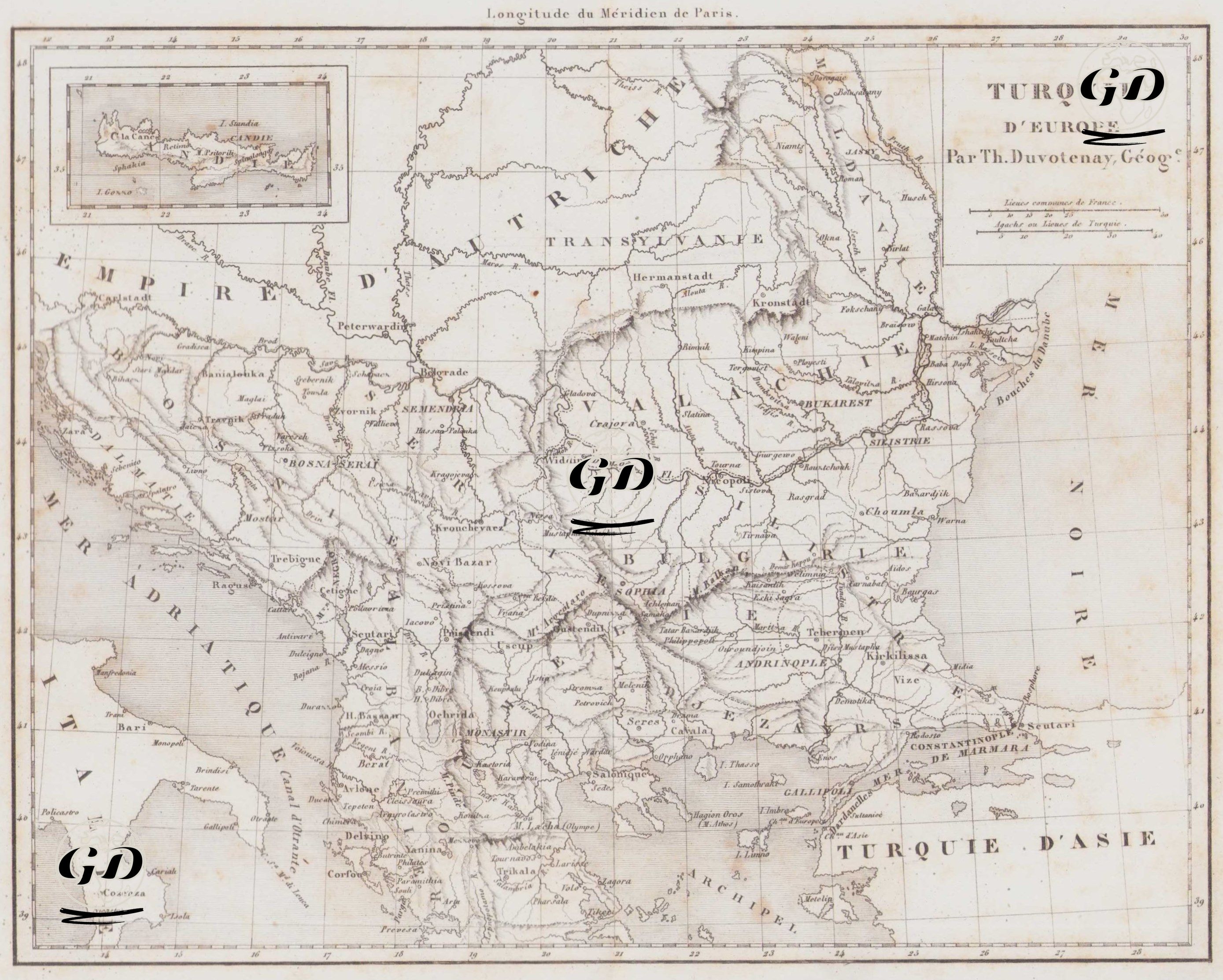
| Artist | Thunot Duvotenay (1796-1875) |
| Date | 1840 |
| Technique | Copper Engraving |
| Category | Maps |
| Source | L'Univers Pittoresque, Paris |
This 1840 map, prepared by French cartographer Thunot Duvotenay, comprehensively depicts the Ottoman Empire's European territories in the 19th century. The map depicts the present-day Balkans—Albania, Kosovo, North Macedonia, Serbia, Bulgaria, Bosnia and Herzegovina, Montenegro, northern and central Greece, and southern Romania—as Ottoman territories. Neighboring regions such as the "Empire d'Autriche" (Empire of Austria) are also indicated at the top of the map, along with "Moldavia" and "Valachie" (Moldavia and Wallachia) to the east, and "Turquie d'Asie" (Asian Turkey) to the south. Istanbul is marked "Constantinople" on the map and is located along the strategic Bosphorus straits. Among the Aegean islands, Crete is also shown as a small legend in a separate box in the upper left corner of the map. The important cities of the Rumelia Province in the center of the map—such as Salonika, Edirne (Andrinople), Uskub (Uskub), Sofia (Sofia), and Plovdiv (Philippopolis)—are clearly shown, and military and administrative routes are drawn in detail.