GRAVÜR DÜNYASI
Digital Engraving Library
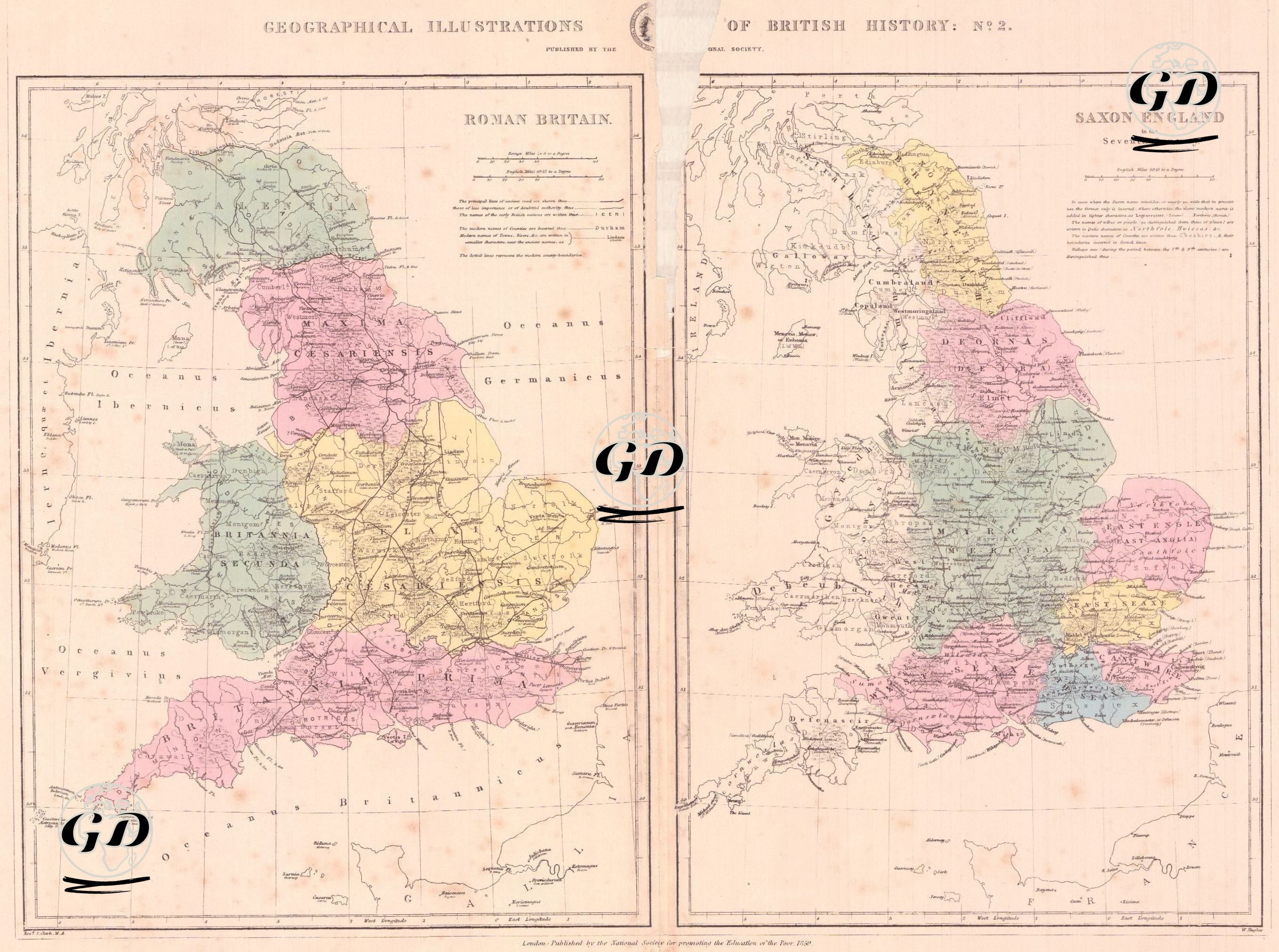
| Artist | S.Clark |
| Engraver | William Hughes (1818-1876) |
| Date | 1859 |
| Technique | Steel Engraving-Original Hand Colored |
| Category | Maps |
| Source | London, Published by the National Society for promoting the Educationor the Poor, 1859 |
This double-panel map presents a comparative analysis of two key periods in British history. The left panel depicts "Roman Britain," the period of Roman rule over Britain, while the right panel depicts "Saxon England," the period shaped by the rise of the Saxon kingdoms in the 7th century AD. The left map shows a detailed depiction of the Roman administrative structure in Britain, divided into five main provinces (e.g., Britannia Prima, Flavia Caesariensis, and Maxima Caesariensis), with Roman roads, military bases, and cities meticulously marked. Defensive lines such as Hadrian's Wall and the territories of indigenous tribes such as the Iceni and Brigantes are also visible. The right map, from the Saxon period, reflects the fragmented political structure that emerged in Britain after the end of Roman rule. The distinct Saxon kingdoms of Mercia, Northumbria, Wessex, East Anglia, Kent, Sussex, and Essex are shown with colored borders, clearly highlighting this political fragmentation. The two maps present comparative administrative structures and territorial divisions of two different eras within the same geographical area, providing a visual means of analysing Britain's transition from the centralised administrative structure of the Roman period to the feudal and divisional order of the Saxon period.