GRAVÜR DÜNYASI
Digital Engraving Library
| Artist | John James Dower (1825-1901) |
| Engraver | John James Dower (1825-1901) |
| Date | 1856 |
| Technique | Woodblock Engraving (Newspaper-Text on Reverse) |
| Category | Maps |
| Source | The İllustrated London News (April 05 1856-Page 360) |
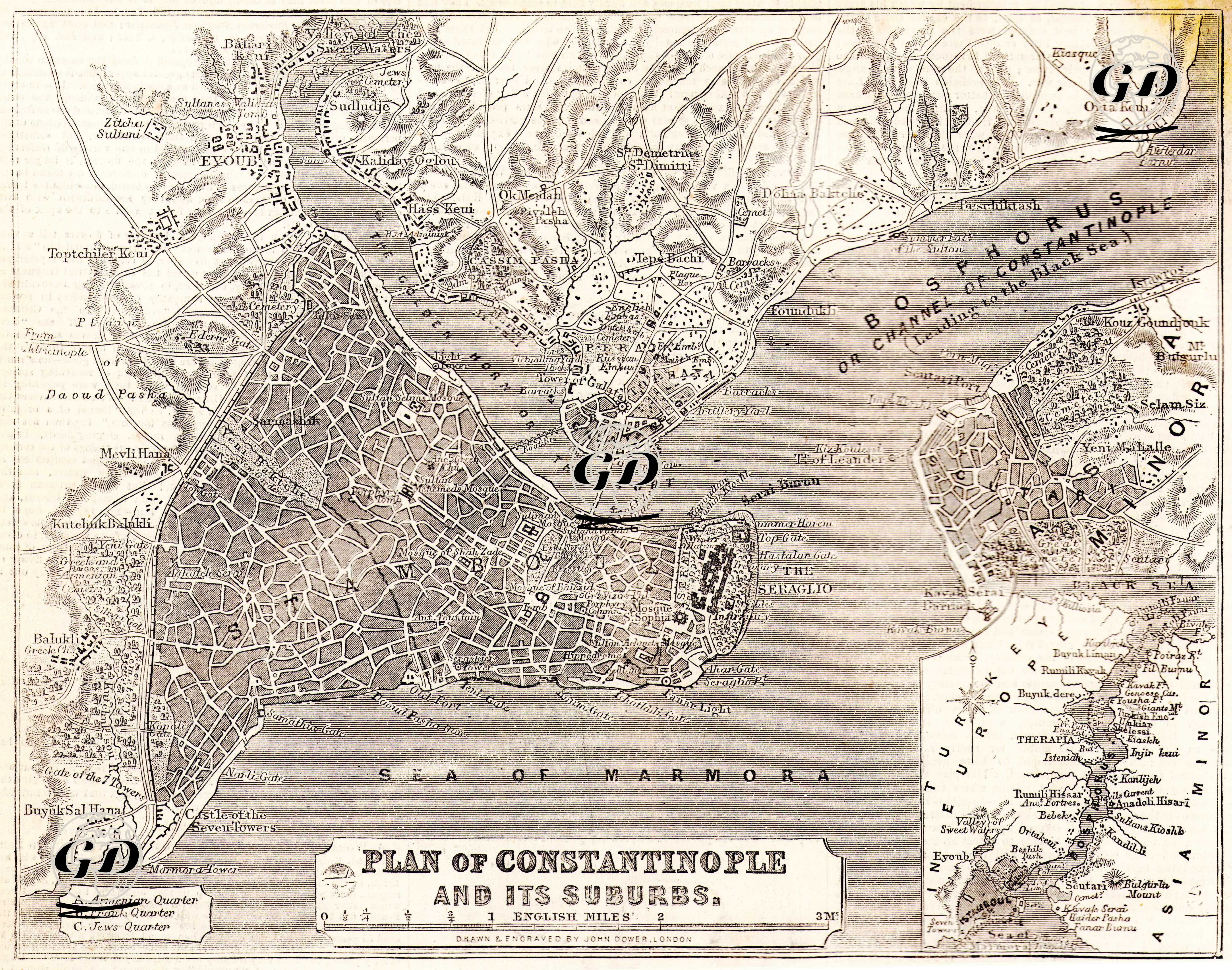
This map, prepared by John James Dower and titled “City Plan of Istanbul”, was published in the Illustrated London News in 1856. This map provided information suitable for both touristic and diplomatic-colonial use to British newspaper readers about Istanbul, which had attracted great interest from the British and French during the Crimean War (1853–1856). It was aimed at a Western audience, especially by emphasizing the ethnic structure of the forts and neighborhoods on the Bosphorus line. Non-Muslim settlements were also marked on the map (Armenian Quarter, Levantine/European Quarter (Beyoğlu-Galata surroundings-Frank Quarter) and Jewish Quarter (Haskoy and Balat surroundings-Jews Quarter)).