GRAVÜR DÜNYASI
Digital Engraving Library
| Engraver | Josiah Neele (1804-1876) - James Neele (active 1828-1832) |
| Date | 1831 |
| Technique | Copper Engraving-Original Hand Colored |
| Category | Maps |
| Source | London Published Feb 1 1831 by T.Cadell & the other Proprietors |
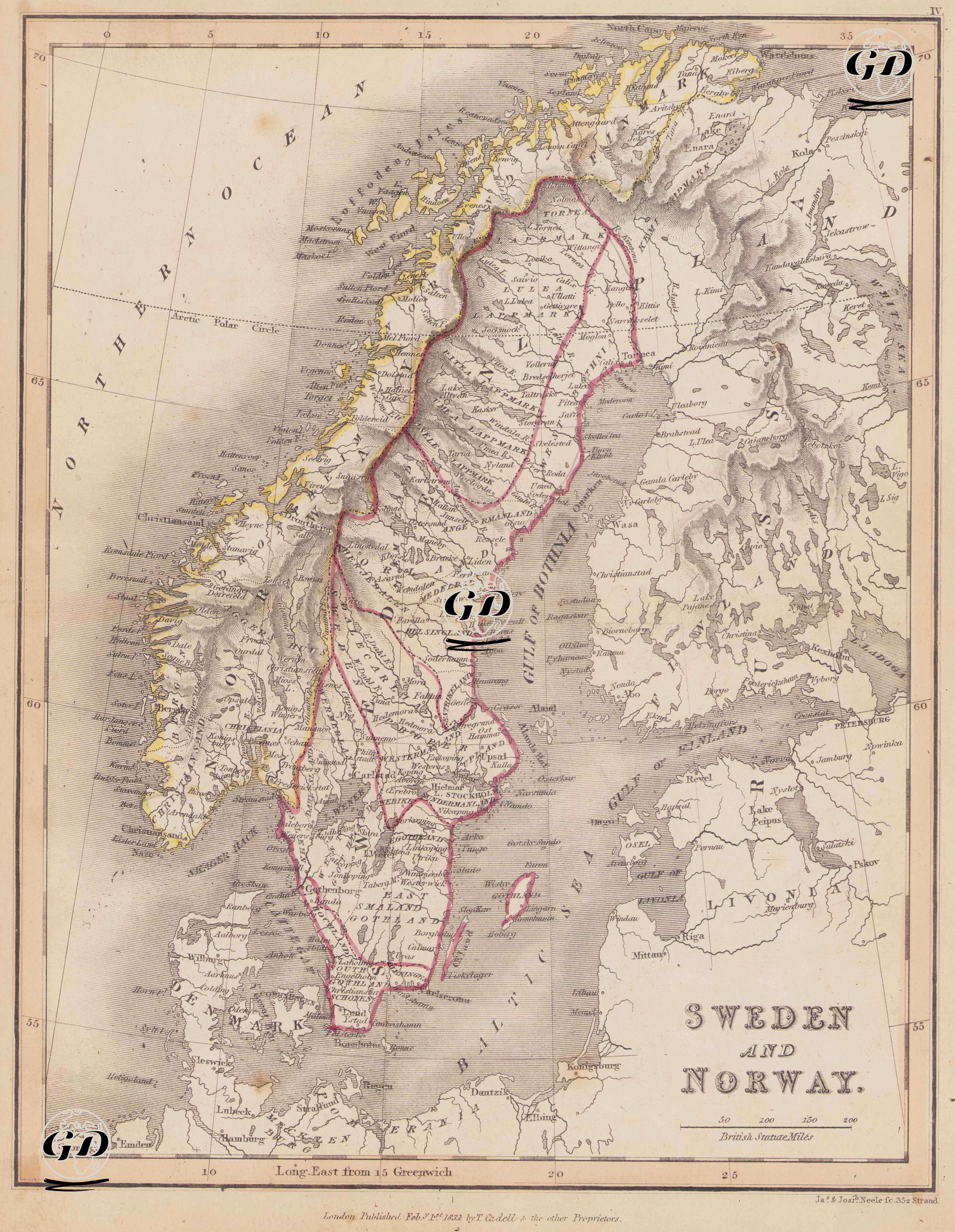
This map dated 1831 depicts the period of unity between Sweden and Norway, a period particularly marked by the reshaping of the political landscape in Europe following the Napoleonic Wars. This period refers to the Swedish-Norwegian Union, which existed from 1814 to 1905. Following the Napoleonic Wars, the Treaty of Kiel signed in 1814 separated Norway from Denmark and ceded it to Sweden. However, following a brief conflict over Norway's demand for independence, a personal union (crown union) was established between the two countries: two separate states, ruled by the same king. This political union is presented on the map as "Sweden and Norway" within a single frame, with borders distinguishing the two countries. Sweden (Sweden) is demarcated by red lines on the map. Its capital, Stockholm, is marked on the eastern shore of the map, along the Baltic Sea. During this period, Sweden continued to exist as an influential kingdom along the Baltic Sea to the east. Lakes (especially Vanern, Vattern, and Malaren) are clearly marked on the map. Finland was part of the Russian Empire at the time (from 1809), so the Swedish border was drawn westward. Norway is separated from Sweden by yellow coastal markings and internal border lines on the map. Christiana (present-day Oslo) is marked as the capital. The mountainous and fjord-like structure along Norway's western coast is shown in detail using the hachure technique. The Arctic Circle is drawn north of the map (near the 66° parallel), and northern settlements such as Tromsø and Nordkapp are included. The North Sea (North Ocean) is shown west of Norway, and the Baltic Sea, Skagerrak, and Kattegat Straits are shown east of Sweden. Additionally, fjords are prominent along the Norwegian coast, and lakes and forests are prominent in Sweden. Longitude is measured using the East from Greenwich system, and British Statute Miles is used as the scale.