GRAVÜR DÜNYASI
Digital Engraving Library
| Engraver | Josiah Neele (1804-1876) - James Neele (active 1828-1832) |
| Date | 1831 |
| Technique | Copper Engraving-Original Hand Colored |
| Category | Maps |
| Source | London Published Feb 1 1831 by T.Cadell & the other Proprietors |
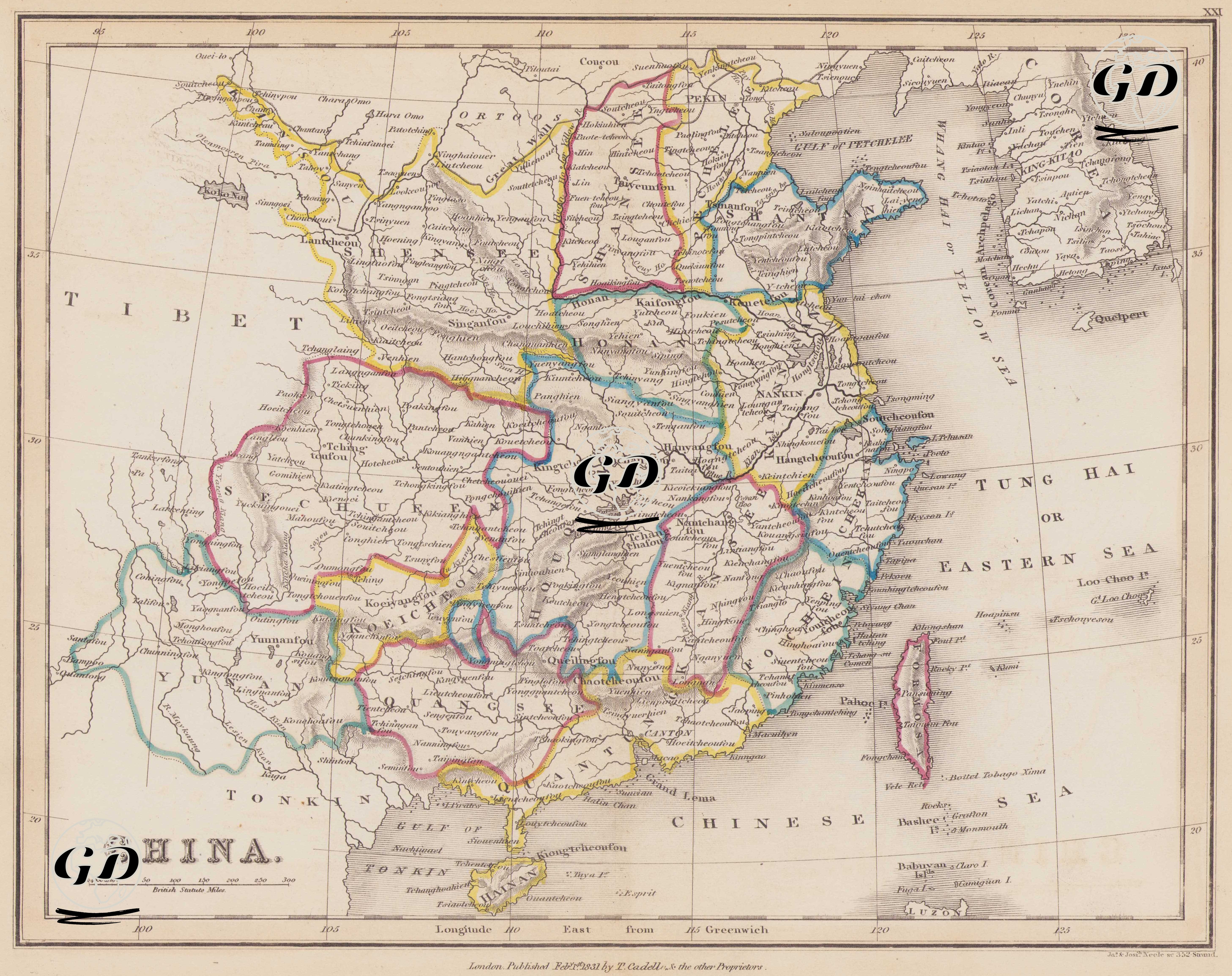
This map dated 1831 reflects the geographic, administrative, and strategic structure of the Chinese Empire during the Qing Dynasty. It encompasses not only the present-day Chinese mainland but also significant surrounding areas—such as Tibet, Tonkin (Northern Vietnam), Formosa (Taiwan), Korea, the Loo-Choo Islands (Ryukyu/Okinawa), and Tung Hai (East China Sea). This map dates to a period before the First Opium War, which began in 1839, when Qing China's contact with the outside world was limited but tense. European interest in China, particularly Britain, was rapidly increasing during this period, and trade and diplomatic routes were highlighted on the map. The map reflects China's administrative division based on the traditional 18-province system. Each province is bordered by a different color. Some of the provinces on the map include Pechelee (Zhili - the province containing the capital Beijing, the seat of the Qing Dynasty), Shantan (Shantung - Shandong), Shansee (Shansi - Shanxi), Shensee (Shensi - Shaanxi), Honan (Henan), and Kiannan (Kiangsu - Jiangsu). Tibet is located in the west of the map and was de facto under Qing control in the 1830s. Tonkin is shown in the southwest of the map (present-day North Vietnam) and is within China's sphere of influence. Formosa (Taiwan) is clearly demarcated and shown as Chinese territory. The Loo-Choo Islands (Ryukyu Islands), present-day Okinawa, were disputed territories between China and Japan and appear within China's sphere of influence. Korea is not designated as a vassal state of China but is directly referred to as "Korea." The map clearly depicts major river systems such as the Yangtze (Yang-tse-Kiang) and the Huang He (Yellow River). Surrounding seas such as the Tung Hai (Eastern Sea), the Chinese Sea, and the Yellow Sea are also depicted in detail. The map is based on the "Longitude East from Greenwich" measurement system, and the scale is given in British Statute Miles. Mountainous areas are shown using the classical “hachure” shading method.