GRAVÜR DÜNYASI
Digital Engraving Library
| Engraver | Josiah Neele (1804-1876) - James Neele (active 1828-1832) |
| Date | 1831 |
| Technique | Copper Engraving-Original Hand Colored |
| Category | Maps |
| Source | London Published Feb 1 1831 by T.Cadell & the other Proprietors |
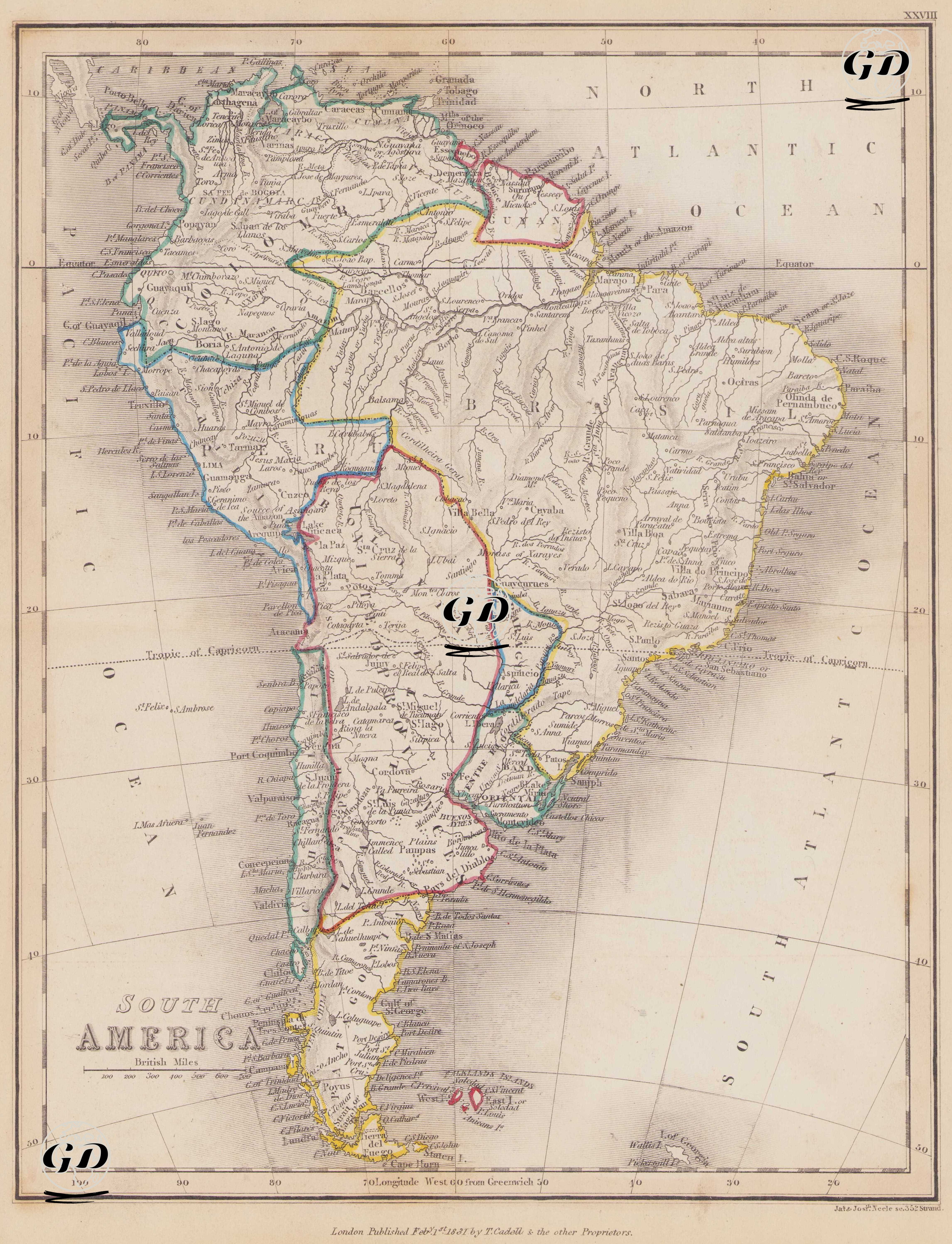
This map dated 1831 shows the political boundaries, geographic structure, and major population centers of the South American continent. The regions separated by different colored borders represent South American countries that had recently achieved independence or were experiencing internal turmoil. Each country's border is drawn with distinct, clear lines, illustrating the political divisions and new state formations the continent was undergoing by the 1830s. Brazil is marked with a yellow border in the east of the map. Colombia (with the remnants of the newly separated Gran Colombia) is in the northwest; Venezuela, as a region, is in the northeast; Peru and Bolivia are clearly marked in the west; and Chile, Patagonia, Paraguay, Entre Ríos, and Banda Oriental are clearly marked in the south. Patagonia, at the southern end of the map, encompasses the southern parts of present-day Argentina and Chile. In the south, it extends to Tierra del Fuego (Land of Fire) and the Strait of Magellan. Patagonia, a region not formally under the full sovereignty of any state after Spanish rule, was inhabited by indigenous peoples (especially the Mapuche, Tehuelche, and Selk'nam), and underwent increased European pressure for exploration and settlement. The map also meticulously depicts major river systems: the Amazon, Orinoco, Paraná, and Sao Francisco rivers are drawn in detail; the Andes extend westward, highlighting mountainous terrain through shading. Furthermore, major port cities (Lima, Buenos Aires, Valparaiso, Rio de Janeiro, Cartagena, Montevideo, La Guaira, Bahia) and inland centers (Quito, Bogotá, Cuzco, Potosí, Asuncion) are highlighted throughout the continent. Longitudes are shown on the map according to the "Longitude West from Greenwich" system, and the "British Mile" is used as the unit of distance. The historical context of the map is also noteworthy: these were the years when the Spanish colonies largely gained their independence, and Brazil broke away from Europe as an empire and became a new political entity; in this respect, the map offers a cartographic section documenting the transition from the colonial era to nation-states in South America.