GRAVÜR DÜNYASI
Digital Engraving Library
| Engraver | Josiah Neele (1804-1876) - James Neele (active 1828-1832) |
| Date | 1831 |
| Technique | Copper Engraving-Original Hand Colored |
| Category | Maps |
| Source | London Published Feb 1 1831 by T.Cadell & the other Proprietors |
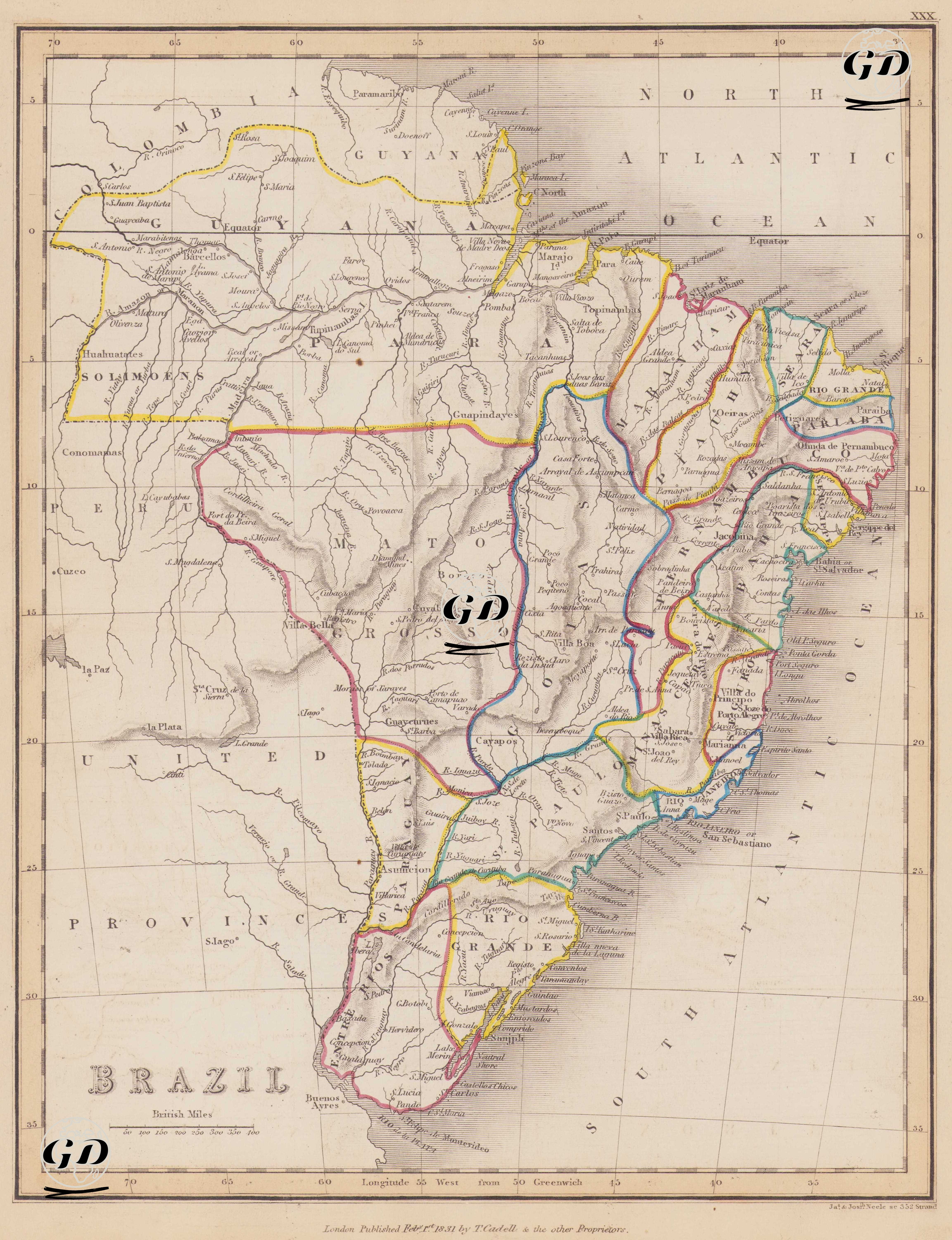
This 1831 map is a cartographic study that detailed the early political and administrative structure and physical geography of the newly independent Brazilian Empire. Having declared independence from Portugal in 1822, Brazil consolidated its imperial structure by internationally promoting this independence in 1825. This map depicts the administrative borders of this new era, drawn in different colors. Major states are shown on the map, including Guyana Para, defined by extensive forested regions encompassing the Amazon basin to the north; Rio de Janeiro, the political and commercial center with its capital and port; Sao Paulo, which would later become Brazil's industrial heartland; and Maranham, defined by the city of S. Luis, southeast of Para. The map comprehensively depicts not only political and administrative divisions but also the country's natural landscape; major river systems such as the Amazon, Sao Francisco, Parana, Madeira, and Tocantins are drawn in detail; the eastern foothills of the Andes, plateaus, and coastal mountain ranges are depicted using the classic volumetric shading technique. The equator runs through the center of the map, clearly distinguishing between the northern and southern hemispheres. The cartographic elements used are arranged in accordance with British standards, with distances given in British Miles and longitudes in the Longitude West from Greenwich measurement system. Place names, while predominantly of Portuguese origin, are written in accordance with English transcription. With all these features, the map is an important resource for documenting the geographic and administrative structure of the Brazilian Empire immediately after its founding, detailing its borders, natural resources, coastal ports, and inland settlements, and for visualizing the transition between the colonial and imperial periods.