GRAVÜR DÜNYASI
Digital Engraving Library
| Artist | Alexander Keith Johnston (1804-1871) |
| Engraver | William Johnston (1802-1888) |
| Date | 1848 |
| Technique | Steel Engraving-Original Hand Colored |
| Category | Maps |
| Source | Atlas Alison's History Of Europe By Alexander Keith Johnston - William Blackwood & Sons, Edinburgh & London |
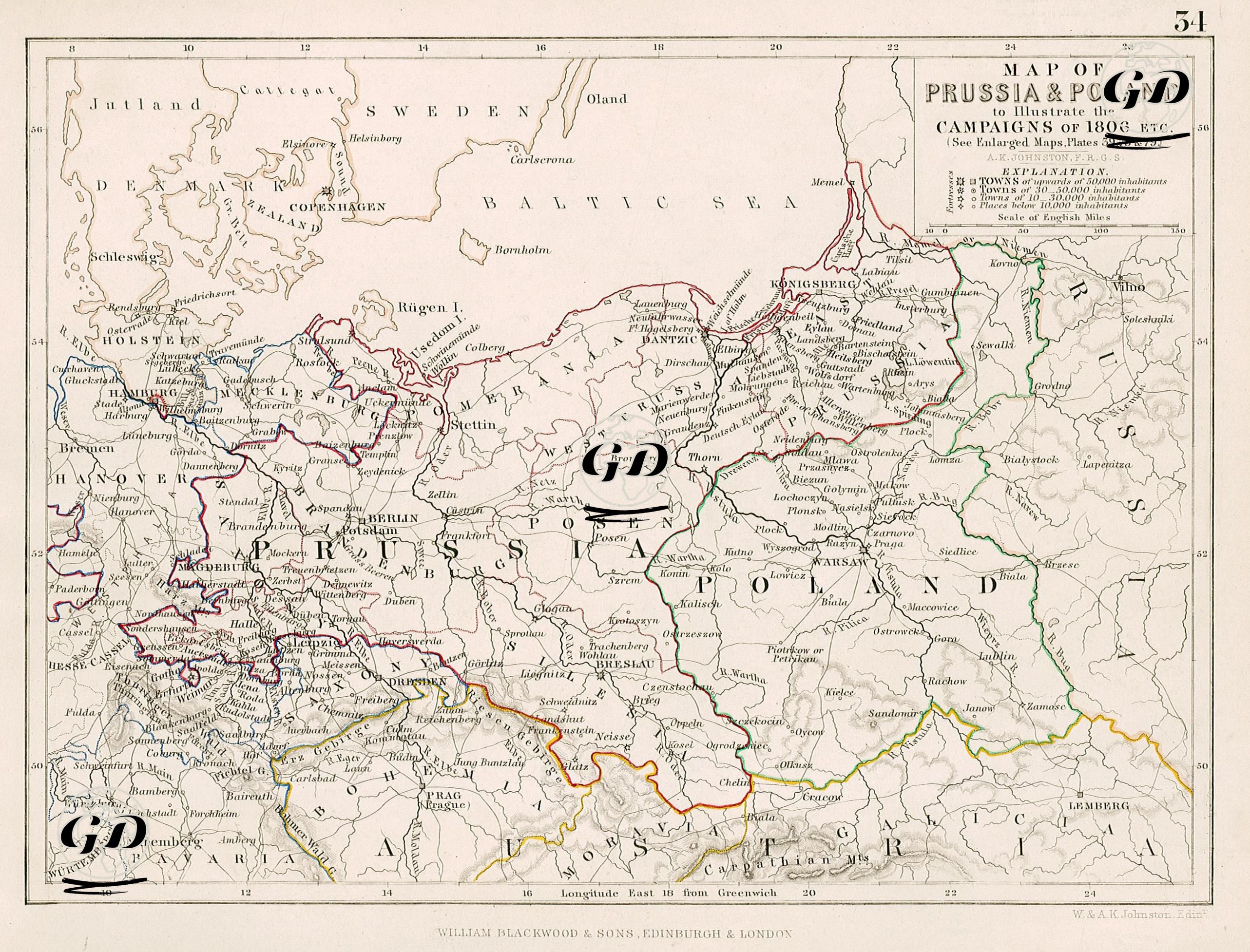
This map was prepared to visualize the military operations in Prussia and Poland within the context of the Napoleonic Wars that took place in 1806 and onward. It sheds light on Napoleon's expansion and strategic maneuvers in northeastern Europe during the War of the Fourth Coalition and the collapse of Prussia. The map shows the geographic-tactical basis of the campaigns that began with the famous double battles of Jena-Auerstedt on 14 October 1806 and concluded with the Treaty of Tilsit in 1807. In this campaign, Napoleon's France fought against the Kingdom of Prussia and its ally Russia. Berlin was the capital of Prussia and the occupation target of the French armies. In the later stages of the war, the eastern front points to which French troops turned were Königsberg and Warsaw. Napoleon's advance in this region took place on an axis from southwest to northeast. The areas where the battle fronts are envisaged on the map are; Potential armies' transit routes—the advance on Warsaw and the turn toward Königsberg—are clearly visible. The Elbe and Vistula Rivers, in particular, are vital arteries for military supply and movement. The map shows the Kingdom of Prussia surrounded by Polish territory (not yet a fully independent state), the Austrian Empire, Russia, Sweden, and Denmark. Thin red, green, yellow, and blue lines on the map indicate regional borders. As a result of this campaign, France inflicted a crushing defeat on Prussia and occupied Berlin. Napoleon's advance into Poland led to the establishment of the Duchy of Warsaw. These developments radically altered the balance of power in Eastern Europe.