GRAVÜR DÜNYASI
Digital Engraving Library
| Artist | Alexander Keith Johnston (1804-1871) |
| Engraver | William Johnston (1802-1888) |
| Date | 1848 |
| Technique | Steel Engraving-Original Hand Colored |
| Category | Maps |
| Source | Atlas Alison's History Of Europe By Alexander Keith Johnston - William Blackwood & Sons, Edinburgh & London |
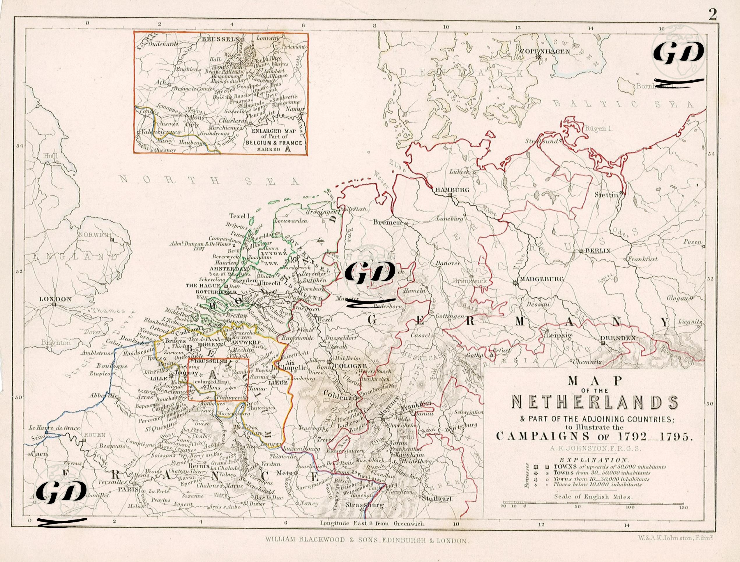
This map was prepared to show some of the Netherlands and neighboring countries, and especially the military campaigns that took place between 1792 and 1795. The military campaigns that took place between 1792 and 1795 and directly concerned the border regions of the Netherlands, Belgium, Germany, and France shown on the map took place within the framework of the Wars of the First Coalition, which constituted the first phase of the French Revolutionary Wars. The main military operations in this period were; 1. Battle of Valmy, 20 September 1792, France 2. Battle of Jemappes, 6 November 1792, Belgium 3. Battle of Neerwinden, 18 March 1793, Belgium 4. Siege of Valenciennes, 1 May – 28 July 1793, Northern France 5. Battle of Fleurus, 26 June 1794, Belgium. Cities are marked with different symbols based on their population (over 50,000, between 20,000 and 50,000, and between 10,000 and 20,000), allowing a clear view of the demographic centers of the period. The map also details the logistical and political centers of the war, including the Rhine River and its surrounding areas, the Brabant region, and cities such as Brussels, Liege, Cologne, Frankfurt, and Strasbourg. The map also details transportation routes, border changes, and strategic crossings between these cities. In the upper left corner, there is an enlarged map of Brussels and its surroundings, and this area is also marked on the main map with the letter "A".