GRAVÜR DÜNYASI
Digital Engraving Library
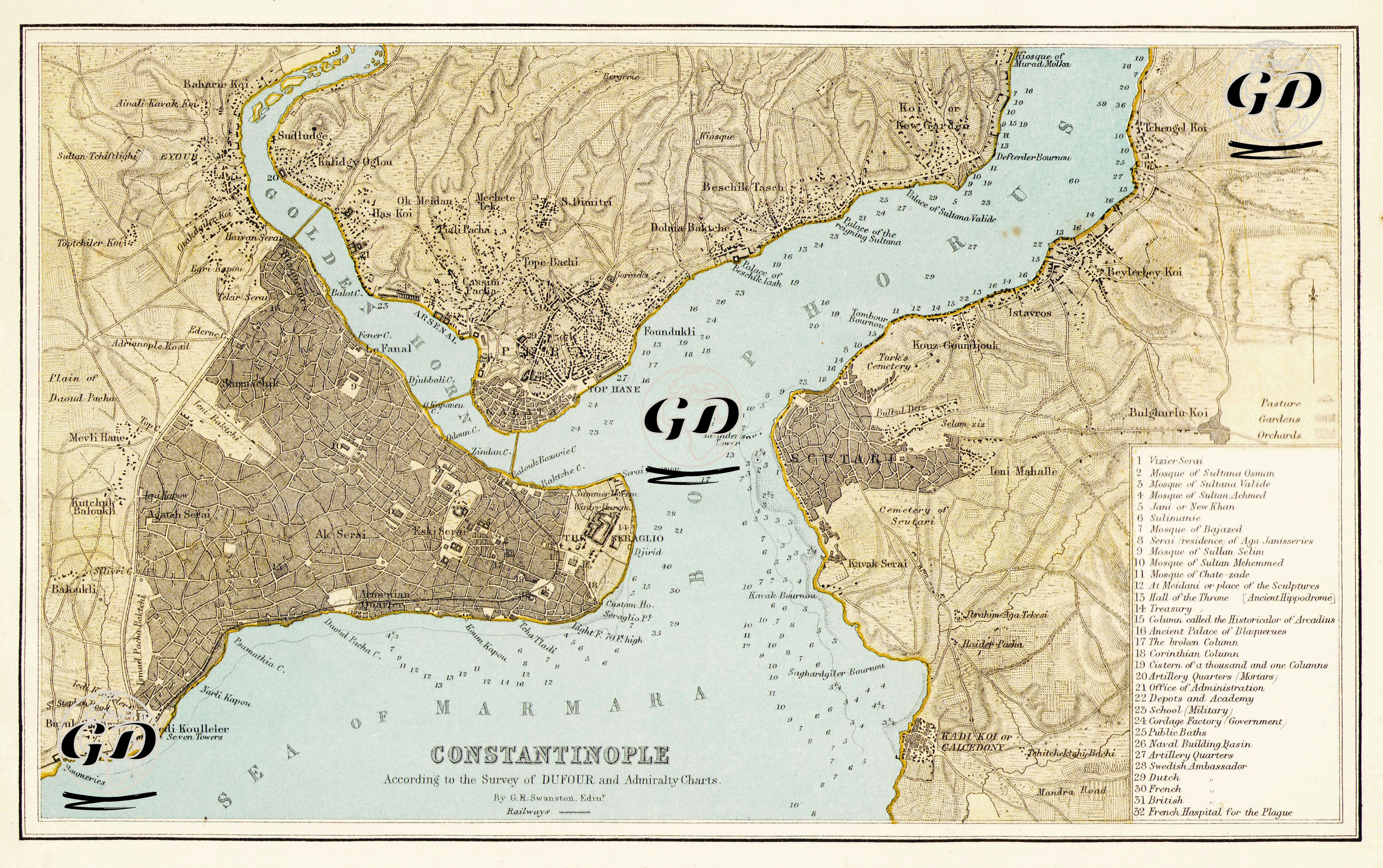
| Engraver | George Heriot Swanston (1814-?) |
| Date | 1872 |
| Technique | Lithography-Colored |
| Category | Maps |
| Source | The Royal Illustrated Atlas, Of Modern Geography With An Introductory Notice By Dr. N. Shaw, Secretary To The Royal Geographical Society &c. - A Fullarton, London & Edinburgh. |
This map was prepared based on both land topography (with or under the influence of the Dufour method) and maritime and coastal structure (Admiralty Charts). Guillaume Henri Dufour (1787–1875) was a Swiss general, engineer and famous cartographer. Dufour was the architect of the first systematic topographic map collection (especially the 1:100,000 scale "Dufour Map") made in Switzerland. These maps were made with military engineering meticulousness and are among the most accurate maps of the 19th century. Although there is no clear document indicating that Dufour directly conducted a map study in Istanbul, the fact that the Dufour method is mentioned in this map indicates that the map was prepared according to the topographic accuracy principles of the Dufour school. In addition, Admiralty Charts, prepared by the Hydrographic Office of the Admiralty, the official cartography institution of the Royal Navy of England, are very detailed and reliable maps prepared for maritime activities (navigation, depth, port structures, lighthouses, currents, etc.). They played a vital role in the global expansion of the British navy. This map provides detailed information about the coasts of Istanbul and Boğaiçi, and it is possible to see depth measurements, underwater slopes, docks, shipyards and port signs. This map is a civilian version of the Admiralty Charts data.