GRAVÜR DÜNYASI
Digital Engraving Library
| Artist | T.Morrice |
| Engraver | Edward Harding (1755-1840) |
| Date | 1800 |
| Technique | Copper Engraving |
| Category | Maps |
| Source | An Historical Tour in Monmouthshire by Archdeacon William Coxe - Pub. 1 July 1800 By Cadell & Davies Strand |
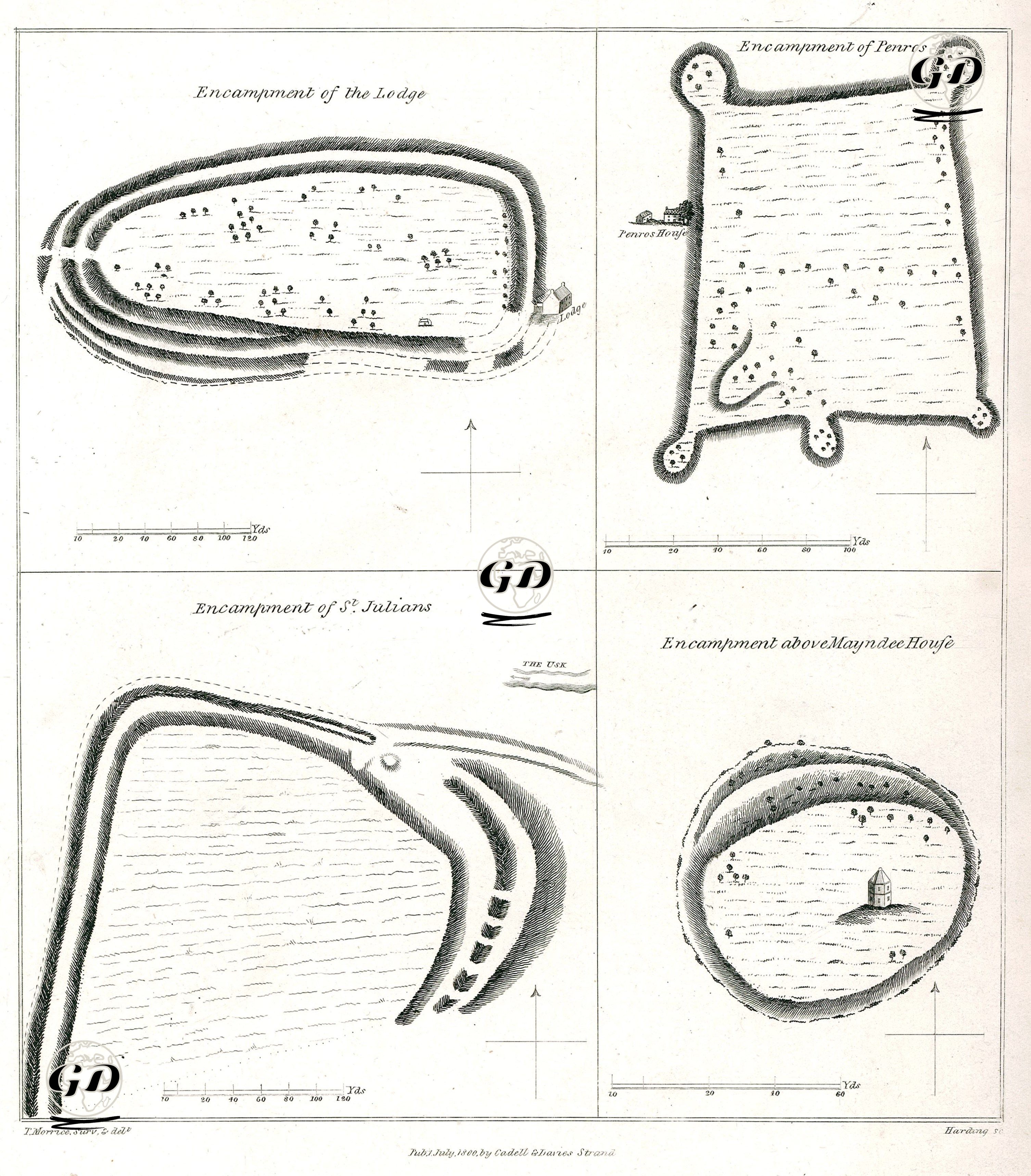
This engraved map shows four distinct hillforts in Monmouthshire, England, used for ancient settlement or defensive purposes. These sites reflect pre-Roman and early British defensive systems and social settlement patterns. The "Lodge Campsite," in the upper left, is an oval-shaped defensive structure surrounded by a multilayered moat system. Its interior displays woodland and individual structures (probably huts or observation posts). Such settlements are typical of Iron Age forts. The "Penros Campsite," in the upper right, depicts a nearly rectangular site. It features bastion-like outcrops at its four corners and a building known as "Penros House" on its western edge. This form suggests typical Roman-era campsites or medieval military arrangements. The "St. Julian's Campsite," in the lower left, is a settlement located on the banks of the River Usk near Newport, notable for its curved ramparts and interlocking defensive lines. This structure provides a complex defensive system integrated with the natural landscape. The “Campsite on Top of Maynadee House” in the bottom right represents an isolated campsite with a structure in the centre, on a circular mound surrounded by moats.