GRAVÜR DÜNYASI
Digital Engraving Library
| Date | 1877 |
| Technique | Woodblock Engraving (Newspaper-Text on Reverse) |
| Category | Maps |
| Source | The İllustrated London News (July 07 1877-Page 18) |
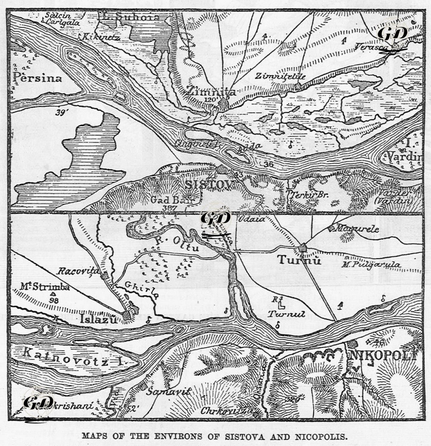
This detailed map, published in The Illustrated London News on July 17, 1877, and featuring Sistova (today's Svishtov) and Nikopolis (today's Nikopol), two strategic points on the Danube Front, documents a critical phase of the Ottoman-Russian War. The map shows how the Russian armies crossed the Danube River and the geographical, tactical and political consequences of this crossing. Located on the southern bank of the Danube, Sistova forms a crossing point opposite the Romanian town of Simnitza (Zimnicea) on the north of the river. The Vardin island and its tributaries in this section of the river were of great importance during the Russian army's crossing with the help of boats and rafts, and thanks to this crossing, the Russians took their first major step into Ottoman territory and captured Sistova. The city became a temporary Russian administrative center after the occupation. The second panel at the bottom of the map depicts the location of Nicopolis and the point where the Olt River meets the Danube, with Turnu Măgurele on the northern coast. This section, which includes the Olt and Turnul tributaries, reveals how complex and strategic the waterways of this section of the Danube were, both in terms of passage and transportation. The map, meticulously rendered with geographical details—mountains (Mt. Strimba), hills (Gad Bar), forests and marshlands, bridges and river deltas—is not only a visual guide, but also one of the most important sources of the period for war engineering and tactical planning. Documenting the main Russian army under Grand Duke Nicholas crossing the Danube and advancing into Bulgaria, this map and accompanying text provide a detailed account of one of the turning points of the Russo-Turkish War of 1877, and show how the fall of Sistova and Nicopolis affected the course of the war in the Balkans.