GRAVÜR DÜNYASI
Digital Engraving Library
| Engraver | John Reid |
| Date | 1788 |
| Technique | Copper Engraving |
| Category | Maps |
| Source | A Voyage Round The World, But More Particularly to The North-West Coast of America, Performed in 1785, 1786, 1787 and 1788, in the King George and Queen Charlotte, Captains Portlock and Dixon - Published As The Act Directs By Cap. Dixon, Oct. 11 1788 |
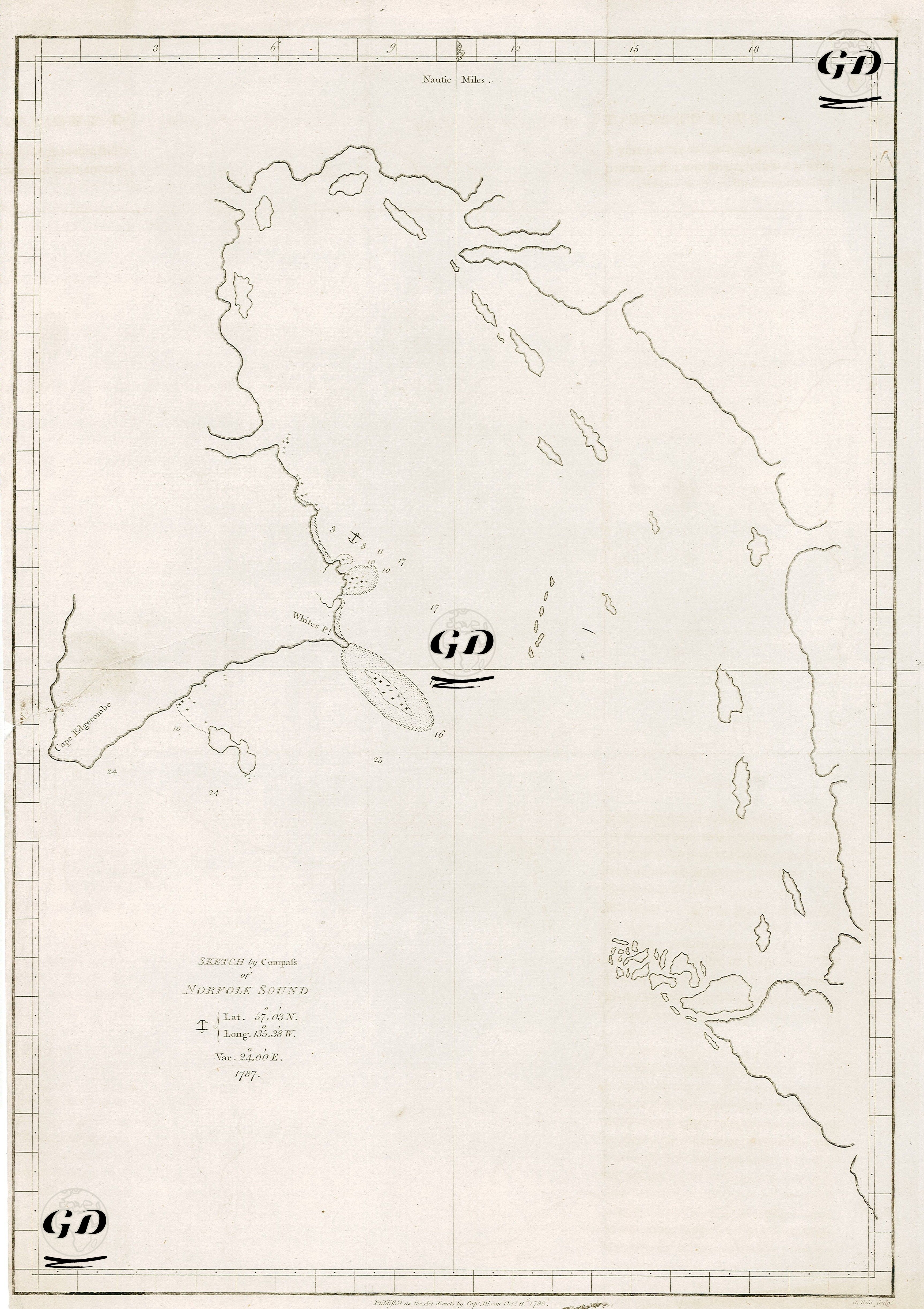
This image is an early sketch of a nautical chart of the southeastern coastline of Alaska (specifically the area around Sitka Sound (Norfolk Sound)), prepared using a compass during the voyages of exploration led by Captain George Dixon between 1785 and 1788. It was published in London on October 11, 1788. The bottom of the map shows latitude 57°03′N, longitude 135°36′W, and magnetic declination 28°00′E. This information indicates the map's geographic accuracy and navigational purpose. The map depicts Cape Macartney, White Pt., Cape Pleasants, the shallows at the entrance to the Sound, coral reefs, islets, and coastal profiles in detail. This sketch is a product of expeditions undertaken by the British Royal Navy, primarily aimed at exploring the economic and strategic potential of the Northwest American coast. The expedition was conducted by Captains Portlock and Dixon on the ships "King George" and "Queen Charlotte." One of the primary goals of the expeditions was to establish new trade routes and fur trade connections in the Pacific and to expand British influence against Russian and Spanish influence. This sketch map, found in his travelogue "A Voyage Round the World," presents coastal profiles of islands, shorelines, and geological formations observed during the 1785-1788 expedition to the Northwest American coast. These visual guides were designed to provide visual information, particularly in foggy and stormy weather, and to facilitate navigation for sailors as they approached land.