GRAVÜR DÜNYASI
Digital Engraving Library
| Engraver | John Reid |
| Date | 1788 |
| Technique | Copper Engraving |
| Category | Maps |
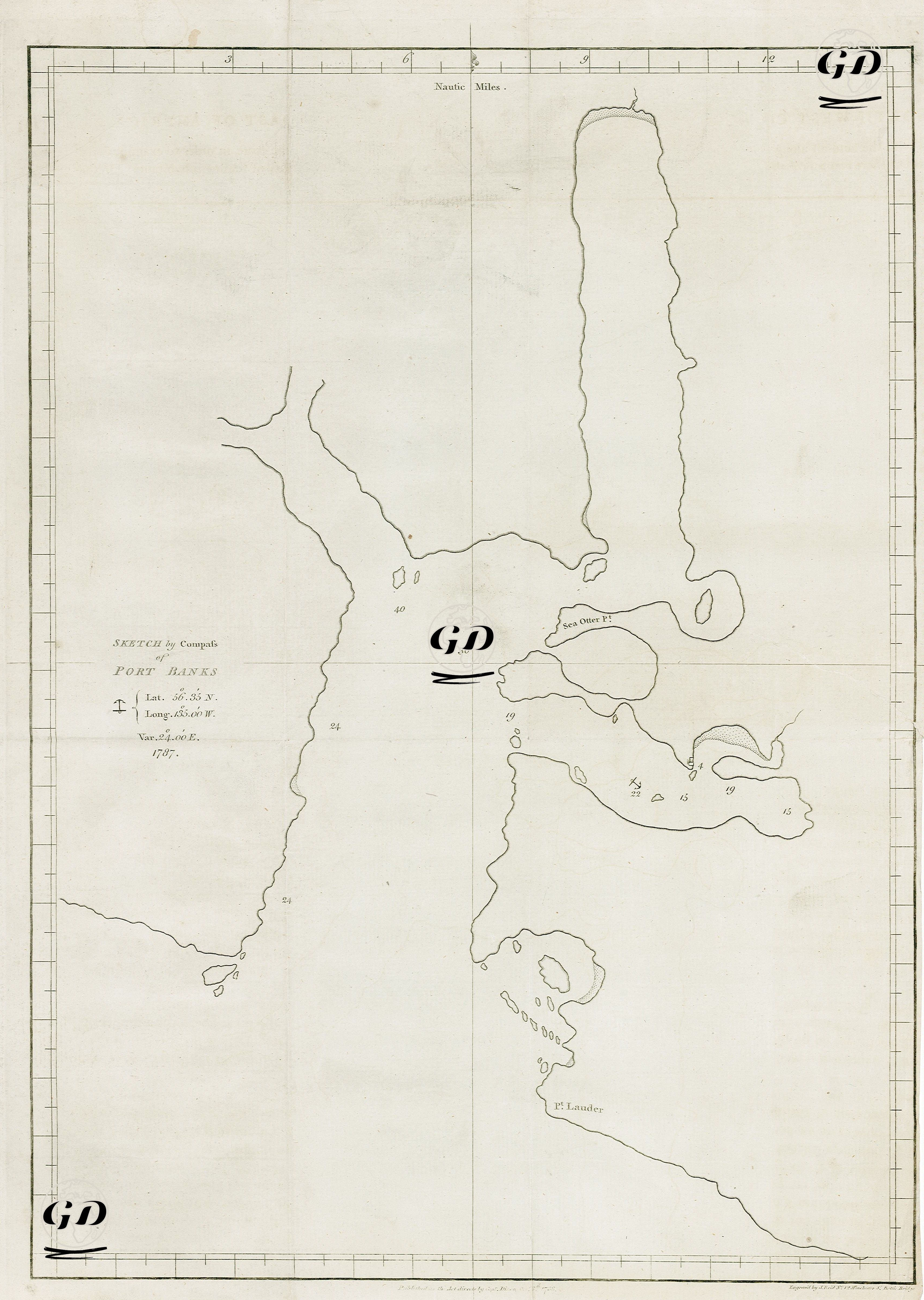
| Source | A Voyage Round The World, But More Particularly to The North-West Coast of America, Performed in 1785, 1786, 1787 and 1788, in the King George and Queen Charlotte, Captains Portlock and Dixon - Published As The Act Directs By Cap. Dixon, Oct. 18 1788 |
This image is an early nautical chart of Robert Banks Harbor, prepared using a compass during the voyages of exploration led by Captain George Dixon between 1785 and 1788. It was published in London on October 18, 1788. The left side of the map shows the latitude of the region as 56°55′ North and longitude as 136°30′ West. A magnetic declination of 2°40′ East is also noted. This sketch is a product of expeditions undertaken by the British Royal Navy, particularly those aimed at exploring the economic and strategic potential of the Northwest American coast. The expedition was led by Captains Portlock and Dixon aboard the ships King George and Queen Charlotte. One of the primary objectives of the explorations was to establish new trade routes and fur trade links in the Pacific, as well as to expand British influence against Russian and Spanish influence. This engraving, found in his travelogue titled “A Voyage Round the World,” presents coastal profiles of the islands, shorelines, and geographical formations observed during the 1785-1788 expedition to the coast of Northwest America. These visual guides were prepared to provide visual information, especially in foggy and stormy weather, and to facilitate navigation for sailors when approaching land.