GRAVÜR DÜNYASI
Digital Engraving Library
| Artist | George Dixon (1748-1795) |
| Engraver | William Harrison (1750-1803) |
| Date | 1788 |
| Technique | Copper Engraving |
| Category | Maps |
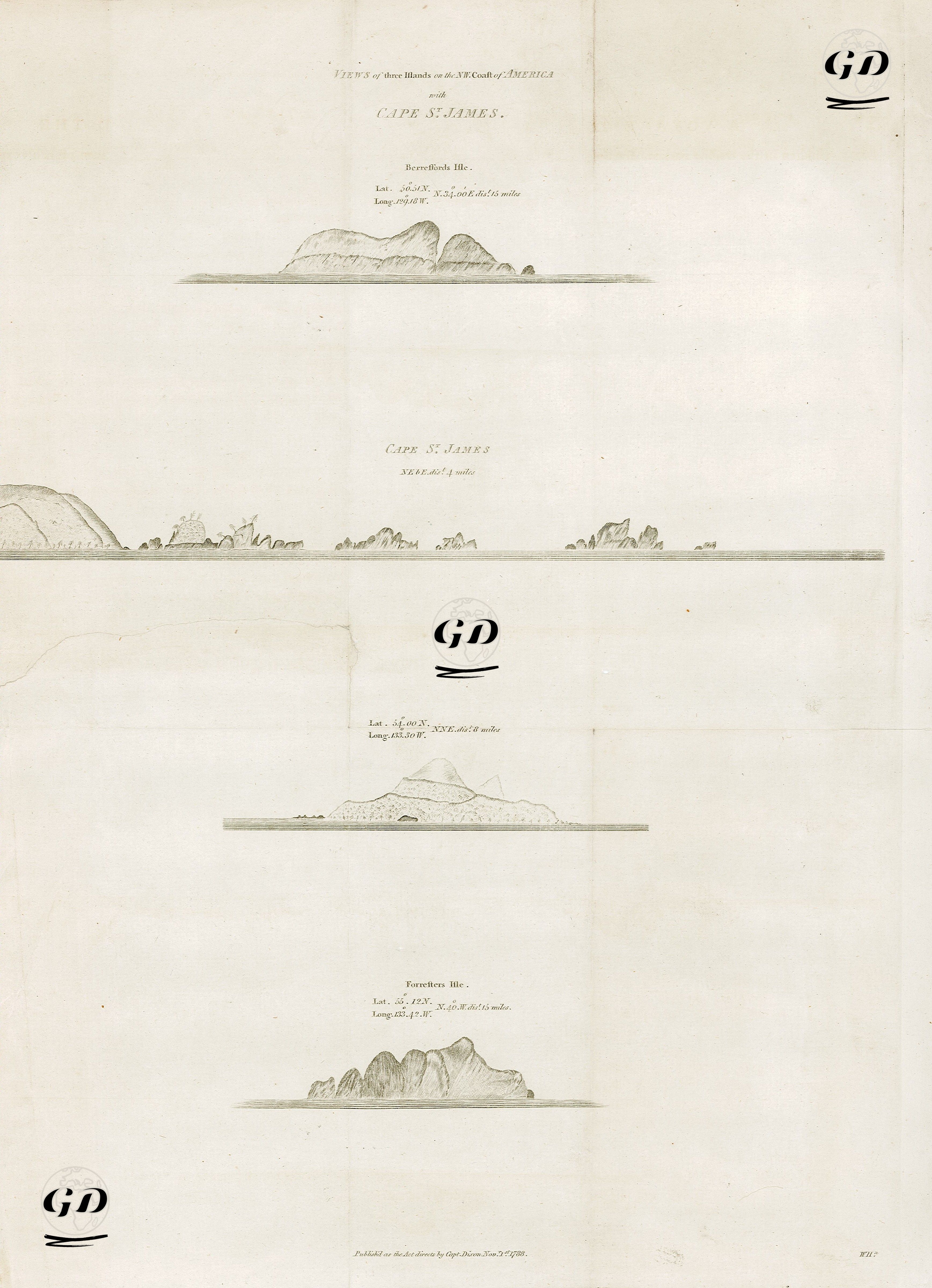
| Source | A Voyage Round The World, But More Particularly to The North-West Coast of America, Performed in 1785, 1786, 1787 and 1788, in the King George and Queen Charlotte, Captains Portlock and Dixon - Published As The Act Directs By Cap. Dixon, Nov. 1 1788 |
This image is an engraving of a map from the voyages of discovery led by Captain George Dixon in the last quarter of the 18th century and was published in London on November 1, 1788. This map and its coastal profiles are the product of important expeditions undertaken by the British Royal Navy, primarily aimed at exploring the economic and strategic potential of the Northwest American coast. The expedition was led by Captains Portlock and Dixon aboard the ships "King George" and "Queen Charlotte." One of the most important objectives of the explorations was to establish new trade routes and fur trade links in the Pacific, as well as to expand British influence against Russian and Spanish influence. This engraving, found in the travelogue "A Voyage Round the World," presents coastal profiles of the islands, coastlines, and geological formations observed during the 1785-1788 expedition to the Northwest American coast. These visual guides were prepared to provide visual information, especially in foggy and stormy weather, and to facilitate navigation for sailors when approaching land. The engraving includes: Cape St. James, drawn from approximately 4 miles, is one of the most prominent headlands at the southern tip of the Queen Charlotte Islands (present-day Haida Gwaii, Canada). With its rocky and mountainous appearance, this area served as an important visual reference point for mariners in orienting themselves. Berrembola Island, located at the top of the engraving, drawn from approximately 6.5 miles, is located near latitude 53°40'N and longitude 132°20'W. The island's double-peaked structure and coastline are depicted in detail. Kurelleon Island (Lat. 53°13'N / Long. 131°12'W), drawn from the bottom at 6.5 miles, is defined by sharp mountain ranges and an indented silhouette. It served as a visual warning and navigation point for mariners. The unnamed island (Lat. 54°40'N / Long. 131°10'W), drawn from a distance of 6.5 miles, stands out with its conical peak and is viewed from the southeast. It presents a typical volcanic island silhouette.