GRAVÜR DÜNYASI
Digital Engraving Library
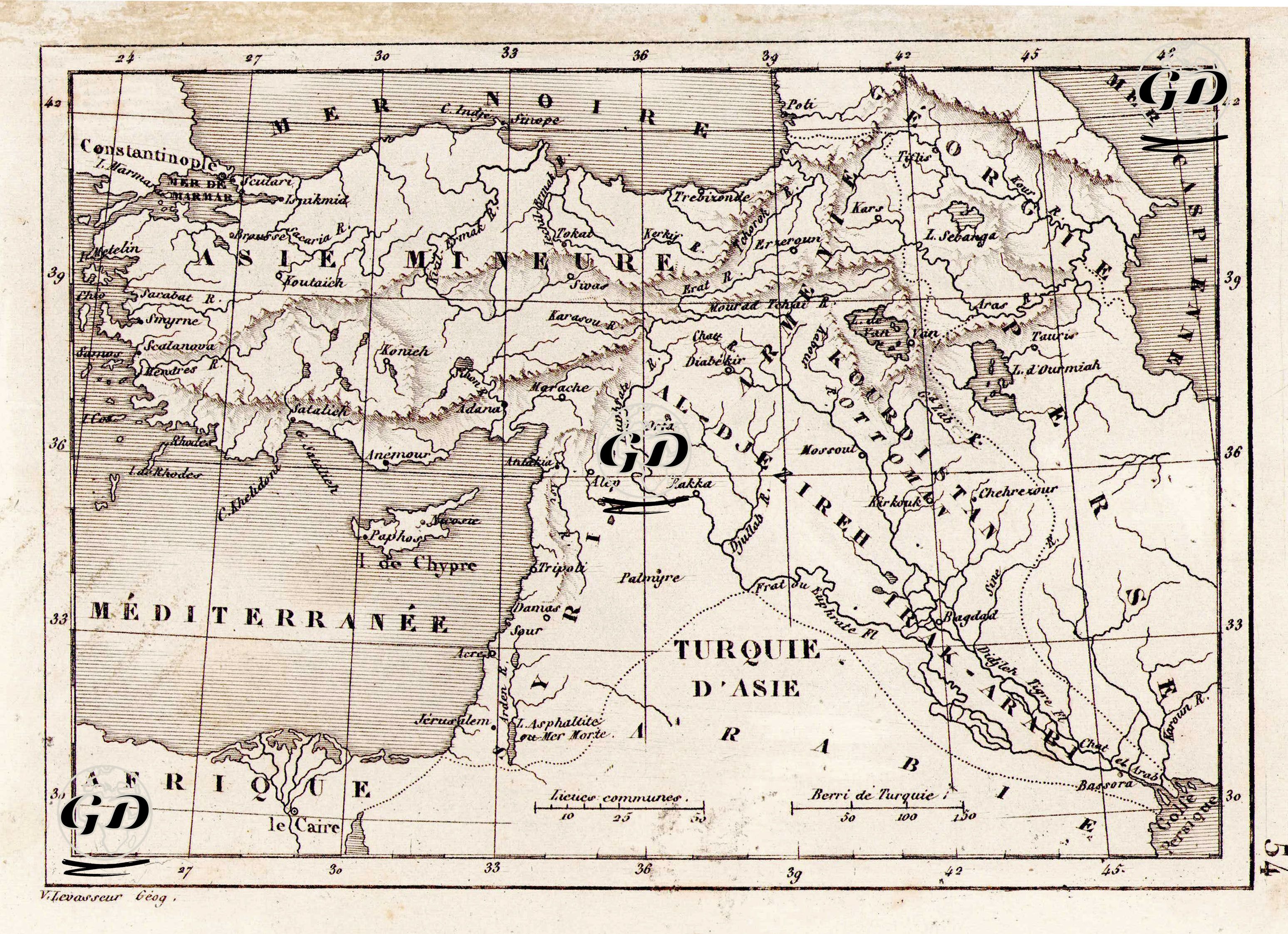
| Artist | Victor Levasseur (1800-1870) |
| Date | 1836 |
| Technique | Copper Engraving |
| Category | Maps |
This map was prepared in French by Victor Levasseur in 1836 with the title "Turquie d'Asie" (Asian Turkey). The map represents the Asian territories of the Ottoman Empire, while also reflecting the geopolitical perceptions of the period in France. The geographical boundaries extend approximately to the borders of modern-day Turkey, Anatolia, Syria, Iraq, and partly to Iran. To the north is the Black Sea (“Mer Noire”), to the east is the Caspian Sea (“Mer Caspienne”), to the south is the Persian Gulf and northeastern Africa (“Afrique”). The map extends on a west-east axis, encompassing Constantinople (Istanbul) and the Nile Delta. Notable geographical locations include major cities such as Constantinople, Smyrne (Izmir), Aleppo (Aleppo), Damas (Damascus), Baghdad (Baghdad), Basra (Basra), and non-imperial centers such as le Caire (Cairo). While the term "Asie Mineure" (Asia Minor) was used for the Anatolian peninsula, the term "Turquie d'Asie" (Asian Turkey) referred to all Ottoman lands on the Asian continent. This distinction also illustrates the tendency of Western cartography at the time to divide the Ottoman Empire into two, European and Asian.