GRAVÜR DÜNYASI
Digital Engraving Library
| Artist | Hogen - George Dixon (1748-1795) |
| Engraver | William Harrison (1750-1803) |
| Date | 1788 |
| Technique | Copper Engraving |
| Category | Maps |
| Source | A Voyage Round The World, But More Particularly to The North-West Coast of America, Performed in 1785, 1786, 1787 and 1788, in the King George and Queen Charlotte, Captains Portlock and Dixon - Published As The Act Directs By Cap. Dixon, Nov. 6 1788 |
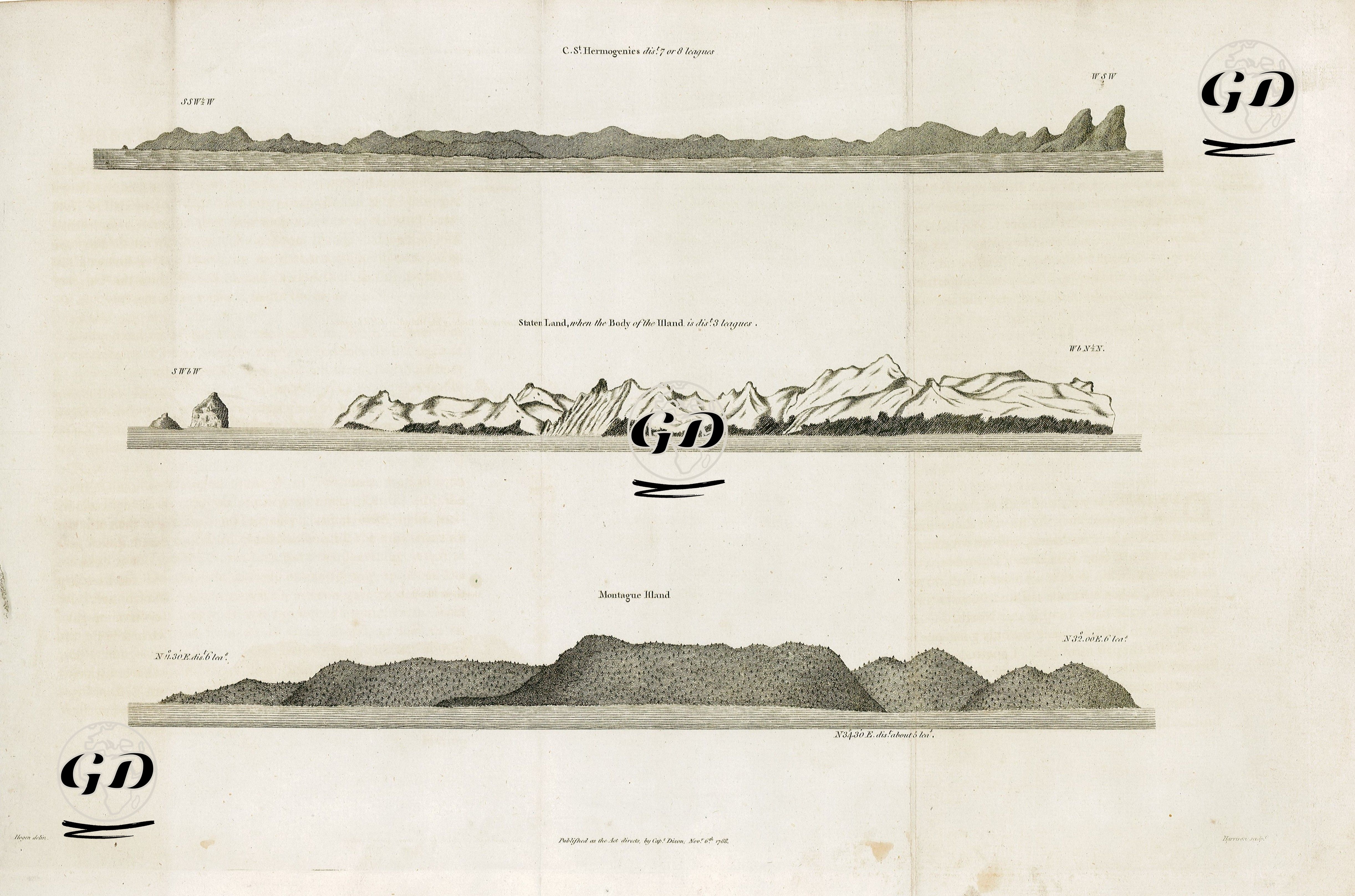
This image is an engraving of a map from the voyages of exploration led by Captain George Dixon in the last quarter of the 18th century and was published in London on November 6, 1788. This map and its coastal profiles are the product of important expeditions undertaken by the British Royal Navy, particularly those aimed at exploring the economic and strategic potential of the Pacific Northwest coast (present-day Alaska and Canada's Pacific coast). The expedition was led by Captains Portlock and Dixon aboard the ships King George and Queen Charlotte. One of the most important objectives of the explorations was to establish new trade routes and fur trade connections in the Pacific, as well as to expand British influence against Russian and Spanish influence. This map, found on page 72 of the travelogue "A Voyage Round the World," presents coastal profiles of the islands, coastlines, and geological formations observed during the 1785-1788 expedition to the Northwest American coast. The map shows three distinct island and land profiles: At the top, Cape St. Hermogenies “dist.t 7 or 8 leagues” (This is the view of Cape Hermogenies from about 7-8 nautical miles away. It is dominated by low ridges and cliffs rising to the west). In the middle, Staten Land – “when the Body of the Island is dist.t 5 leagues” (This is the visual representation of Staten Island’s mass from about 5 nautical miles away. The sharp, jagged mountain ranges create a dramatic silhouette, providing the island’s most distinctive appearance). At the bottom, Montague Island – “N. 3 or 4 miles distant” (This depicts Montague Island viewed from about 3-4 miles away. The island is depicted as a gentler, vegetated landmass surrounded by low hills). Montague Island, featured in this engraving, is located in the Gulf of Alaska and was a critical reference point for captains navigating Alaska's coastline. Similarly, Staten Land is a frequently encountered island, particularly on exploration routes around the southern tip of South America. Such drawings not only provide geographical information, but also create visual memory for sailors, making it easier for them to find their way when approaching land.