GRAVÜR DÜNYASI
Digital Engraving Library
| Artist | Alexander Hogg (active 1778-1824) - Philip Carteret (1733-1796) |
| Engraver | Hatchet |
| Date | 1784 |
| Technique | Copper Engraving |
| Category | Maps |
| Source | A New, Authentic and Complete Collection of Voyages Round the World - London Published By Alex Hogg At The Kings Arms No.16 Paternoster Row. |
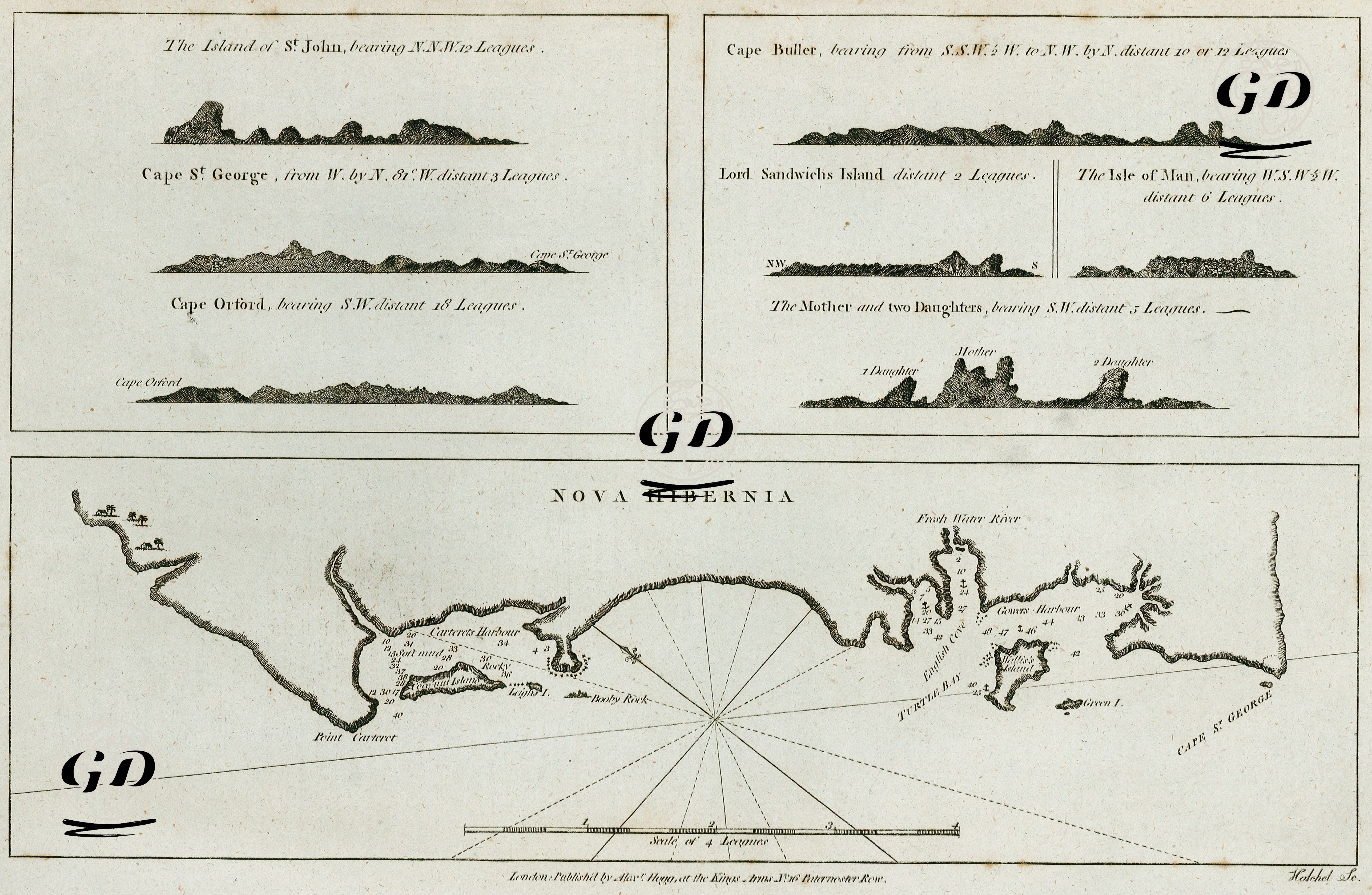
This map is an important early exploration map depicting the southwestern coast of New Ireland Island (Nova Hibernia) and surrounding islands, based on routes charted by British navigator Philip Carteret during his 1767 voyage of discovery in the second half of the 18th century. The map is part of a comprehensive series of explorations published by Alexander Hogg in London between 1784 and 1786, titled "A new, authentic, and complete collection of voyages around the world." The coastline at the bottom of the map shows the southwestern coast of New Ireland Island, its principal bays, headlands, water depths, and important ports in detail. Geographical areas such as Cape St. George, Cannor Harbour, Freshwater River, and Turtle Bay are particularly well-labeled. Soundings are crucial for navigational safety and are detailed on the map. The seven-point coastal profile at the top of the map are silhouette engravings depicting other important landmasses from the sea. This section of "coastal views" was of great navigational importance to sailors of the period because it depicts the visual appearance of land as it first appeared on the horizon. The following islands and headlands are depicted in this section: St. John's Island (12 leagues away, bearing N.N.W.), Cape St. George (3 leagues away, bearing W. by N. 8° W.), Cape Orford (18 leagues away, bearing S.W.), Cape Buller (10-12 leagues away, S.S.W. ½ W. to N.W. by N.), Lord Sandwich's Island (2 leagues away), Isle of Man (6 leagues away, W.S.W. ½ W.), and The Mother and Two Daughters (5 leagues away, bearing S.W.). These islands, part of the Bismarck Archipelago of Papua New Guinea, were at the time largely unexplored or misplaced on maps. In 1767, Philip Carteret discovered a passage (St. George's Channel) between New Britain and New Guinea, previously thought to be a single landmass, proving that New Ireland was a separate island. In this context, the map is of great importance for correcting geographical information.