GRAVÜR DÜNYASI
Digital Engraving Library
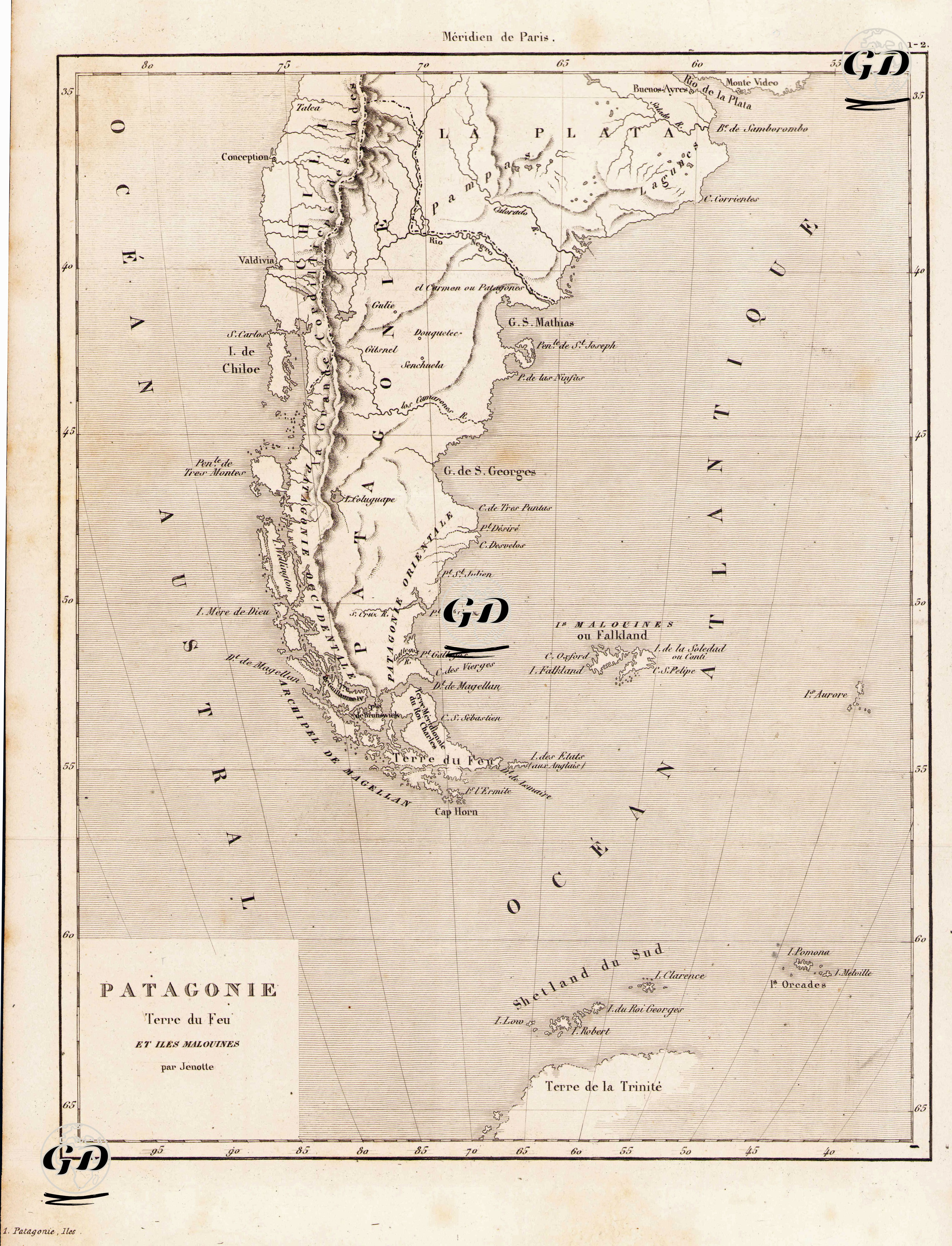
| Engraver | Jenotte |
| Date | 1840 |
| Technique | Steel Engraving |
| Category | Maps |
This 1840 map, a classic example of the geography of exploration, encompasses Patagonia, the extreme southernmost region of South America, the Land of Fire (Terre du Feu), the Strait of Magellan, the Falkland Islands (Malouines ou Falkland), and further south, the South Shetland Islands and a possibly fictional or unexplored landmass called "Terre de la Trinité" (Trinity Land). The latitude-longitude diagrams in the region and the emphasis on the "Méridien de Paris" (Paris Meridian) demonstrate that French cartography was prepared according to the surveying standards of the time. Among the notable geographical features on the map are Cap Horn, the Strait of Magellan, the Río de la Plata, Montevideo, Valdivia, Chiloe Island, and the rivers and mountain ranges of Patagonia's interior. Furthermore, the Falkland Islands, a region of intense British interest, are referred to here as "îles Malouines," indicating that the map was named according to the French perspective. This map is not only a geographical document, but also an important cultural-historical source reflecting Europe's imagination and colonial interest in the southern hemisphere. Patagonia's barren, mountainous landscape, perceived as almost the "end of the earth," can be interpreted through the map's design as a reflection of the Eurocentric ideology of exploration. Designations such as "Terre de la Trinité" at the southern end of the map were among the elements included in the maps to document unconfirmed or speculative discoveries at the time.