GRAVÜR DÜNYASI
Digital Engraving Library
| Artist | Jean Baptiste Bourguignon D'Anville (1697-1782) |
| Date | 1758 |
| Technique | Copper Engraving-Original Hand Colored |
| Category | Maps |
| Source | Atlas De "l'Histoire Generale des Voyages" by Antoine François Prevost |
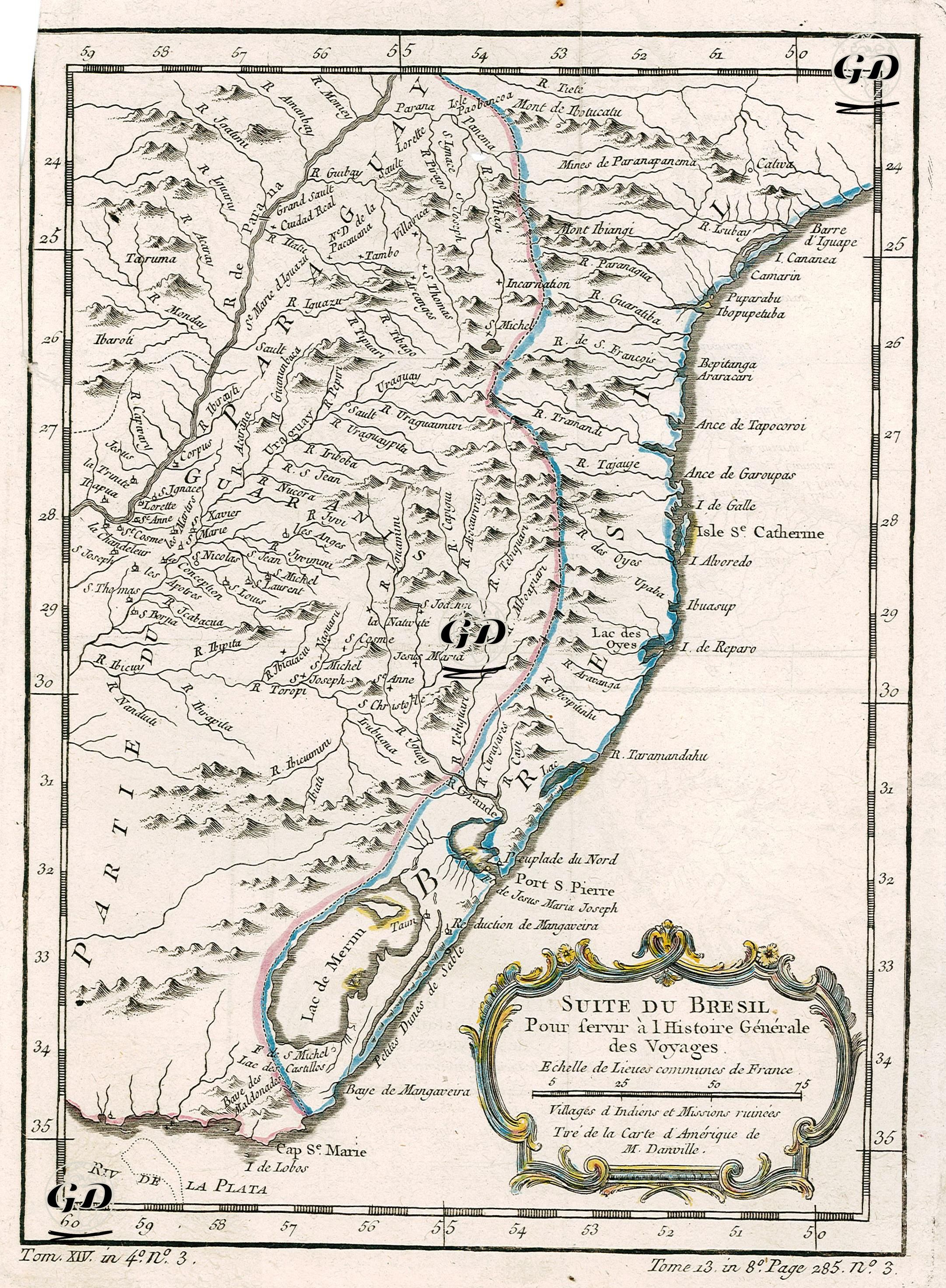
This map is a detailed map of Brazil, prepared in 1758 based on the American maps of the renowned French geographer Jean-Baptiste Bourguignon d'Anville and produced to serve as part of the multi-volume collection of exploration and geography entitled "Histoire Générale des Voyages" (General History of Travels - page 285 of Volume 8). The ornate title box in the lower right corner of the map, "Suite du Brésil - Pour servir à l'Histoire Générale des Voyages," clearly indicates that this map was published for scientific and exploratory purposes. The same section includes the phrase "Village d'Indiens et Missions ruinées," meaning "Indigenous villages and ruined missions," highlighting the abandoned or demolished traces of colonial religious institutions in this region, where missionary activity was intense. The map covers the southeastern region of present-day Brazil and the area up to the Uruguayan border. The Atlantic coastline features important settlements and geographical features, such as São Pedro, Isle Sainte-Catherine (present-day Santa Catarina), Porto de São Pierre, and Monte de Paranaparnama. Inland, dense river systems (R. Iguaçu, R. Paraguay, R. Uruguay) and mountain ranges are meticulously depicted. In addition to geographical features, inland lakes such as Lac des Xeres and Lac de Mangueru are also included. The map's scale, indicated in lieues communes de France (the commonly used French unit of length), provides a clear reference for both French and European travel writers. The map also serves as a rich observational tool for natural resources, indigenous settlements, and the historical traces of missionary activity. In this respect, it is an early cartographic document that provides valuable information not only on geography but also on sociocultural and colonial history.