GRAVÜR DÜNYASI
Digital Engraving Library
| Date | 1877 |
| Technique | Woodblock Engraving (Newspaper-Text on Reverse) |
| Category | Maps |
| Source | The İllustrated London News (July 14 1877-Page 45) |
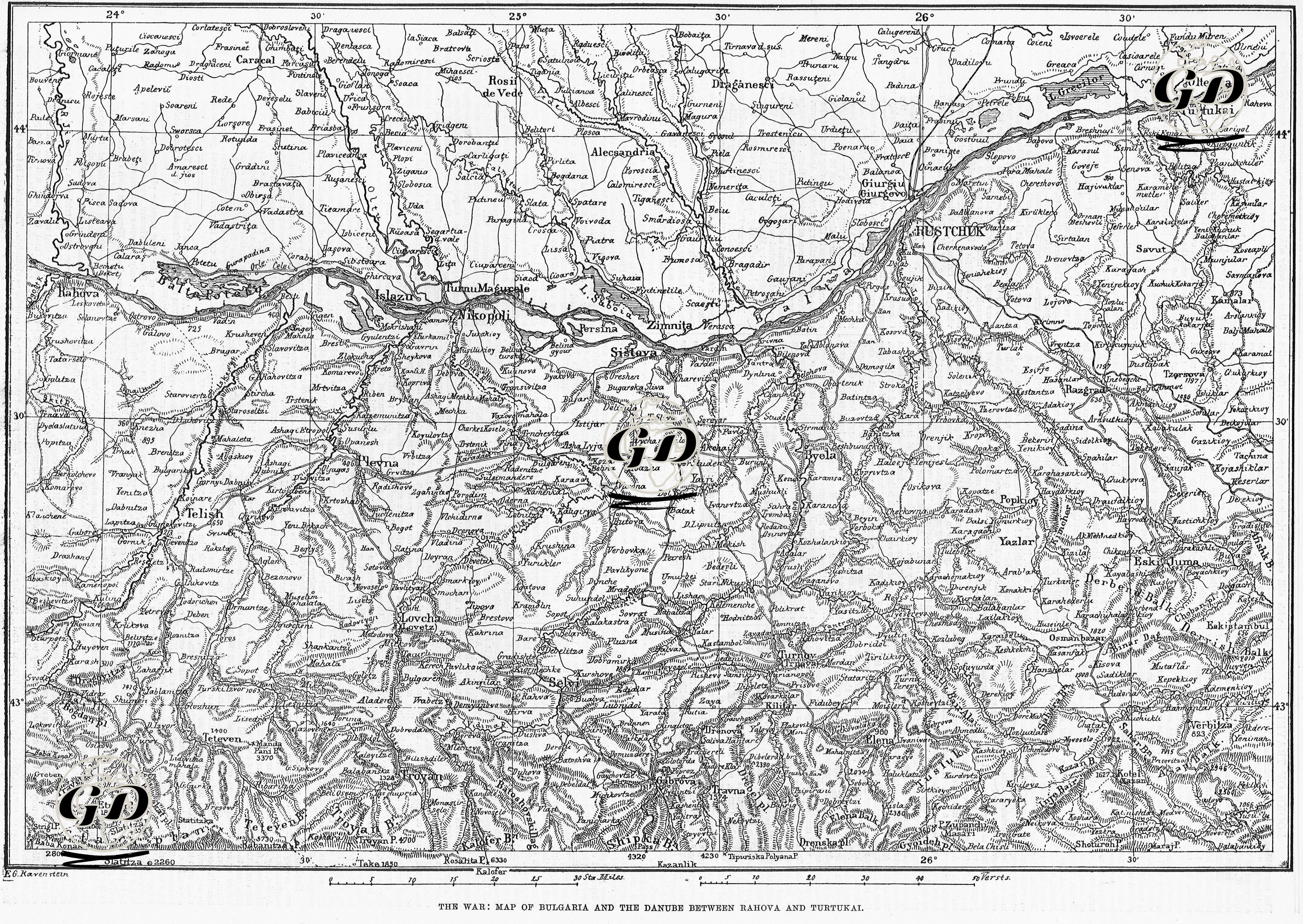
The map titled “War: Bulgaria and the Section of the Danube between Rahova and Turtukai” shows the major areas of military activity on the north and south banks of the Danube River during the 1877–1878 Russo-Turkish War . The map covers an area of approximately 150 miles east-west and 95 miles north-south, stretching from Rahova in the west to Turtukai in the east, and from Oltenitza in the north to Tirnova (today's Veliko Tarnovo) in the south. Strategic crossings on the Danube River (e.g. the opposite banks of Sistova and Simnitza) stand out on the map as fronts where the Ottoman and Russian armies confronted each other. According to newspaper reports, Russian troops in the Simnitza (Zimnita) region crossed the Danube River via Vardin Island and from there captured Sistova. It is reported that Ottoman troops established certain points of resistance against the Russian advance; However, it is stated that the Russians were advancing rapidly. The points of conflict where the Ottoman troops tried to stop the Russian troops in places such as Biela (Byela) are marked on the map. Despite the resistance in these regions, the Ottoman troops settled in the region of Tirnova (Turnov or Trnava), the old Bulgarian capital, and established a defensive line around Tirnova. In addition, the city of Rusçuk was under siege and the news reported that Ottoman soldiers waited in the streets around fires during night watches in anticipation of a Russian attack. However, no serious Russian attack had yet taken place at this stage. Although Rusçuk, which was defended under the command of Osman Nuri Pasha, was bombarded with heavy artillery fire throughout the war (especially from the Russian batteries in Giurgiu on the opposite shore), it resisted like Silistre and Vidin until the end of the war (the Treaty of San Stefano) and was not captured by the Russians.