GRAVÜR DÜNYASI
Digital Engraving Library
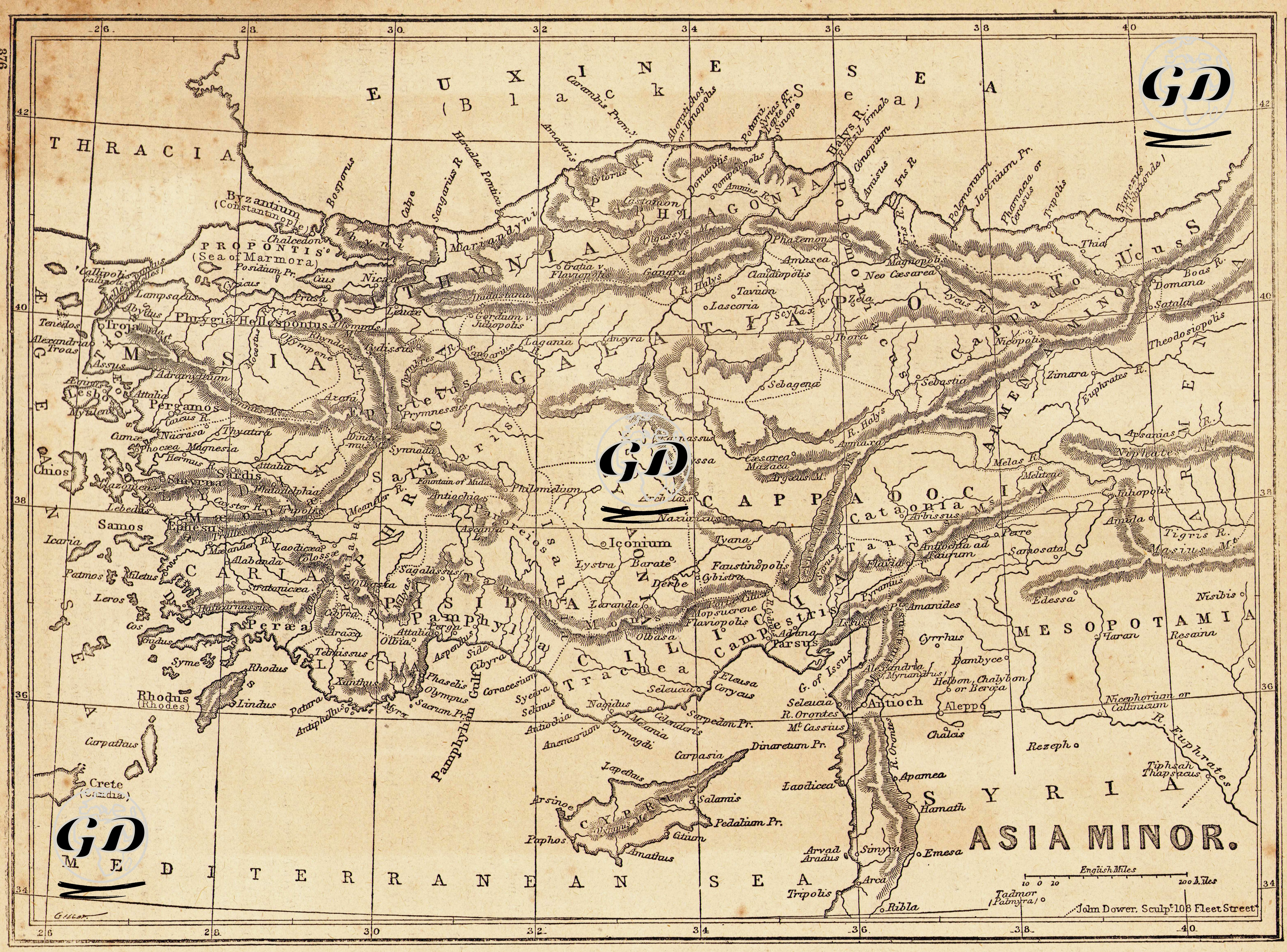
| Engraver | John James Dower (1825-1901) |
| Date | 1870's |
| Technique | Steel Engraving (Text on Reverse) |
| Category | Maps |
This map is titled "Asia Minor" and shows the ancient geography of the region that covers modern Turkey. The map depicts in detail the ancient place names and regions of the Anatolian Peninsula during the Roman and Hellenistic periods. Bounded to the north by the "Euxine Sea", to the south by the "Mediterranean Sea", to the east by "Mesopotamia" and to the west by "Thrace", this drawing is a comprehensive compilation of the geographic information of the period. Regionally: to the west are the ancient regions of Mysia, Lydia, Caria, Ionia and Aeolis; in central Anatolia are the regions of Phrygia, Galatia, Lycaonia, Pisidia and Cappadocia; to the south are the coastal cities and mountainous regions of Pamphylia, Lycia, Cilicia, Isauria, Caria and Lycia; and to the east are Commagene, Sophene, Armenia Minor, Mesopotamia, Osrhoene and Syria. Among the city names, Byzantium (Istanbul), Smyrna (Izmir), Ephesus, Antioch (Antakya), Tarsus, Iconium (Konya), Ancyra (Ankara) and Caesarea (Kayseri) are notable. Mountain ranges, rivers and plains are drawn quite clearly, which allows for the analysis of ancient military and trade routes. For example, the Halys River (today's Kızılırmak), the Taurus (Toros) Mountains, the Amanos Mountains and other natural obstacles are shown in detail on the map. In addition, the names of important cultural and military centers such as Seleukeia, Myra, Rhodes, Crete, Tarsus, Corycus, Issus, Troas, Pergamon are noticeable on the map. This map is especially important for classical studies, the localization of ancient cities, biblical geography and early Christian history.