GRAVÜR DÜNYASI
Digital Engraving Library
| Artist | Thomas Bowen (….-1790) |
| Date | 1780 |
| Technique | Copper Engraving |
| Category | Maps |
| Source | A New And Authentic History of England By William Augustus Russel (Engraved For Russel's History Of England) |
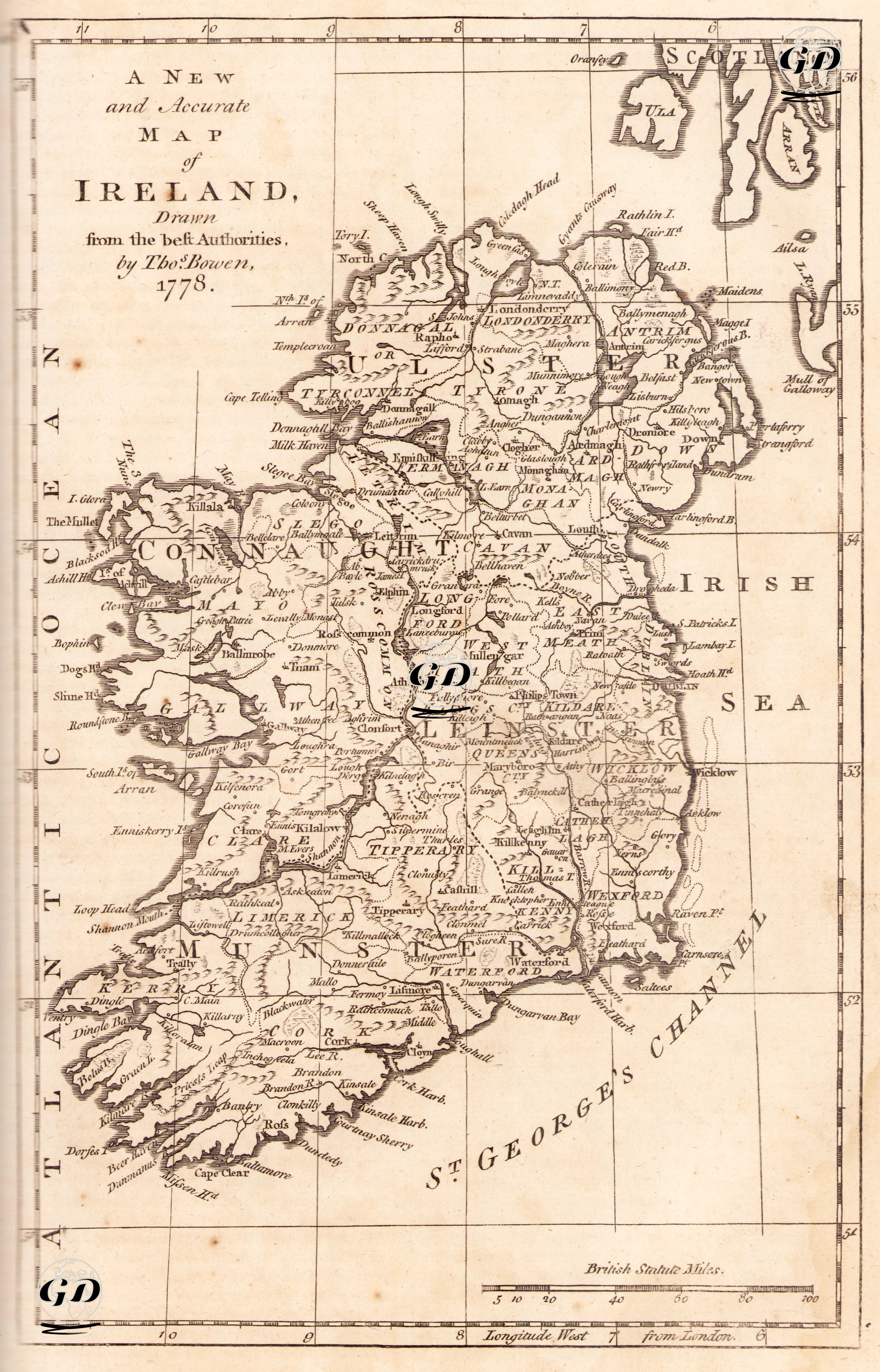
The map's title in the upper left corner reads "A New and Accurate Map of Ireland, Drawn from the Best Authorities," emphasizing its innovative and accurate nature. Richly detailed in terms of both political and administrative structure and physical geography, this map details Ireland's settlements from north to south and east to west, its natural landscape, coastal geography, and the transportation and topography of the period. The map divides Ireland according to the traditional four-province system of the period: Ulster (northeast), Connaught (west), Leinster (east), and Munster (south). This division represents both cultural differences and the administrative structure of British rule. While the boundaries of each county are not clearly demarcated, the individual counties within these regions are clearly labeled: for example, Down, Antrim, Armagh, Meath, Tipperary, Kerry, and Cork. The date the map was published was one of the years when British rule in Ireland and the oppression of the Catholic population were at their most intense. The Catholic Irish were largely deprived of political rights, and this map was designed as a geographical entity within the British Empire, not as a representation of Ireland's internal unity. The map details Ireland's physical geography, coastlines, major river systems, and major settlements. Mountain ranges, rivers, and harbors (e.g., Lough Neagh, the River Shannon, Galway Bay, Dingle Bay, Cork Harbour) are carefully rendered. Natural harbors and bays, islets, and headlands along the coastline are named (e.g., Achill Island, Cape Clear, Loop Head). This detail demonstrates that the map was created not only for political purposes but also for commercial and transportation geography. Inland, important cities and towns of the period are shown: Dublin, Cork, Limerick, Galway, Kilkenny, Waterford, and Belfast were considered among the administrative, commercial, and cultural centers of the period. The scale bar at the bottom of the map is in "British Statute Miles," allowing for measurements up to 100 miles.