GRAVÜR DÜNYASI
Digital Engraving Library
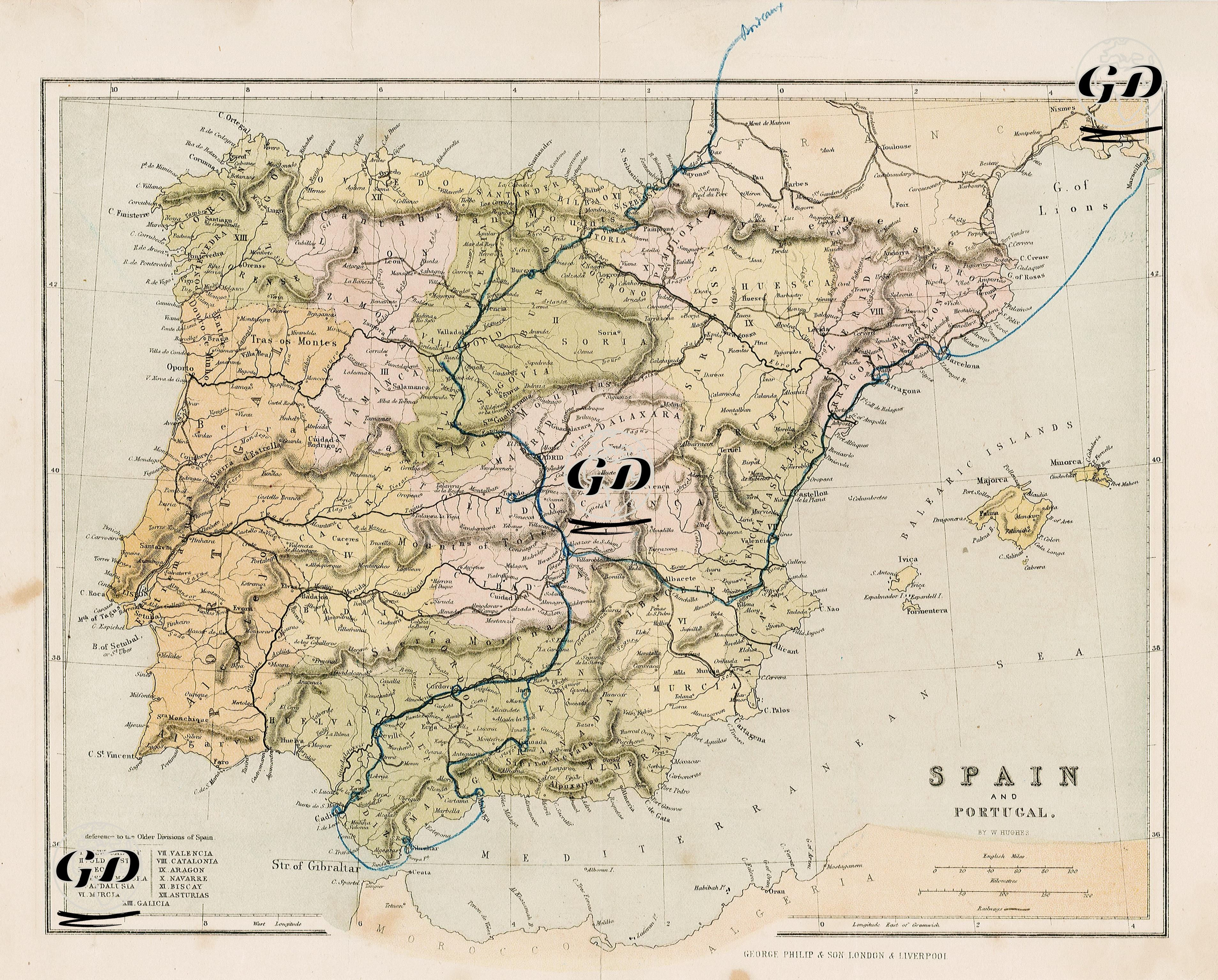
| Date | 1875 |
| Technique | Chromolithography |
| Category | Maps |
| Source | Philip's Library Atlas (George Philip & Son. London & Liverpool) |
This map, prepared in 1875, is an exceptionally detailed political map reflecting the historical-administrative geography of Spain and Portugal. The legend located in the lower left corner of the map, titled “Reference to the Older Divisions of Spain,” lists thirteen major historical administrative regions that were used throughout history. These regions represent historical provinces that can be considered predecessors of modern Spain’s autonomous communities and are visually coded on the map through a numbering system. The legend enumerates the regions as follows:I. New Castile, II. Old Castile, III. León, IV. Estremadura, V. Andalusia, VI. Murcia, VII. Valencia, VIII. Catalonia, IX. Aragon, X. Navarre, XI. Biscay, XII. Galicia, XIII. Asturias. Each region is distinctly delineated on the map through the use of different colors and boundary lines. The map not only displays political boundaries but also provides geographical data including major rivers, mountain ranges, coastal cities, inland urban centers, and transportation routes. Additionally, strategic regions such as the Balearic Islands and the Strait of Gibraltar are included.