GRAVÜR DÜNYASI
Digital Engraving Library
| Artist | Alexandre Vuillemin (1812-1880) |
| Date | 1866 |
| Technique | Steel Engraving |
| Category | Maps |
| Source | Atlas Universel D'Histoire et de Geographie (Atlas of Universal History and Geography) - Librairie-Hachette Et Cie A Paris. Imp. E.Dufrenay |
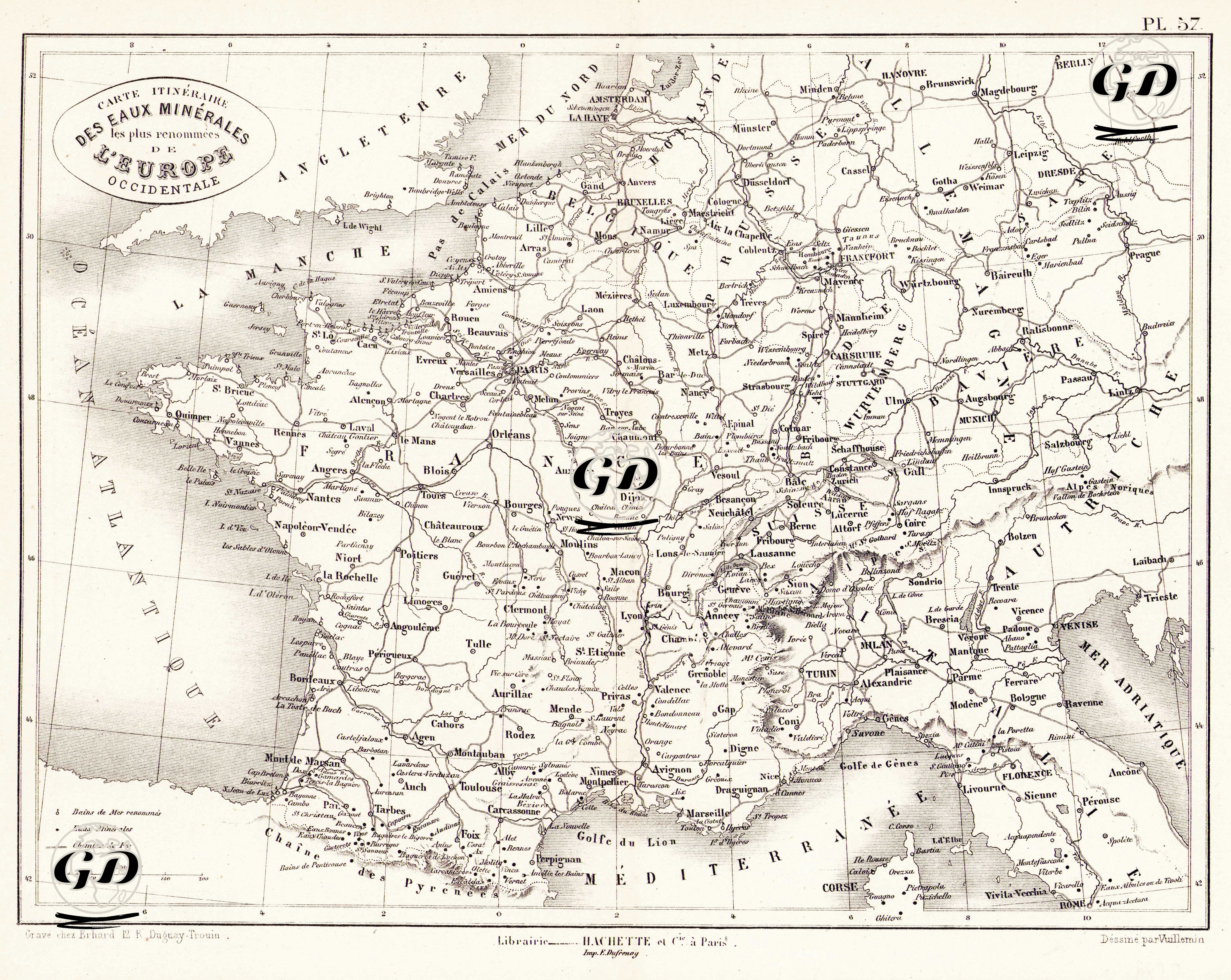
This map, drawn in 1860 and centered around France, marks Western Europe's most renowned healing springs and spa centers and the routes leading to them. The mineral water regions, particularly concentrated in France, Germany, Switzerland, Belgium, and Northern Italy, are shown in detail. The phrase "Bains de mer renommes - Eaux Minerales - Chemins de Fer" in the legend in the lower left corner of the map reveals the map's three main thematic elements. "Bains de mer renommes" designates Europe's most famous and prestigious thermal bath centers. These locations are indicated on the map with a dashed circle. "Eaux Minérales" refers to the mineral-rich natural mineral water sources originating from natural underground sources found in these centers. These mineral waters were used for drinking cures or bath treatments. These locations are indicated on the map with a filled circle. "Chemins de Fer" indicates the railway lines providing access to these important health and tourism destinations. Thanks to this tripartite structure, the map goes beyond being a mere geographical document and serves as an important resource that visualises the transportation infrastructure for health tourism and the distribution of healing water centres in Europe.