GRAVÜR DÜNYASI
Digital Engraving Library
| Engraver | William Hughes (1818-1876) |
| Date | 1854 |
| Technique | Steel Engraving |
| Category | Maps |
| Source | The Danube By William Beattle, M.D. İllustrated in A Series Of Views Taken Expressly For This Work By William Bartlett (G.Virtue, London & New York) |
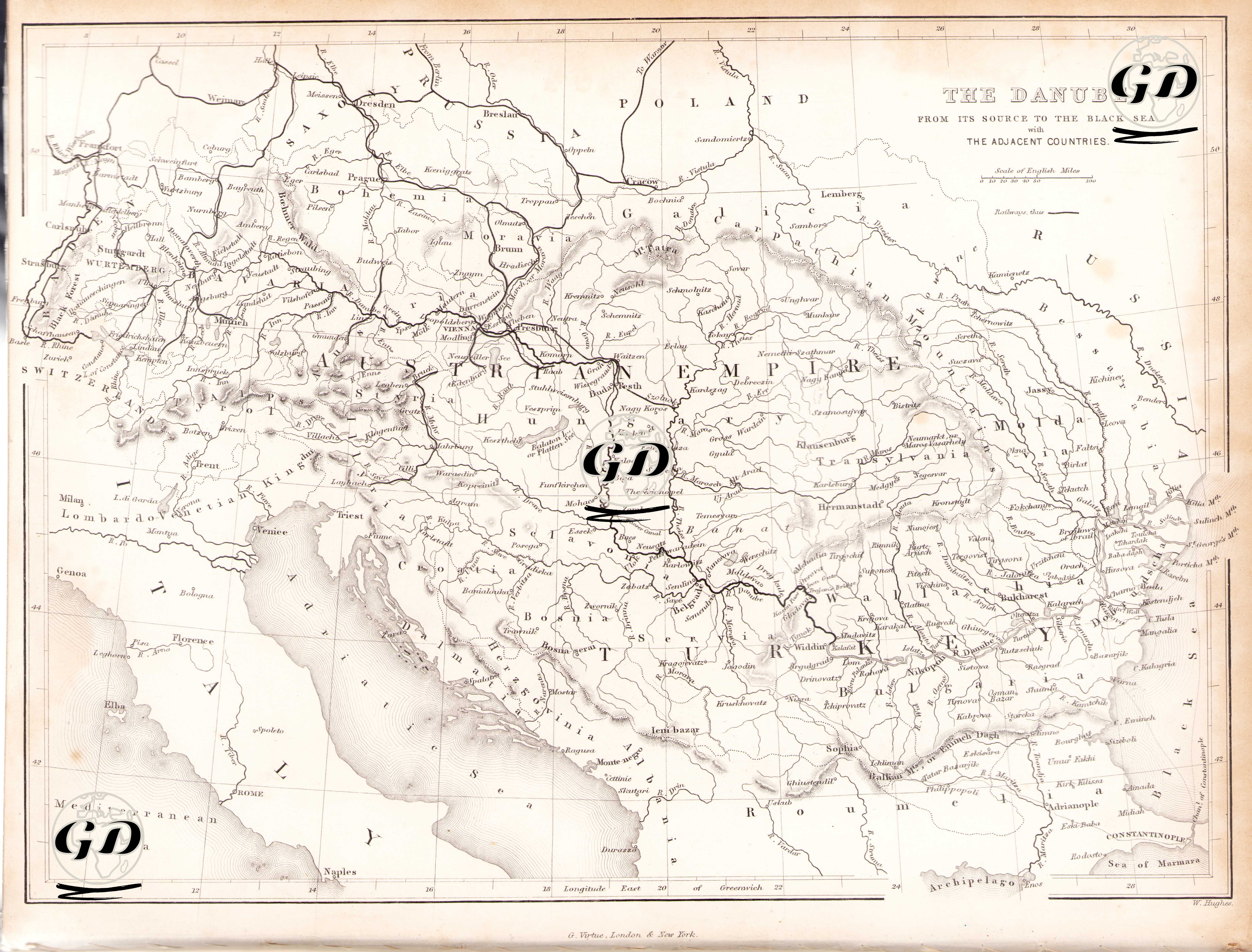
The Danube River originates in the Black Forest (Schwarzwald) region of southwestern Germany. The confluence of the two smaller rivers, the Brigach and Breg, in the town of Donaueschingen in this region is traditionally considered the Danube's birthplace. Donaueschingen, located in the state of Baden-Württemberg, is known for its symbolic location as the Danube's source. From this point, the Danube travels approximately 2,850 kilometers, traversing numerous countries before reaching the Black Sea. This makes the Danube the second longest river in Europe and holds great historical and geographical significance. The map includes the major cities and regions through which the Danube flows—its main waterway passing through countries such as Germany, Austria, Hungary, Slovakia, Croatia, Serbia, Bulgaria, and Romania. Cities, mountains, and tributaries along the Danube's meandering course are detailed, emphasizing the river's military and commercial importance. Notable central settlements on the map include cities such as Ulm, Vienna, Pesth (Budapest), Belgrade, Vidin, Galatz, Braila, Tulcea and Sulina. In addition, the change in the drawing style of the Danube River after the Widdin (Vidin) and Kalafat (Calafat) line emphasizes that the river flowed within the borders of the Ottoman Empire from this point on.