GRAVÜR DÜNYASI
Digital Engraving Library
| Artist | Guillaume Delisle (1675-1726) |
| Engraver | John Blundell (active 1739-1751) |
| Date | 1747 |
| Technique | Copper Engraving |
| Category | Maps |
| Source | An Universal History, from the Earliest Account of Time |
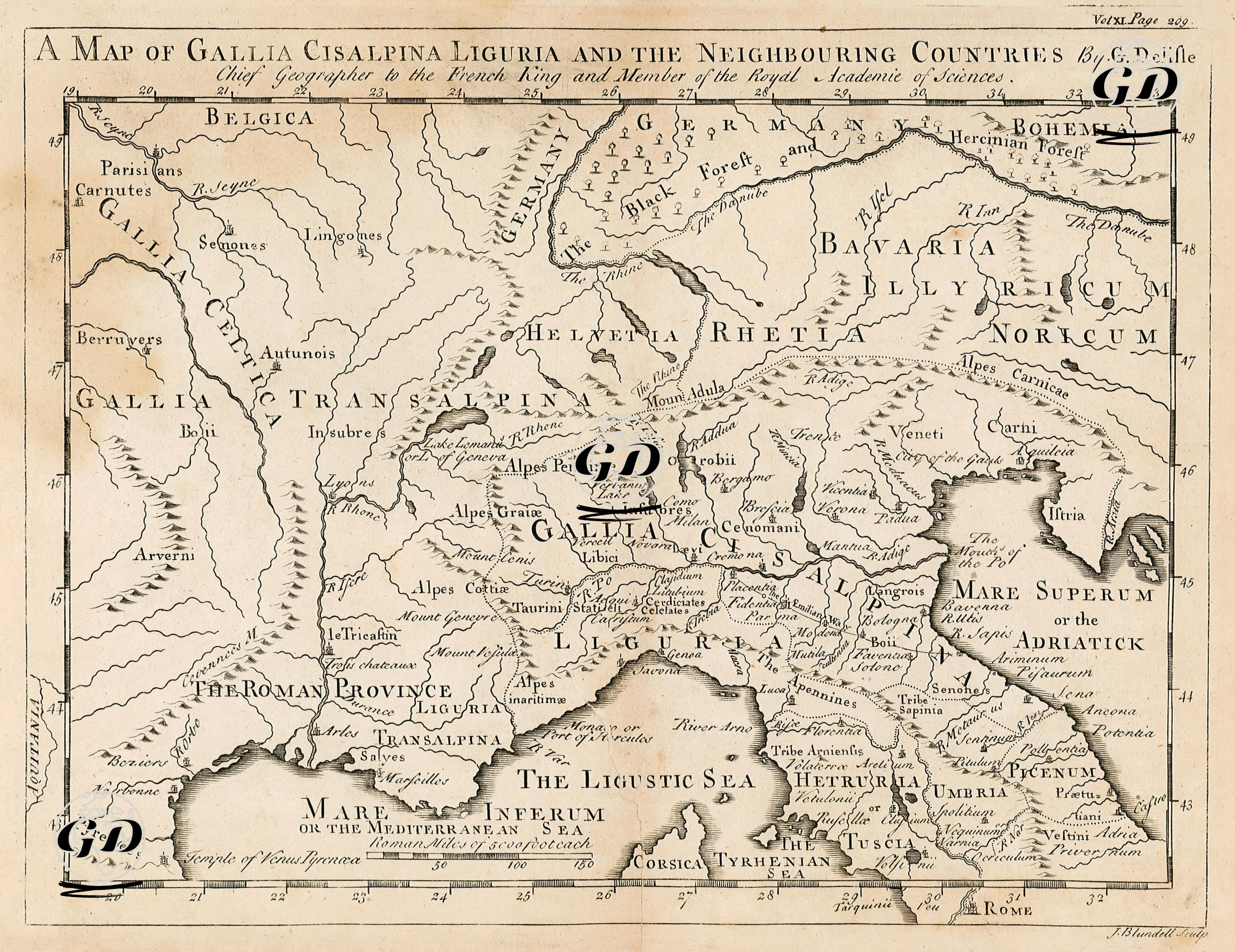
Centered on Gallia Cisalpina and Gallia Transalpina, the map represents a vast area stretching from northern Italy in ancient times to present-day France, Switzerland, Germany, and Slovenia, synthesizing ancient Roman and Gallic toponyms with modern geographic data. Regions such as Gallia Cisalpina (Gaul south of the Alps, northern Italy), Gallia Transalpina (Gaul beyond the Alps, southern France), Liguria (northwestern Italy), Illyricum (western Balkans), Noricum (present-day Austria), Rhetia (Switzerland and surrounding areas), Bavaria (Bavaria), Helvetia (Switzerland), Venetia (surrounding Venice), Etruria (Tuscany), Umbria, and Picenum are shown on the map. Furthermore, the distinction between "Cisalpina Gallia" and "Transalpina Gallia," which helps understand Rome's northwestern provincial structure, is clearly emphasized, and strategic passes (e.g., "Alpes Cottiae," "Alpes Graiae," and "Alpes Penninae") relevant to both the Roman Republic and Hannibal's campaign routes are carefully depicted. Important maritime areas such as the Ligurian Sea and the Adriatic Sea, as well as ancient mountain ranges (Alps, Apennines) and river systems, are also meticulously depicted. Furthermore, the region designated "The Roman Province" on the map, corresponding to modern Provence, represents Rome's first administrative dominance over Gaul. Guillaume Delisle's academic title as a member of the Royal Academy of Sciences and chief geographer to the French king of the time, imbues this map with not only visual but also historical-geographical authority.