GRAVÜR DÜNYASI
Digital Engraving Library
| Date | 1830's |
| Technique | Steel Engraving |
| Category | Maps |
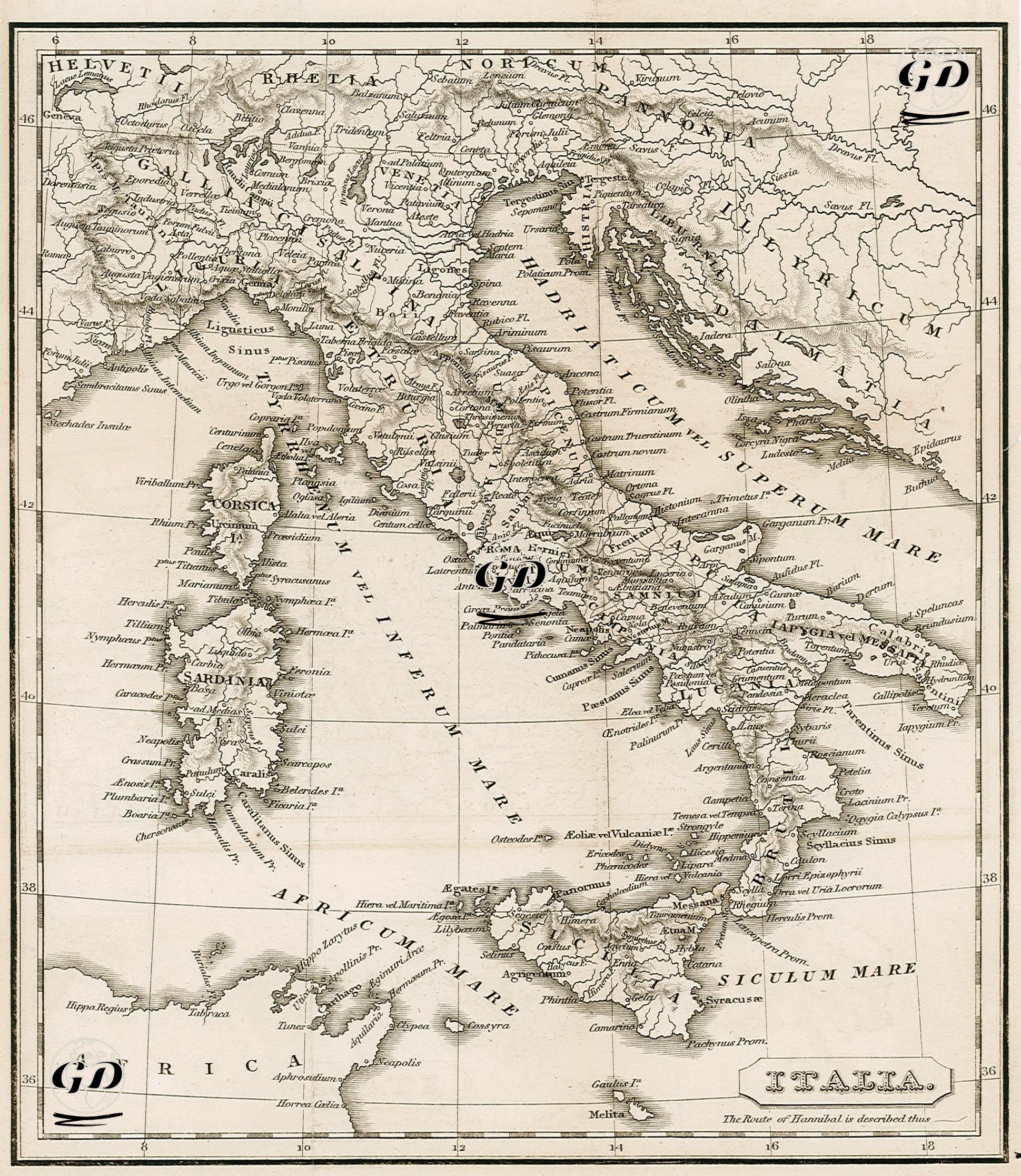
This map provides a detailed overview of the geography and ancient place names of the Italian peninsula during the Roman Republic. The map is faithful to the Latin terminology of the period, comprehensively depicting ancient Roman roads, cities, regions, and significant natural features. During the Second Punic War, which began in 218 BC, the Carthaginian commander Hannibal Barca set out from the Iberian Peninsula, crossed the Alps, and advanced into central Italy. The cities, passes, mountain ranges, and strategic junctions Hannibal and his army passed through are shown, along with their ancient Roman place names. Important crossing cities in northern Italy, such as the Padus (Po) River, Ticinum (Ticino), Placentia (Piacenza), and Ariminum (Rimini), are clearly marked. In addition, cities such as Lake Trasimene (Trasimenus Lacus), Capua, Cannae, Tarentum and Beneventum, which Hannibal passed through and were the scene of battles during the Second Punic War, are also shown in detail. This drawing, inspired by sources such as ancient historians Polybius and Livy, visualizes Hannibal's route on both a geographical and tactical level, presenting the course of the battle to the user as a narrative map.