GRAVÜR DÜNYASI
Digital Engraving Library
| Engraver | William Johnston (1802-1888) - Alexander Keith Johnston (1804-1871) |
| Date | 1856 |
| Technique | Lithography-Colored |
| Category | Maps |
| Source | Pictorial History Of The Russian War 1854-5-6 - W.R.Chambers London & Edinburgh -Printed in Colours by Schenck & McFarlane, Edinburgh |
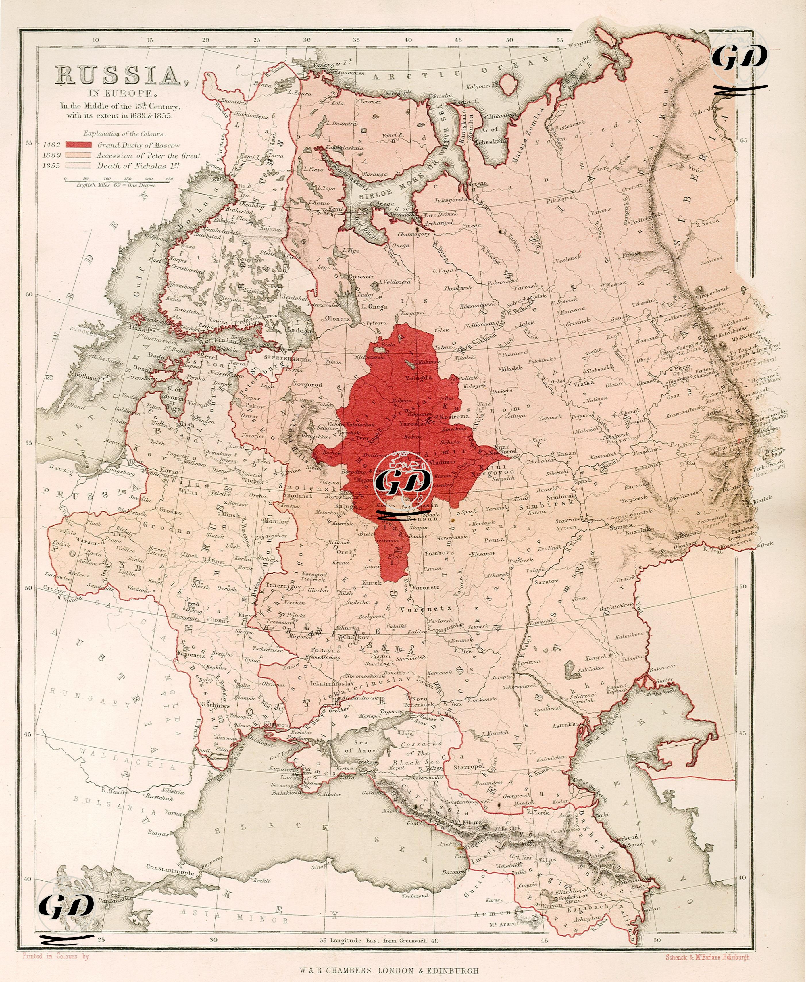
The 1856 map presents a geopolitical narrative while also showing the political and geographical borders of European Russia in the mid-19th century, and particularly sheds light on Russia’s expansion processes. The explanatory legend in the upper left corner shows Russia’s border changes during three important periods in different shades of red. The dark red area on the map shows the Grand Duchy of Moscow in 1462, while the regions shown in lighter shades reflect the expansion that continued until the accession to the throne of Tsar Peter the Great in 1682 and finally until the death of Nicholas I in 1855. This visual narrative provides a chronological picture of how Russia became a major land power in Europe and how it increased its influence from east to west and north to south. The map covers a vast geography stretching from the Baltic Sea to the Black Sea, from Poland to the Caucasus; St. Key cities such as Petersburg, Moscow, Odessa, Crimean Peninsula, Riga, Vilnius are marked in detail. In addition, the map clearly shows Russia’s borders with neighboring states: Prussia to the west, Ottoman lands to the south (especially Bulgaria and the Crimean line), the Caspian Sea to the southeast, the Ural Mountains to the east, and areas extending into Siberia are noteworthy. The map is valuable not only in terms of military geography but also political history, as it visualizes the perception of Western public opinion of Russian expansionism, which began in 1853 and paved the way for the Crimean War. The borders shown on the map also explain the historical context of Peter the Great’s modernization projects, threats to Ottoman lands, and especially Russian domination in the Black Sea. Therefore, this map is not only a geographical document, but also a representation tool of imperial history.