GRAVÜR DÜNYASI
Digital Engraving Library
| Engraver | William Johnston (1802-1888) - Alexander Keith Johnston (1804-1871) |
| Date | 1856 |
| Technique | Lithography-Colored |
| Category | Maps |
| Source | Pictorial History Of The Russian War 1854-5-6 - W.R.Chambers London & Edinburgh -Printed in Colours by Schenck & McFarlane, Edinburgh |
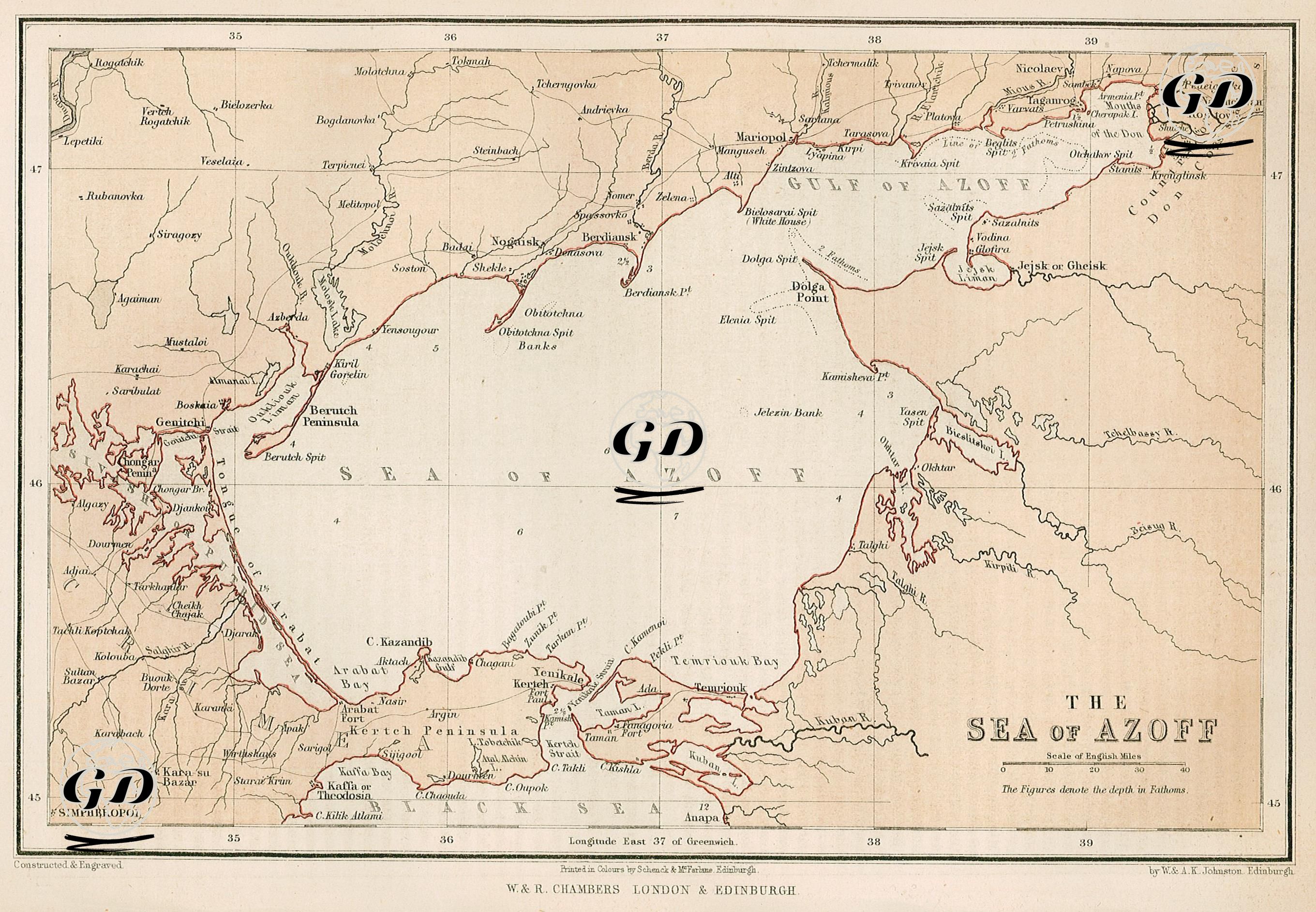
This map, dated 1856, depicts in detail the Sea of Azov and its surroundings, a critical area in terms of naval operations in the Crimean War. The map covers a wide geography starting from the coast of today's Ukraine in the north and extending to the east of the Crimean Peninsula and the coast of the Caucasus in the south. Ports such as Taganrog, Mariupol, Berdyansk, and Genitchi located on the northern shores of the Sea of Azov formed a supply line between the interior regions of Russia and the military units in Crimea. In order to cut off Russian supply lines and prevent access to the Don basin, the British and French navies entered the Sea of Azov in the summer of 1855 and bombed port cities such as Taganrog, Mariupol, and Genitchi, weakening the logistic capabilities of the Russian army. In addition to these ports, the map also shows military and commercial centers such as the mouth of the Don River, the Kerch Peninsula, the Arabat Fortress, Yenikale, Taman, and Anapa. At the same time, sea depths were given in fathoms, providing information on the navigation capabilities of ships. The map also shows how the Sea of Azov, with its shallow structure, indented bays and long headlands (e.g. Obitochna Spit, Dolga Point, Berutch Spit), was used in defensive and offensive planning.