GRAVÜR DÜNYASI
Digital Engraving Library
| Engraver | William Johnston (1802-1888) - Alexander Keith Johnston (1804-1871) |
| Date | 1856 |
| Technique | Steel Engraving (Text on Reverse) |
| Category | Maps |
| Source | Pictorial History Of The Russian War 1854-5-6 - W.R.Chambers London & Edinburgh |
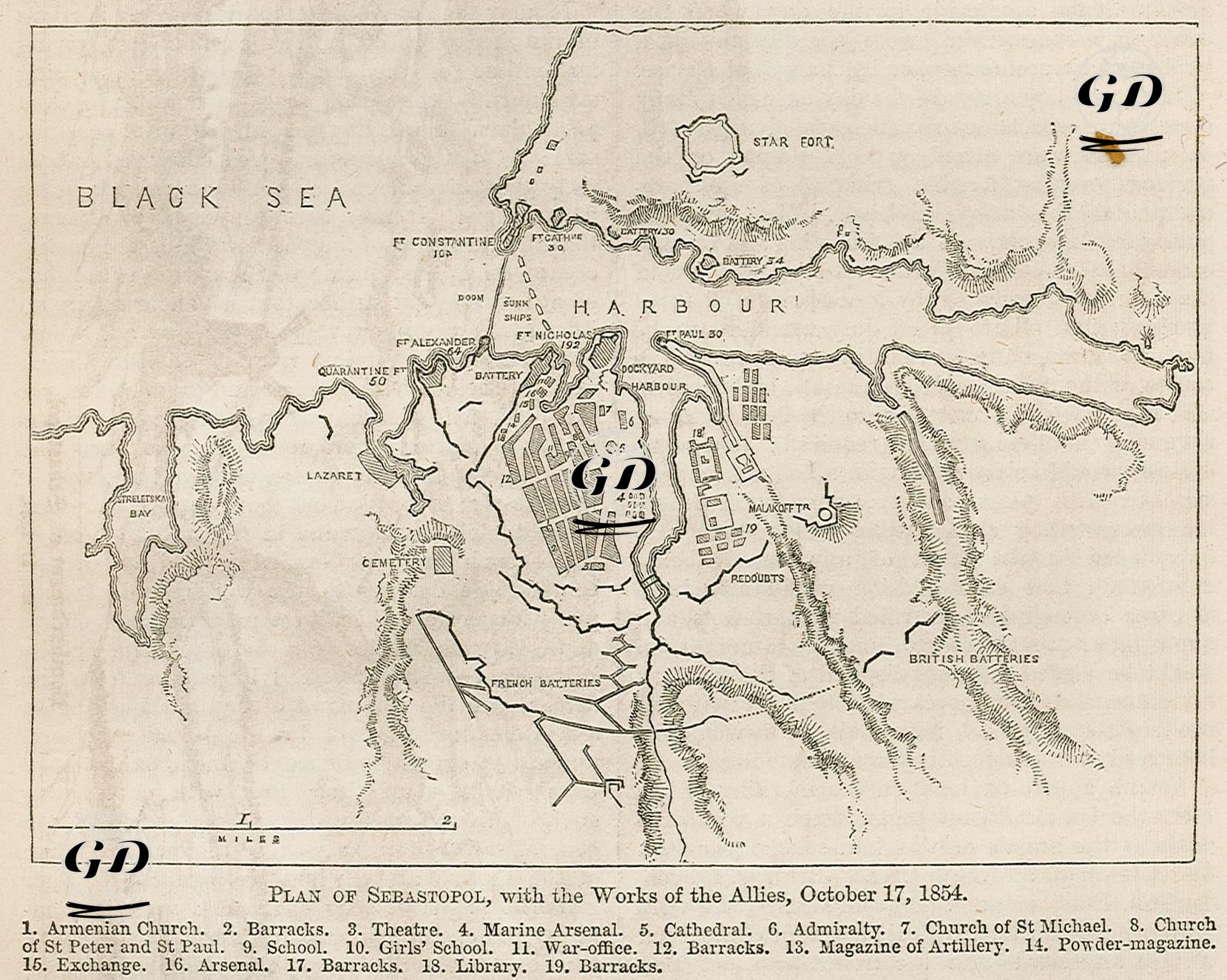
This map shows a detailed plan of the first phase of the Siege of Sevastopol, which began on 17 October 1854. The timing of the map is significant: 17 October 1854 is the day the Allied forces launched their first major artillery bombardment of Sevastopol. The map documents the structure of the city of Sevastopol and its surrounding fortifications, enemy positions and Allied advance plans just before this attack, and is important for understanding the later stages of the siege. The city is shown in symmetrically structured blocks in the middle. Directly in the middle of the city is the “Dockyard Harbour” area and important military structures (arsenals, barracks, headquarters). To the north are large coastal defence forts such as Fort Constantine, Fort Nicholas and Fort Alexander. The star-shaped fortification known as the “Star Fort” is located on the northern defensive front and was intended to directly protect the harbour. The map also includes port areas on the Black Sea coast, the Dockyard area and sunken ship spots (“Sunk Ships”). The French artillery would attack from the west and southwest, the British from the southeast and east. The trench lines and battery positions of both sides were marked by hand on the map. The Malakoff position, which was the key point of the siege of Sevastopol and located in the center-east of the map, was carefully drawn. This was where the French would capture it on later maps. Redoubts, or small defensive structures with fortifications, surrounded the Malakoff. 19 different numbered structures are identified at the bottom of the map. These include: the Armenian church (1), barracks (2-12-17-18), theater (3), naval dockyard (4), cathedral (5), command center (6), St. Michael's and St. Peter & Paul's churches (7-8), school and girls' school (9-10), war office (11), artillery arsenal and powder magazine (13-14-16), trade center and library (15-19). These details are not only military; It also provides information about the internal structure, cultural and social fabric of the city.