GRAVÜR DÜNYASI
Digital Engraving Library
| Engraver | William Johnston (1802-1888) - Alexander Keith Johnston (1804-1871) |
| Date | 1856 |
| Technique | Lithography-Colored |
| Category | Maps |
| Source | Pictorial History Of The Russian War 1854-5-6 - W.R.Chambers London & Edinburgh -Printed in Colours by Schenck & McFarlane, Edinburgh |
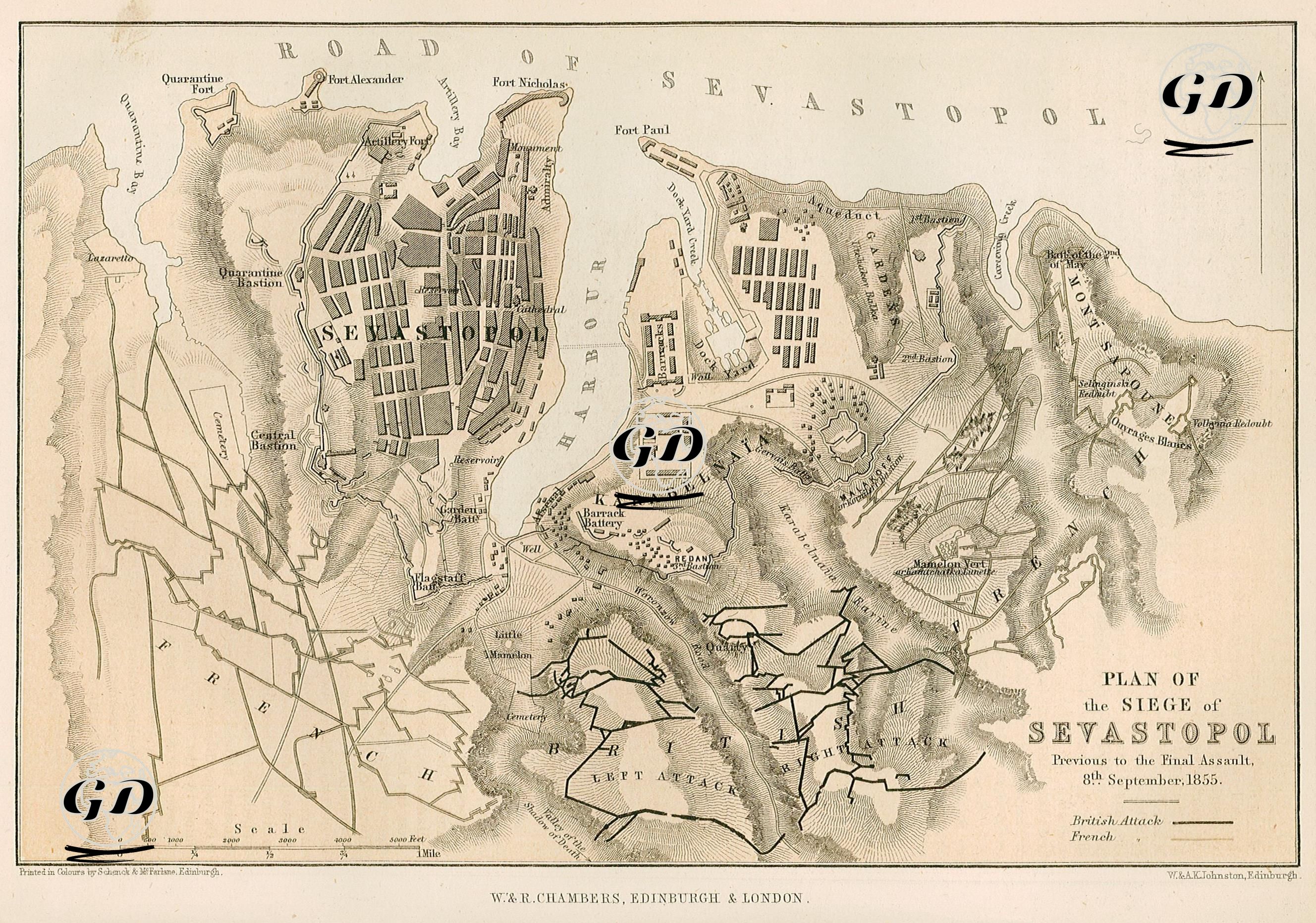
This detailed map, included in the work titled "Pictorial History of the Russian War 1854–5–6" published in 1856, reflects the plan, topography and the positions and dispositions of the parties participating in the Siege of Sevastopol in detail before the final assault on September 8, 1855, and visually explains the siege lines of the British and French forces in particular. Sevastopol is structured in large blocks in the northern center of the map; barracks, hospitals, artillery ramps, forts and dockyard areas are shown in detail. Important defensive points such as Quarantine Fort, Fort Nicholas, Fort Paul, Malakoff Redoubt, Redan, Barrack Battery, Little Redan and Flagstaff Bastion are clearly shown on the map; these structures represent the core elements of the Russian defense. The port area is the center of the siege both militarily and strategically. The hills surrounding the city, trench lines and positions of the siege troops are depicted in great detail. The map distinguishes British attack lines with solid lines and French attack lines with broken lines. The British positions were generally in the southwest, while the French positions were in the south and southeast. The attack axes were shown in detail with descriptions such as “Left Attack”, “Right Attack”, “II Attack”, “III Attack”. The French troops captured the Malakoff Redoubt on September 8, 1855, and the British troops attacked the Redan fortifications on the same day, causing the Russian defense to collapse. The Russian army evacuated the city on the night of September 8 and the morning of September 9, and withdrew to the northern shore of the Sevastopol Bay (Severnaya Storona). On September 9, the Allies entered the empty city and declared victory. Since the fall of Sevastopol was a turning point in the Crimean War, this map provides visual testimony to the dramatic finale of the war.