GRAVÜR DÜNYASI
Digital Engraving Library
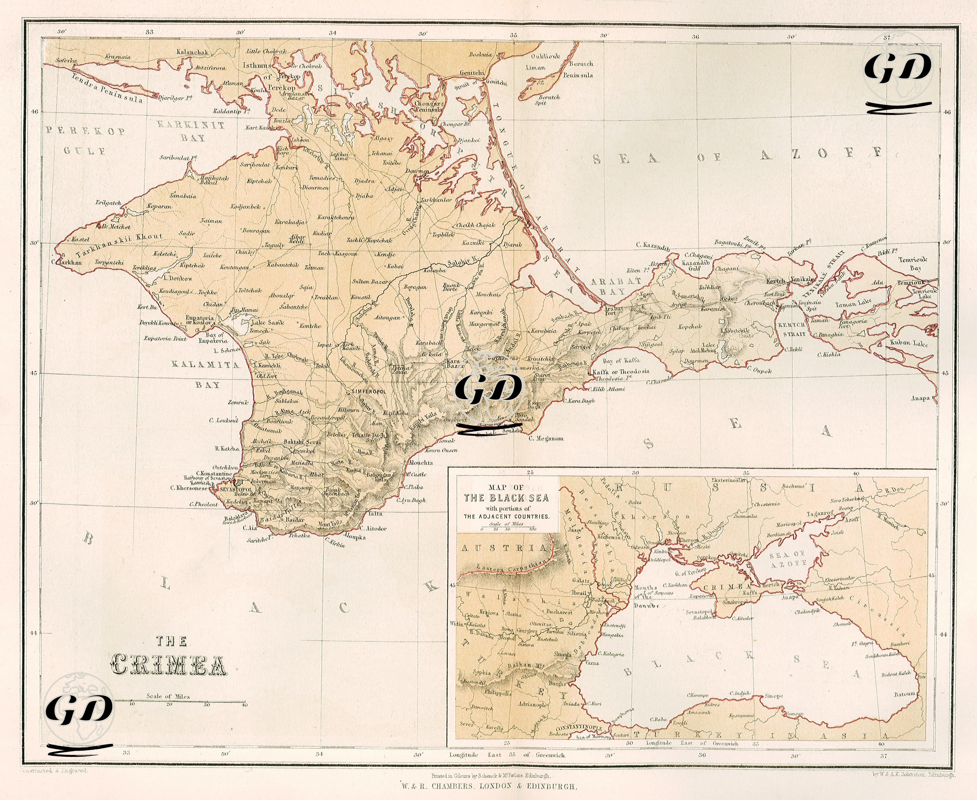
| Engraver | William Johnston (1802-1888) - Alexander Keith Johnston (1804-1871) |
| Date | 1856 |
| Technique | Lithography-Colored |
| Category | Maps |
| Source | Pictorial History Of The Russian War 1854-5-6 - W.R.Chambers London & Edinburgh -Printed in Colours by Schenck & McFarlane, Edinburgh |
This map is a geopolitical and military map showing the Crimean Peninsula, the main battlefield of the Crimean War, in detail, which was included in the work titled “Pictorial History of the Russian War 1854-5-6” published in 1856. The map carefully depicts the topography of Crimea, which was an important strategic region during the war, including its main cities (Sevastopol, Simferopol, Yalta, Yevpatoria, Kerch), bays (Kalamita Bay, Karkinit Bay, Arabat Bay), rivers, roads and mountainous areas; Sevastopol and its surroundings are particularly detailed as they were the center of the war. The inset map in the lower right corner of the map visually demonstrates the geopolitical scope of the war, covering the Black Sea and surrounding countries (Austria, Russia, Ottoman Empire). This small map clearly emphasizes Crimea’s strategic position on the Black Sea.