GRAVÜR DÜNYASI
Digital Engraving Library
| Engraver | William Johnston (1802-1888) - Alexander Keith Johnston (1804-1871) |
| Date | 1856 |
| Technique | Lithography-Colored |
| Category | Maps |
| Source | Pictorial History Of The Russian War 1854-5-6 - W.R.Chambers London & Edinburgh -Printed in Colours by Schenck & McFarlane, Edinburgh |
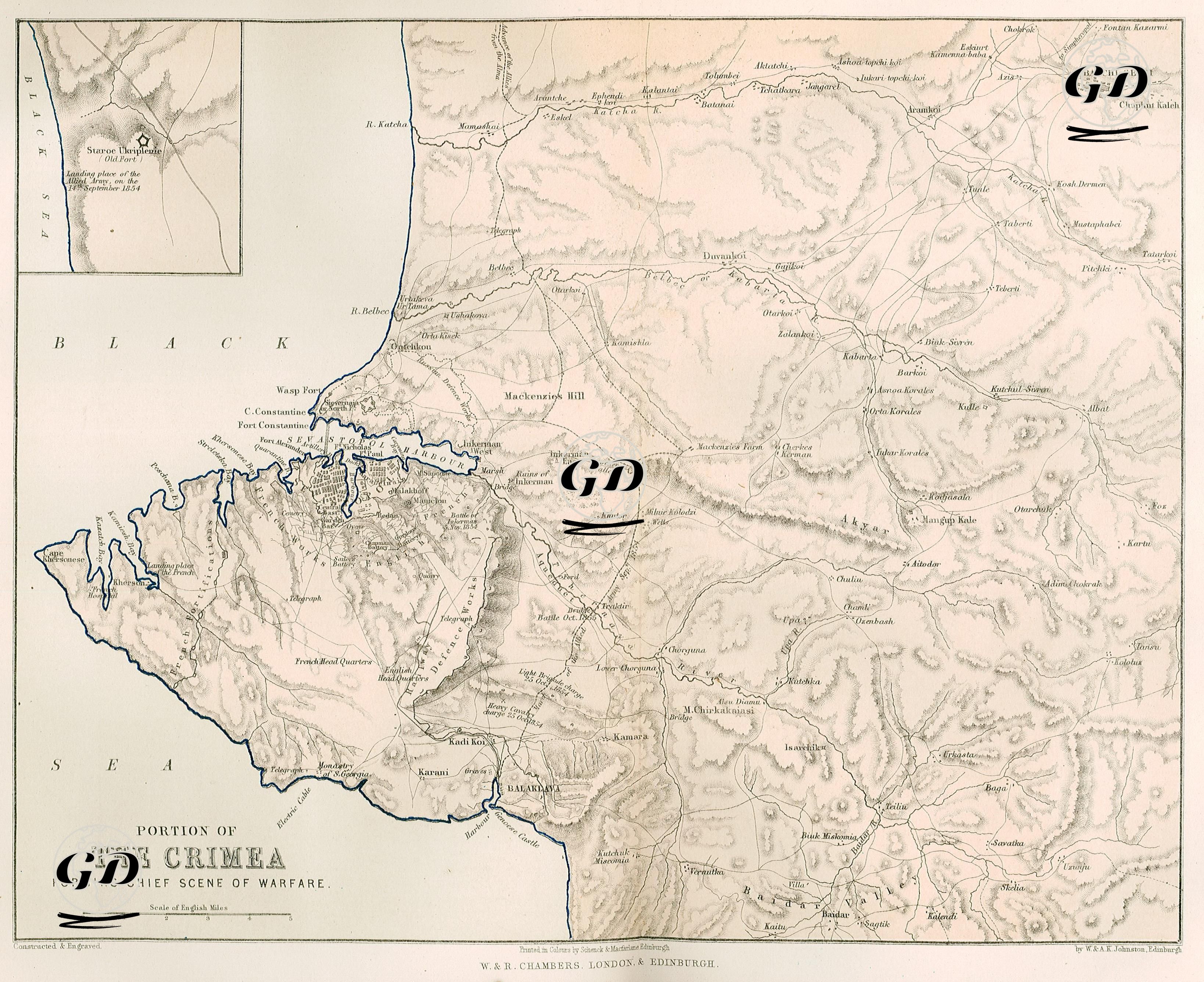
This map, included in the book "Pictorial History of the Russian War 1854–5–6" published in 1856, shows in detail the southwest of the Crimean Peninsula, the region where the most intense and critical battles of the Crimean War took place. The map aims to document the siege of Sevastopol, the fortifications around it, the front line and the positions of the military units. While the map details the military and geographically important areas such as Sevastopol, Balaklava, Inkerman, Mackenzie's Hill, Woronzoff Road, Redan, Malakoff and Kamara, military critical elements such as ports, fortifications, roads, hills, rivers and camps are carefully indicated. Names such as Redan and Malakoff stand out as the main Russian defensive points attacked by the French and British forces. Similarly, the port of Balaklava is also known for the supply point of the British forces and the famous scene of the "Charge of the Light Horse Brigade". The small inset in the upper left corner of the map shows the Gulf of Kalamita, southeast of the city of Yevpatoria (Eupatoria), where the Allied Armies (British, French and Ottoman forces) first landed in Crimea on September 14, 1854. In addition, a map of Staroe Fort was included, which was located very close to the shore where the allied troops landed and was used as a reference point on maps kept on the day of the landing.